Surveys in Geophysics ( IF 4.9 ) Pub Date : 2022-05-27 , DOI: 10.1007/s10712-022-09708-1 Miao Lin , Xiaopeng Li
|
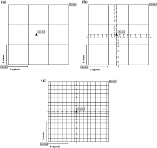
Until now, the prismatic mass approximation of the topography and the constant density assumption have been mostly utilized in topographic reductions, which are rough approximations of reality and can be avoided. In this study, the more rigorous tesseroidal mass representation of topographic masses and the global lateral topographic density variation model UNB_TopoDens are considered in topographic reductions. Three tesseroidal modeling methods based on different combinations of numerical tesseroidal approaches are developed for precise topographic gravity modeling. The computational performances of the classic prismatic modeling method and new tesseroidal modeling methods in computing the residual terrain modeling (RTM), terrain correction (TC), full topographic, and Airy-Heiskanen (AH) model-based isostatic effects are tested in the Colorado area with rugged topography. In addition, the improvement of computational efficiency achieved by applying the OpenMP parallelizing technique and the contribution of considering the UNB_TopoDens model are investigated. Then, the RTM effects are applied to local geoid modeling to see the geoid model changes caused by using rigorous tesseroidal modeling methods and by considering lateral density variations. The main numerical findings are: (1) The application of the OpenMP parallelization can significantly reduce the computational time, while the efficiency improvement rate depends on the number of used threads; (2) The modeling method effect on the computation of the RTM, TC, full topographic, and AH isostatic effects is smaller than the lateral density variation effect; (3) In the case of using the RTM reduction, the use of the tesseroidal modeling method instead of the prismatic modeling method can cause geoid model differences at the millimeter level, while almost the same standard deviations are obtained by comparing the geoid models to the GSVS17 and historical GNSS-leveling data; (4) the differences in the geoid height due to lateral density variations can reach a magnitude of about 8 cm when using the RTM reduction scheme, while the validation of geoid models at the GSVS17 GNSS-leveling benchmarks revealed that the geoid considering the UNB_TopoDens model has a slightly larger standard deviation than the one using a constant density of \(2.67\;{\text{g}}/{\text{cm}}^{3}\).
中文翻译:
使用严格的地形重力建模方法和横向密度变化模型对地形缩减和大地水准面建模的影响:美国科罗拉多州的案例研究
到目前为止,地形的棱柱质量近似和恒定密度假设主要用于地形减少,这是对现实的粗略近似,可以避免。在这项研究中,地形质量的更严格的 tesseroidal 质量表示和全局横向地形密度变化模型 UNB_TopoDens 被考虑在地形减少中。为精确的地形重力建模,开发了三种基于数值曲面方法不同组合的曲面建模方法。经典棱柱建模方法和新的 tessroidal 建模方法在计算剩余地形建模 (RTM)、地形校正 (TC)、全地形、和 Airy-Heiskanen (AH) 基于模型的等静压效应在地形崎岖的科罗拉多地区进行了测试。此外,还研究了通过应用 OpenMP 并行化技术实现的计算效率的提高以及考虑 UNB_TopoDens 模型的贡献。然后,将 RTM 效应应用于局部大地水准面建模,以查看使用严格的 tesseroidal 建模方法和考虑横向密度变化引起的大地水准面模型变化。主要数值研究结果是:(1)OpenMP并行化的应用可以显着减少计算时间,而效率提升率取决于使用的线程数;(2) 建模方法对 RTM、TC、全地形计算的影响,AH等静压效应小于横向密度变化效应;(3) 在使用 RTM 约简的情况下,使用 tesseroidal 建模方法代替棱柱建模方法会导致大地水准面模型在毫米级上的差异,而将大地水准面模型与GSVS17 和历史 GNSS 水准测量数据;(4) 使用 RTM 缩减方案时,由于横向密度变化导致的大地水准面高度差异可达 8 cm 左右,而在 GSVS17 GNSS 水准测量基准上对大地水准面模型的验证表明,考虑 UNB_TopoDens 模型的大地水准面比使用恒定密度的标准差稍大 使用 tesseroidal 建模方法代替棱柱建模方法会导致大地水准面模型在毫米级上的差异,而通过将大地水准面模型与 GSVS17 和历史 GNSS 水准数据进行比较,可以获得几乎相同的标准偏差;(4) 使用 RTM 缩减方案时,由于横向密度变化导致的大地水准面高度差异可达 8 cm 左右,而在 GSVS17 GNSS 水准测量基准上对大地水准面模型的验证表明,考虑 UNB_TopoDens 模型的大地水准面比使用恒定密度的标准差稍大 使用 tesseroidal 建模方法代替棱柱建模方法会导致大地水准面模型在毫米级上的差异,而通过将大地水准面模型与 GSVS17 和历史 GNSS 水准数据进行比较,可以获得几乎相同的标准偏差;(4) 使用 RTM 缩减方案时,由于横向密度变化导致的大地水准面高度差异可达 8 cm 左右,而在 GSVS17 GNSS 水准测量基准上对大地水准面模型的验证表明,考虑 UNB_TopoDens 模型的大地水准面比使用恒定密度的标准差稍大 而通过将大地水准面模型与 GSVS17 和历史 GNSS 水准测量数据进行比较,可以获得几乎相同的标准偏差;(4) 使用 RTM 缩减方案时,由于横向密度变化导致的大地水准面高度差异可达 8 cm 左右,而在 GSVS17 GNSS 水准测量基准上对大地水准面模型的验证表明,考虑 UNB_TopoDens 模型的大地水准面比使用恒定密度的标准差稍大 而通过将大地水准面模型与 GSVS17 和历史 GNSS 水准测量数据进行比较,可以获得几乎相同的标准偏差;(4) 使用 RTM 缩减方案时,由于横向密度变化导致的大地水准面高度差异可达 8 cm 左右,而在 GSVS17 GNSS 水准测量基准上对大地水准面模型的验证表明,考虑 UNB_TopoDens 模型的大地水准面比使用恒定密度的标准差稍大\(2.67\;{\text{g}}/{\text{cm}}^{3}\)。


 京公网安备 11010802027423号