当前位置:
X-MOL 学术
›
ISPRS J. Photogramm. Remote Sens.
›
论文详情
Our official English website, www.x-mol.net, welcomes your feedback! (Note: you will need to create a separate account there.)
The SAR2Height framework for urban height map reconstruction from single SAR intensity images
ISPRS Journal of Photogrammetry and Remote Sensing ( IF 12.7 ) Pub Date : 2024-04-08 , DOI: 10.1016/j.isprsjprs.2024.03.023 Michael Recla , Michael Schmitt
ISPRS Journal of Photogrammetry and Remote Sensing ( IF 12.7 ) Pub Date : 2024-04-08 , DOI: 10.1016/j.isprsjprs.2024.03.023 Michael Recla , Michael Schmitt
|
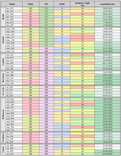
Recently, it was shown that a detailed reconstruction of urban height maps is possible from single very high resolution (VHR) synthetic aperture radar (SAR) images with deep convolutional neural networks. Being merely a proof-of-concept so far, the potential of this approach has not been fully exploited yet. With this work, we present an optimized deep learning model for height estimation from single VHR SAR images, which incorporates sensor knowledge into the estimation. We embed this model into a SAR-specific processing chain that allows the generation of seamless georeferenced digital surface models (DSMs) with geodetically defined heights in an orthometric map coordinate system. Extensive experiments are carried out with a custom-generated dataset including over 50 TerraSAR-X images from 8 different cities. They confirm that our workflow generalizes well across different locations while being robust to different properties of the input data. Thus, our workflow provides the unique ability to produce elevation models of urban areas quickly, regardless of weather, around the clock, and at low cost. This can be of immense benefit when time is critical, e.g. in disaster response scenarios or in the context of reconnaissance activities.
中文翻译:

用于从单个 SAR 强度图像重建城市高度图的 SAR2Height 框架
最近,研究表明,可以利用深度卷积神经网络从单个极高分辨率(VHR)合成孔径雷达(SAR)图像中详细重建城市高度图。到目前为止,这只是一个概念验证,这种方法的潜力尚未得到充分利用。通过这项工作,我们提出了一种优化的深度学习模型,用于根据单个 VHR SAR 图像进行高度估计,该模型将传感器知识纳入估计中。我们将此模型嵌入到特定于 SAR 的处理链中,该处理链允许生成无缝地理参考数字表面模型 (DSM),并在正交地图坐标系中具有大地测量定义的高度。使用自定义生成的数据集进行了广泛的实验,其中包括来自 8 个不同城市的 50 多张 TerraSAR-X 图像。他们确认我们的工作流程可以很好地跨不同位置推广,同时对输入数据的不同属性具有鲁棒性。因此,我们的工作流程提供了独特的能力,无论天气如何,全天候且低成本地快速生成城市地区的高程模型。当时间紧迫时,例如在灾难响应场景或侦察活动中,这可以带来巨大的好处。
更新日期:2024-04-08
中文翻译:
用于从单个 SAR 强度图像重建城市高度图的 SAR2Height 框架
最近,研究表明,可以利用深度卷积神经网络从单个极高分辨率(VHR)合成孔径雷达(SAR)图像中详细重建城市高度图。到目前为止,这只是一个概念验证,这种方法的潜力尚未得到充分利用。通过这项工作,我们提出了一种优化的深度学习模型,用于根据单个 VHR SAR 图像进行高度估计,该模型将传感器知识纳入估计中。我们将此模型嵌入到特定于 SAR 的处理链中,该处理链允许生成无缝地理参考数字表面模型 (DSM),并在正交地图坐标系中具有大地测量定义的高度。使用自定义生成的数据集进行了广泛的实验,其中包括来自 8 个不同城市的 50 多张 TerraSAR-X 图像。他们确认我们的工作流程可以很好地跨不同位置推广,同时对输入数据的不同属性具有鲁棒性。因此,我们的工作流程提供了独特的能力,无论天气如何,全天候且低成本地快速生成城市地区的高程模型。当时间紧迫时,例如在灾难响应场景或侦察活动中,这可以带来巨大的好处。


 京公网安备 11010802027423号