Precision Agriculture ( IF 6.2 ) Pub Date : 2024-03-11 , DOI: 10.1007/s11119-024-10130-3 Rose V Vagedes , Jason P Ackerson , William G Johnson , Bryan G Young
|
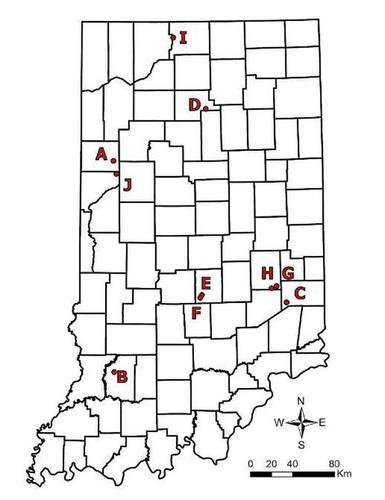
The use of soil residual herbicides, along with other practices that diversify weed management strategies, have been recommended to improve weed management and deter the progression of herbicide resistance. Although soil characteristics influence recommended application rates for these herbicides, the common practice is to apply a uniform dose of soil residual herbicides across fields with variable soil characteristics. Mapping fields for soil characteristics that dictate the optimal dose of soil residual herbicides could improve the efficiency and effectiveness of these herbicides, as well as improve environmental stewardship. The objectives of this research were to develop and quantify the accuracy of management zone classifications for variable-rate residual herbicide applications using multiple soil data sources and soil sampling intensities. The maps were created from soil data that included (i) Soil Survey Geographic database (SSURGO), (ii) soil samples (SS), (iii) soil samples regressed onto soil electrical conductivity (EC) measurements (SSEC), (iv) soil samples with organic matter (OM) data from SmartFirmer® (SF) sensors (SSSF), and (v) soil samples regressed onto EC measurements plus OM data from SmartFirmer® sensor (SSECSF). A modified Monte Carlo cross validation method was used on ten commercial Indiana fields to generate 36,000 maps across all sources of spatial soil data, sampling density, and three representative herbicides (pyroxasulfone, s-metolachlor, and metribuzin). Maps developed from SSEC data were most frequently ranked with the highest management zone classification accuracy compared to maps developed from SS data. However, SS and SSEC maps concurrently had the highest management zone classification accuracy of 34% among maps developed across all fields, herbicides, and sampling intensities. One soil sample per hectare was the most reliable sampling intensity to generate herbicide application management zones compared to one soil sample for every 2 or 4 hectares. In conclusion, soil sampling with ECa data should be used for defining the management zones for variable-rate (VR) residual herbicide applications.
中文翻译:
土壤残留除草剂施用量可变的管理区分类
建议使用土壤残留除草剂以及其他使杂草管理策略多样化的做法,以改善杂草管理并阻止除草剂抗性的发展。尽管土壤特性影响这些除草剂的推荐施用量,但常见的做法是在土壤特性不同的田地中施用统一剂量的土壤残留除草剂。绘制田野土壤特征图可以确定土壤残留除草剂的最佳剂量,可以提高这些除草剂的效率和效果,并改善环境管理。本研究的目的是使用多个土壤数据源和土壤采样强度,开发和量化可变残留除草剂应用的管理区分类的准确性。这些地图是根据土壤数据创建的,其中包括(i)土壤调查地理数据库(SSURGO),(ii)土壤样本(SS),(iii)回归到土壤电导率(EC)测量值(SSEC)的土壤样本,(iv)具有来自 SmartFirmer® (SF) 传感器 (SSSF) 的有机质 (OM) 数据的土壤样本,以及 (v) 回归到 EC 测量值和来自 SmartFirmer® 传感器 (SSECSF) 的 OM 数据的土壤样本。在印第安纳州的 10 个商业田地中使用了改进的蒙特卡罗交叉验证方法,生成了 36,000 个涵盖所有空间土壤数据源、采样密度和三种代表性除草剂(吡草磺、精异丙甲草胺和赛克津)的地图。与根据 SS 数据开发的地图相比,根据 SSEC 数据开发的地图最常以最高的管理区分类精度排名。然而,在跨所有田地、除草剂和采样强度开发的地图中,SS 和 SSEC 地图同时具有最高的管理区分类精度,为 34%。与每 2 或 4 公顷采样一个土壤样本相比,每公顷采样一个土壤样本是生成除草剂施用管理区的最可靠的采样强度。总之,应使用带有 EC a数据的土壤采样来确定可变比率 (VR) 残留除草剂施用的管理区域。


 京公网安备 11010802027423号