Precision Agriculture ( IF 5.4 ) Pub Date : 2023-04-17 , DOI: 10.1007/s11119-023-10013-z Igor Lima Bretas , Domingos Sarvio Magalhães Valente , Thiago Furtado de Oliveira , Denise Baptaglin Montagner , Valéria Pacheco Batista Euclides , Fernanda Helena Martins Chizzotti
|
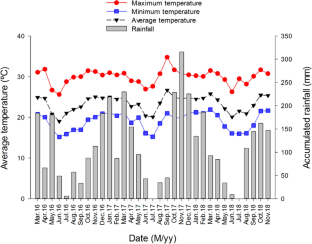
Remote sensing can serve as a promising solution for monitoring spatio-temporal variability in grasslands, providing timely information about different biophysical parameters. We aimed to develop models for canopy height classification and aboveground biomass estimation in pastures of Megathyrsus maximus cv. Mombaça using machine learning techniques and images obtained from the Sentinel-2 satellite. We used different spectral bands from the Sentinel-2, which were obtained and processed entirely in the cloud computing space. Three canopy height classes were defined according to grazing management recommendations: Class 0 (< 0.45 m), Class 1 (0.45–0.80 m) and Class 2 (> 0.80 m). For modeling, the original database was divided into training data (85%) and test data (15%). To avoid dependency between our training and test datasets and ensure greater generalization capacity, we used a spatial grouping evaluation structure. The random forest algorithm was used to predict canopy height and aboveground biomass by using height and biomass field reference data obtained from 54 paddocks in Brazil between 2016 and 2018. Our results demonstrated precision, recall, and accuracy values of up to 73%, 73%, and 72%, respectively, for canopy height classification. In addition, the models showed reasonable predictive performance for aboveground fresh biomass (AFB) and dry matter concentration (DMC; R2 = 0.61 and 0.69, respectively). We conclude that the combined use of satellite imagery and machine learning techniques has potential to predict canopy height and aboveground biomass of Megathyrsus maximus cv. Mombaça. However, further studies should be conducted to improve the proposed models and develop software to implement the tool under field conditions.
中文翻译:
使用卫星图像和机器学习预测蒙巴萨几内亚草牧场的冠层高度和生物量
遥感可以作为监测草原时空变异性的有前途的解决方案,提供有关不同生物物理参数的及时信息。我们旨在开发Megathysus maximus牧场的冠层高度分类和地上生物量估算模型简历。Mombaça 使用机器学习技术和从 Sentinel-2 卫星获得的图像。我们使用了 Sentinel-2 的不同光谱带,这些光谱带完全在云计算空间中获得和处理。根据放牧管理建议定义了三个冠层高度等级:0 级(< 0.45 m)、1 级(0.45-0.80 m)和 2 级(> 0.80 m)。为了建模,将原始数据库分为训练数据(85%)和测试数据(15%)。为了避免我们的训练和测试数据集之间的依赖性并确保更大的泛化能力,我们使用了空间分组评估结构。利用随机森林算法,利用 2016 年至 2018 年间从巴西 54 个牧场获得的高度和生物量田间参考数据,预测冠层高度和地上生物量。我们的结果表明,冠层高度分类的精确度、召回率和准确度值分别高达 73%、73% 和 72%。此外,该模型对地上新鲜生物量 (AFB) 和干物质浓度 (DMC; R) 表现出合理的预测性能2 = 0.61 和 0.69,分别)。我们得出结论,结合使用卫星图像和机器学习技术有可能预测Megathysus maximus cv 的冠层高度和地上生物量。蒙巴萨。然而,应该进行进一步的研究以改进所提出的模型并开发软件以在现场条件下实施该工具。


 京公网安备 11010802027423号