Applied Water Science ( IF 5.5 ) Pub Date : 2022-06-18 , DOI: 10.1007/s13201-022-01707-2 Gokmen Tayfur , Tommaso Moramarco
|
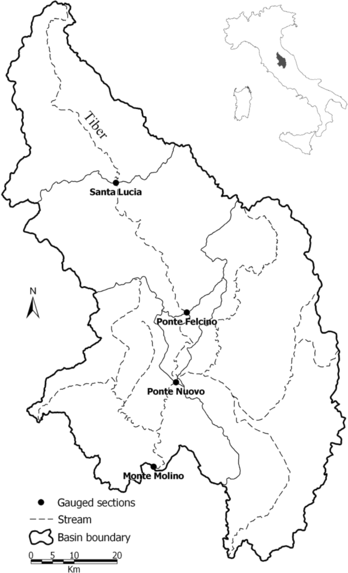
In many developing countries, due to economic constraints, a single station on a river reach is often equipped to record flow variables. On the other hand, hydrographs at the upstream sections may also be needed for especially assessing flooded areas. The upstream flow hydrograph prediction is called the reverse flood routing. There are some reverse flood routing pocedures requiring sophisticated methods together with substantial data requirements. This study proposes a new reverse flood routing procedure, based upon the simple kinematic wave (KW) equation, requiring only easily measurable downstream stage data. The KW equation is first averaged along a channel length at a fixed time, t, assuming that channel width is spatially constant, and then the spatially averaged equation is averaged in time, Δt. The temporally averaged terms are approximated as the arithmetical mean of the corresponding terms evaluated at time t and t + Δt. The Chezy roughness equation is employed for flow velocity, and the upstream flow stage hydrograph is assumed be described by a two parameter gamma distribution (Pearson Type III). The spatially averaged mean flow depth and lateral flow are related to the downstream flow stage. The resulting routing equation is thus obtained as a function of only downstream flow stage, meaning that the method mainly requires measurements of downstream flow stage data besides the mean values of channel length, channel width, roughness coefficient and bed slope. The optimal values of the parameters of reverse flood routing are obtained using the genetic algorithm. The calibration of the model is accomplished by using the measured downstream hydrographs. The validation is performed by comparing the model-generated upstream hydrographs against the measured upstream hydrographs. The proposed model is applied to generate upstream hydrographs at four different river reaches of Tiber River, located in central Italy. The length of river reaches varied from 20 to 65 km. Several upstream hydrographs at different stations on this river are generated using the developed method and compared with the observed hydrographs. The method predicts the time to peak with less than 5% error and peak rates with less than 10% error in the short river reaches of 20 km and 31 km. It also predicts the time to peak and peak rate in other two brances of 45 km and 65 km with less than 15% error. The method satisfactorily generates upstream hydrographs, with an overall mean absolute error (MAE) of 42 m3/s.


 京公网安备 11010802027423号