Natural Resources Research ( IF 4.8 ) Pub Date : 2022-05-14 , DOI: 10.1007/s11053-022-10071-6 Jiateng Guo , Zhaoxue Wang , Chaoling Li , Fengdan Li , Mark Walter Jessell , Lixin Wu , Jiangmei Wang
|
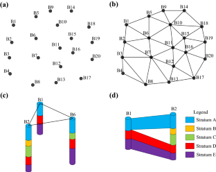
The three-dimensional characterization of geological structures is important for determining the distribution of subsurface mineral resources. However, geological structures and geological phenomena have great stochasticity and uncertainty at the microscopic level. Traditional multiple-point geostatistics use mostly three-dimensional conceptual models or two-dimensional sections as training images, while simulations using direct low-dimensional borehole data are lacking. In this paper, we propose a new multiple-point geostatistical method to automatically reconstruct three-dimensional geological models directly from borehole data, which can significantly reduce the complexity of intermediate manual operations. First, the geological structure characteristics in the borehole data are extracted, and then an initial prior model is constructed based on geological constraints. Next, for the non-stationary problem, the mobile local scan approach is proposed to make the simulation nodes scan in a certain range of scaled area to simultaneously achieve the zonal simulation effect and eliminate the discontinuity problem between zonal boundaries. Based on this solution, the whole modeling workflow is designed. Finally, the algorithm is validated using actual plains area geological survey data, compared to other modeling methods, and evaluated for model uncertainty. The results show that the proposed 3D geological modeling method can effectively expose the stratigraphic structural morphology, stratigraphic attributes and overburden relationships. It will provide decision support for resource exploration and reduce exploration costs.
中文翻译:
基于多点地质统计学的三维自动地质建模和钻孔数据的不确定性分析
地质构造的三维特征对于确定地下矿产资源的分布很重要。然而,地质构造和地质现象在微观层面具有很大的随机性和不确定性。传统的多点地质统计学主要使用三维概念模型或二维剖面作为训练图像,而缺乏直接使用低维钻孔数据的模拟。在本文中,我们提出了一种新的多点地质统计方法,可以直接从钻孔数据中自动重建三维地质模型,可以显着降低中间人工操作的复杂性。首先,提取钻孔数据中的地质构造特征,然后基于地质约束构造初始先验模型。其次,针对非平稳问题,提出了移动局部扫描的方法,使模拟节点在一定范围的缩放区域内进行扫描,同时达到带状模拟效果,消除带状边界之间的不连续问题。基于此解决方案,设计了整个建模工作流程。最后,利用实际平原地区地质调查数据对该算法进行了验证,与其他建模方法进行了比较,并评估了模型的不确定性。结果表明,所提出的3D地质建模方法可以有效地揭示地层构造形态、地层属性和覆盖层关系。为资源勘探提供决策支持,降低勘探成本。


 京公网安备 11010802027423号