Hydrogeology Journal ( IF 2.4 ) Pub Date : 2022-04-09 , DOI: 10.1007/s10040-022-02465-w Rimbaud E. Lapperre 1 , Cornelis Kasse 1 , Ronald T. van Balen 1, 2 , Victor F. Bense 3
|
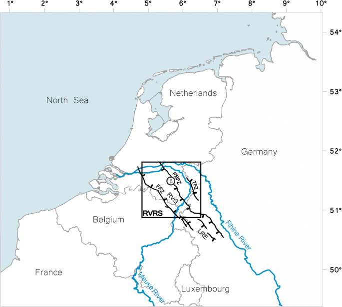
Faults in the Roer Valley Rift System (Netherlands, Belgium, and Germany) act as barriers to lateral groundwater flow in unconsolidated sedimentary aquifers. This causes a cross-fault groundwater-level step of up to several metres. Using a dataset obtained through 5 years of high-frequency monitoring, the effect of fault-zone permeability, precipitation and evapotranspiration on cross-fault groundwater-level steps is studied at two sites situated across the Peel Boundary Fault. Hydraulic conductivity values at the fault are 1–3 orders of magnitude lower than that of similar lithologies away from the fault, indicating that fault displacement has a significant impact on groundwater flow. The influence of precipitation and evapotranspiration on fault-zone hydrology is inferred from water-table fluctuations over short distances across the fault. On the foot wall, the water table is nearer to the surface and displays a shorter level range with a spiky temporal variability. On the hanging wall, a deeper water table is sloping away from the fault and shows a wider level range with a smoother temporal variability. The observed groundwater level fluctuations are attributed mainly to precipitation and evapotranspiration dynamics. At a larger spatial scale, the 5-year-average cross-fault groundwater-level steps at the two sites are 1.59 and 1.39 m. At a smaller scale, the cross-fault groundwater-level step is much less because of the rising water table towards the fault on the hanging wall. At the smallest scale, just across the fault zone, the groundwater level step is around 0.2 m, indicating that the fault is semi-impermeable.
中文翻译:
跨断层地下水位差异的时空变化:断层引起的渗透率降低、降水和蒸散的影响
鲁尔河谷裂谷系统(荷兰、比利时和德国)中的断层是松散沉积含水层中地下水侧向流动的障碍。这导致高达数米的跨断层地下水位台阶。使用通过 5 年的高频监测获得的数据集,在位于皮尔边界断层的两个地点研究断层带渗透率、降水和蒸散对跨断层地下水位阶跃的影响。断层处的水力传导率值比远离断层的类似岩性低1-3个数量级,表明断层位移对地下水流量有显着影响。降水和蒸散对断层带水文的影响是从断层短距离的地下水位波动推断出来的。在下墙上,地下水位更接近地表,并显示出较短的水位范围和尖峰的时间变化。在上盘,较深的地下水位远离断层倾斜,显示出更宽的水位范围和更平滑的时间变化。观测到的地下水位波动主要归因于降水和蒸散动态。在更大的空间尺度上,两个地点的5年平均跨断层地下水位台阶分别为1.59和1.39 m。在较小的尺度上,由于地下水位向上盘断层上升,跨断层地下水位阶跃要小得多。在最小尺度上,就在断裂带的对面,地下水位台阶在0.2 m左右,表明该断裂是半不透水的。地下水位更接近地表,并显示出较短的水位范围和尖峰的时间变化。在上盘,较深的地下水位远离断层倾斜,显示出更宽的水位范围和更平滑的时间变化。观测到的地下水位波动主要归因于降水和蒸散动态。在更大的空间尺度上,两个地点的5年平均跨断层地下水位台阶分别为1.59和1.39 m。在较小的尺度上,由于地下水位向上盘断层上升,跨断层地下水位阶跃要小得多。在最小尺度上,就在断裂带的对面,地下水位台阶在0.2 m左右,表明该断裂是半不透水的。地下水位更接近地表,并显示出较短的水位范围和尖峰的时间变化。在上盘,较深的地下水位远离断层倾斜,显示出更宽的水位范围和更平滑的时间变化。观测到的地下水位波动主要归因于降水和蒸散动态。在更大的空间尺度上,两个地点的5年平均跨断层地下水位台阶分别为1.59和1.39 m。在较小的尺度上,由于地下水位向上盘断层上升,跨断层地下水位阶跃要小得多。在最小尺度上,就在断裂带的对面,地下水位台阶在0.2 m左右,表明该断裂是半不透水的。一个更深的地下水位从断层倾斜,并显示出更宽的水位范围和更平滑的时间变化。观测到的地下水位波动主要归因于降水和蒸散动态。在更大的空间尺度上,两个地点的5年平均跨断层地下水位台阶分别为1.59和1.39 m。在较小的尺度上,由于地下水位向上盘断层上升,跨断层地下水位阶跃要小得多。在最小尺度上,就在断裂带的对面,地下水位台阶在0.2 m左右,表明该断裂是半不透水的。一个更深的地下水位从断层倾斜,并显示出更宽的水位范围和更平滑的时间变化。观测到的地下水位波动主要归因于降水和蒸散动态。在更大的空间尺度上,两个地点的5年平均跨断层地下水位台阶分别为1.59和1.39 m。在较小的尺度上,由于地下水位向上盘断层上升,跨断层地下水位阶跃要小得多。在最小尺度上,就在断裂带的对面,地下水位台阶在0.2 m左右,表明该断裂是半不透水的。观测到的地下水位波动主要归因于降水和蒸散动态。在更大的空间尺度上,两个地点的5年平均跨断层地下水位台阶分别为1.59和1.39 m。在较小的尺度上,由于地下水位向上盘断层上升,跨断层地下水位阶跃要小得多。在最小尺度上,就在断裂带的对面,地下水位台阶在0.2 m左右,表明该断裂是半不透水的。观测到的地下水位波动主要归因于降水和蒸散动态。在更大的空间尺度上,两个地点的5年平均跨断层地下水位台阶分别为1.59和1.39 m。在较小的尺度上,由于地下水位向上盘断层上升,跨断层地下水位阶跃要小得多。在最小尺度上,就在断裂带的对面,地下水位台阶在0.2 m左右,表明该断裂是半不透水的。


 京公网安备 11010802027423号