当前位置:
X-MOL 学术
›
Int. J. Climatol.
›
论文详情
Our official English website, www.x-mol.net, welcomes your
feedback! (Note: you will need to create a separate account there.)
On occurrence of rapid intensification and rainfall changes in tropical cyclones over the North Indian Ocean
International Journal of Climatology ( IF 3.5 ) Pub Date : 2021-06-24 , DOI: 10.1002/joc.7268 Buri Vinodhkumar 1 , Nanda Kishore Reddy Busireddy 1 , Kumar Ankur 2 , Raghu Nadimpalli 3 , Krishna Kishore Osuri 1
International Journal of Climatology ( IF 3.5 ) Pub Date : 2021-06-24 , DOI: 10.1002/joc.7268 Buri Vinodhkumar 1 , Nanda Kishore Reddy Busireddy 1 , Kumar Ankur 2 , Raghu Nadimpalli 3 , Krishna Kishore Osuri 1
Affiliation
|
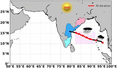
The present study examines the climatological characteristics and possible triggers of rapid intensification (RI) of tropical cyclones (TCs) during 1990–2019 over the North Indian Ocean (NIO). RI is defined as an increase in maximum sustained surface wind speed of 30 knots (15.4 m⋅s−1) or more in a 24 hr duration. In the NIO basin, the threshold of 24 hr intensity change represents the 93rd percentile using a 3-min sustained wind, while, it is 95th percentile in the Atlantic basin, where 1-min sustained wind is used. A total of 46 TCs (~38% of the total TCs) have exhibited RI at an average rate of 1–2 TCs year−1 over the NIO. A significant increase of RI-TCs is seen from the year 2000 onwards over the region. The maximum RI-TCs occurrence is found in the post-monsoon season. The majority of TCs (~48%) undergo the RI phase within a 12–24 hr time during the depression stage. About ~35% (26%) of the TCs are retained in the RI phase for the duration of at least 24 hr (36 hr). Most of the RI-TCs move northwestward (38%) and westward (31%) direction 6 hr before the RI onset with slow/normal translation speeds. During the RI phase, ~72% of TCs travels a distance of ~150–450 km. The TC inner-core region receives heavy rainfall, and a ~ 3 mm⋅hr−1 increment is noticed 12 hr before the RI to the RI onset. Most of the RI-TCs made landfall over eastern states of India showing the vulnerability of the regions. Composite analysis demonstrated that higher precipitable water (~55 mm), surface flux (500 W⋅m−2), cyclone heat potential (50–60 kJ⋅cm−2) in the moderate shear (6–8 m⋅s−1) environment favours the RI process. This study highlights the significance of RI-TCs and triggering conditions for the RI onset over the NIO region.
中文翻译:

论北印度洋热带气旋快速增强和降雨变化的发生
本研究考察了 1990-2019 年北印度洋 (NIO) 上空热带气旋 (TC) 快速增强 (RI) 的气候特征和可能的触发因素。RI 定义为在 24 小时内最大持续表面风速增加 30 节 (15.4 m·s -1 ) 或更多。在 NIO 流域,24 小时强度变化的阈值代表使用 3 分钟持续风的第 93 个百分位,而在大西洋盆地,使用 1 分钟持续风的阈值是第 95 个百分位。共有 46 个 TC(约占总 TC 的 38%)以 1-2 个 TC 年的平均速率-1表现出 RI在蔚来。从 2000 年开始,该地区的 RI-TC 显着增加。RI-TCs 的发生最多出现在季风后季节。大多数 TC (~48%) 在抑郁阶段的 12-24 小时内经历 RI 阶段。约 35% (26%) 的 TC 在 RI 阶段保留至少 24 小时 (36 小时)。大多数 RI-TC 在 RI 开始前 6 小时以缓慢/正常的平移速度向西北 (38%) 和向西 (31%) 方向移动。在 RI 阶段,约 72% 的 TC 行进了约 150-450 公里的距离。TC 内核区接收强降雨,约 3 mm⋅hr -1在 RI 到 RI 发作前 12 小时注意到增量。大多数 RI-TC 登陆印度东部各州,显示该地区的脆弱性。综合分析表明,在中等剪切(6-8 m⋅s -1 ) 环境有利于 RI 过程。本研究强调了 RI-TC 的重要性以及 NIO 地区 RI 发病的触发条件。
更新日期:2021-06-24
中文翻译:
论北印度洋热带气旋快速增强和降雨变化的发生
本研究考察了 1990-2019 年北印度洋 (NIO) 上空热带气旋 (TC) 快速增强 (RI) 的气候特征和可能的触发因素。RI 定义为在 24 小时内最大持续表面风速增加 30 节 (15.4 m·s -1 ) 或更多。在 NIO 流域,24 小时强度变化的阈值代表使用 3 分钟持续风的第 93 个百分位,而在大西洋盆地,使用 1 分钟持续风的阈值是第 95 个百分位。共有 46 个 TC(约占总 TC 的 38%)以 1-2 个 TC 年的平均速率-1表现出 RI在蔚来。从 2000 年开始,该地区的 RI-TC 显着增加。RI-TCs 的发生最多出现在季风后季节。大多数 TC (~48%) 在抑郁阶段的 12-24 小时内经历 RI 阶段。约 35% (26%) 的 TC 在 RI 阶段保留至少 24 小时 (36 小时)。大多数 RI-TC 在 RI 开始前 6 小时以缓慢/正常的平移速度向西北 (38%) 和向西 (31%) 方向移动。在 RI 阶段,约 72% 的 TC 行进了约 150-450 公里的距离。TC 内核区接收强降雨,约 3 mm⋅hr -1在 RI 到 RI 发作前 12 小时注意到增量。大多数 RI-TC 登陆印度东部各州,显示该地区的脆弱性。综合分析表明,在中等剪切(6-8 m⋅s -1 ) 环境有利于 RI 过程。本研究强调了 RI-TC 的重要性以及 NIO 地区 RI 发病的触发条件。


 京公网安备 11010802027423号