当前位置:
X-MOL 学术
›
Meteorol. Appl.
›
论文详情
Our official English website, www.x-mol.net, welcomes your
feedback! (Note: you will need to create a separate account there.)
Long‐term hydrological assessment of remote sensing precipitation from multiple sources over the lower Yangtze River basin, China
Meteorological Applications ( IF 2.3 ) Pub Date : 2021-05-07 , DOI: 10.1002/met.1991 Dehua Zhu 1 , Abro M. Ilyas 1 , Gaoxu Wang 2, 3 , Biqiu Zeng 4
Meteorological Applications ( IF 2.3 ) Pub Date : 2021-05-07 , DOI: 10.1002/met.1991 Dehua Zhu 1 , Abro M. Ilyas 1 , Gaoxu Wang 2, 3 , Biqiu Zeng 4
Affiliation
|
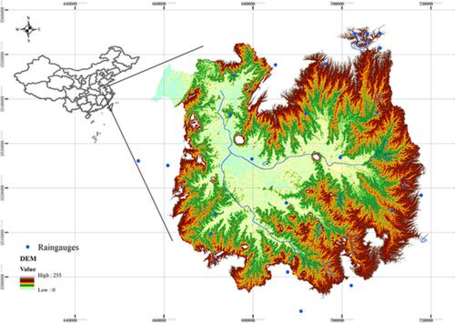
Multi‐source remote sensing precipitation products are being used more and more frequently for rainfall analysis and hydrological applications around the world. The aim of the present study was to assess the variances and uncertainty of long‐term precipitation and corresponding hydrological simulations from 1984 to 2016 using rain gauge measurements, two satellite rainfall products retrieved from the Climate Prediction Center (CPC) and the Precipitation Estimation from Remotely Sensed Information using Artificial Neural Networks – Climate Data Record (PERSIANN‐CDR) respectively, along with rainfall reanalysis data from the ERA‐Interim over the lower Yangtze River basin, China. The results indicated overestimation from ERA‐Interim and PERSIANN‐CDR on seasonal rainfall. CPC rainfall estimation had marginal bias with rain gauge measurements among all the remote sensing rainfall products on a daily scale, while the ERA‐Interim tended to overestimate when the rainfall rate was less than 50 mm. On a monthly scale, CPC rainfall estimations were very close to the rain gauge measurements, with a correlation coefficient of 0.96, whilst the ERA‐Interim rainfall products showed significant overestimation in February, March and September. Nevertheless, all remote sensing rainfall products achieved good performance in June and July, showing promising potential to be an alternative to rainfall data for long‐term water resource analysis. Furthermore, ERA‐Interim rainfall products did not perform as well as the other rainfall sources in flow simulations, as evidenced by the large root‐mean‐square error and bias. CPC rainfall products outperformed all other rainfall sources in terms of the Nash–Sutcliffe coefficient at all temporal scales. In addition, the skill scores suggested that the performance of the streamflow simulation improved significantly on a monthly scale, with a higher Nash–Sutcliffe coefficient and smaller total streamflow errors.
中文翻译:

长江下游流域多源遥感降水的长期水文评估
多源遥感降水产品在世界范围内越来越多地用于降雨分析和水文应用。本研究的目的是使用雨量计测量,从气候预测中心(CPC)检索到的两个卫星降雨产品以及从远程的降水估算来评估1984年至2016年的长期降水和相应的水文模拟的方差和不确定性。分别使用人工神经网络-气候数据记录(PERSIANN-CDR)以及来自ERA-Interim的长江下游流域的降雨再分析数据来感测信息。结果表明ERA-Interim和PERSIANN-CDR对季节性降雨的估计过高。在所有规模的遥感降雨产品中,CPC降雨估算与雨量计的测量值之间存在边际偏差,而当降雨率小于50 mm时,ERA-Interim往往会高估。在月度范围内,CPC降雨量估算值非常接近雨量计的测量值,相关系数为0.96,而ERA-中期降雨产品在2月,3月和9月显示出明显的高估。尽管如此,所有遥感降雨产品在6月和7月都取得了良好的性能,显示出有望成为长期水资源分析的替代降雨数据的潜力。此外,在流量模拟中,ERA中期降雨产品的性能不及其他降雨源,这由较大的均方根误差和偏差所证明。在所有时间尺度上,CPC降雨产品的纳什–萨特克利夫系数均优于其他所有降雨源。此外,技能得分表明,流量模拟的性能在每月范围内显着提高,具有更高的Nash–Sutcliffe系数和较小的总流量误差。
更新日期:2021-05-07
中文翻译:
长江下游流域多源遥感降水的长期水文评估
多源遥感降水产品在世界范围内越来越多地用于降雨分析和水文应用。本研究的目的是使用雨量计测量,从气候预测中心(CPC)检索到的两个卫星降雨产品以及从远程的降水估算来评估1984年至2016年的长期降水和相应的水文模拟的方差和不确定性。分别使用人工神经网络-气候数据记录(PERSIANN-CDR)以及来自ERA-Interim的长江下游流域的降雨再分析数据来感测信息。结果表明ERA-Interim和PERSIANN-CDR对季节性降雨的估计过高。在所有规模的遥感降雨产品中,CPC降雨估算与雨量计的测量值之间存在边际偏差,而当降雨率小于50 mm时,ERA-Interim往往会高估。在月度范围内,CPC降雨量估算值非常接近雨量计的测量值,相关系数为0.96,而ERA-中期降雨产品在2月,3月和9月显示出明显的高估。尽管如此,所有遥感降雨产品在6月和7月都取得了良好的性能,显示出有望成为长期水资源分析的替代降雨数据的潜力。此外,在流量模拟中,ERA中期降雨产品的性能不及其他降雨源,这由较大的均方根误差和偏差所证明。在所有时间尺度上,CPC降雨产品的纳什–萨特克利夫系数均优于其他所有降雨源。此外,技能得分表明,流量模拟的性能在每月范围内显着提高,具有更高的Nash–Sutcliffe系数和较小的总流量误差。


 京公网安备 11010802027423号