Spatial Demography ( IF 1.1 ) Pub Date : 2021-03-15 , DOI: 10.1007/s40980-021-00081-y Jonathan P Schroeder 1 , José D Pacas 1
|
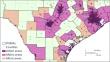
Microdata from U.S. decennial censuses and the American Community Survey are a key resource for social science and policy analysis, enabling researchers to investigate relationships among all reported characteristics for individual respondents and their households. To protect privacy, the Census Bureau restricts the detail of geographic information in public use microdata, and this complicates how researchers can investigate and account for variations across levels of urbanization when analyzing microdata. One option is to focus on metropolitan status, which can be determined exactly for most microdata records and approximated for others, but a binary metro/nonmetro classification is still coarse and limited on its own, emphasizing one aspect of rural–urban variation and discounting others. To address these issues, we compute two continuous indices for public use microdata—average tract density and average metro/micro-area population—using population-weighted geometric means. We show how these indices correspond to two key dimensions of urbanization—concentration and size—and we demonstrate their utility through an examination of disparities in poverty throughout the rural–urban universe. Poverty rates vary across settlement types in nonlinear ways: rates are lowest in moderately dense parts of major metro areas, and rates are higher in both low- and high-density areas, as well as in smaller commuting systems. Using the two indices also reveals that correlations between poverty and demographic characteristics vary considerably across settlement types. Both indices are now available for recent census microdata via IPUMS USA (https://usa.ipums.org).
中文翻译:
纵观城乡宇宙:美国人口普查微观数据的两个连续城市化指数
美国十年一次的人口普查和美国社区调查的微观数据是社会科学和政策分析的关键资源,使研究人员能够调查个体受访者及其家庭的所有报告特征之间的关系。为了保护隐私,人口普查局限制了公共使用微观数据中地理信息的细节,这使得研究人员在分析微观数据时调查和解释不同城市化水平的变化变得复杂。一种选择是关注大都市地位,对于大多数微观数据记录来说,大都市地位可以准确确定,而对于其他记录,大都市地位可以进行近似确定,但都市/非都市的二元分类仍然是粗略的,其本身也有局限性,强调了城乡差异的一个方面,而忽视了其他方面。为了解决这些问题,我们使用人口加权几何平均值计算公共使用微观数据的两个连续指数——平均区域密度和平均都市/微区域人口。我们展示了这些指数如何与城市化的两个关键维度(集中度和规模)相对应,并通过考察整个城乡贫困差异来展示它们的效用。不同居住类型的贫困率以非线性方式变化:主要都市区中等密度地区的贫困率最低,低密度和高密度地区以及较小通勤系统的贫困率较高。使用这两个指数还表明,贫困与人口特征之间的相关性在不同的定居点类型之间存在很大差异。现在,这两个指数均可通过 IPUMS USA (https://usa.ipums.org) 获取最近的人口普查微观数据。


 京公网安备 11010802027423号