当前位置:
X-MOL 学术
›
Earth Surf.Process. Land.
›
论文详情
Our official English website, www.x-mol.net, welcomes your
feedback! (Note: you will need to create a separate account there.)
Interrelations between relief, vegetation, disturbances, and permafrost in the forest-steppe of central Mongolia
Earth Surface Processes and Landforms ( IF 2.8 ) Pub Date : 2021-03-15 , DOI: 10.1002/esp.5116 Michael Klinge 1 , Florian Schneider 1 , Choimaa Dulamsuren 2 , Kim Arndt 1 , Uudus Bayarsaikhan 3 , Daniela Sauer 1
Earth Surface Processes and Landforms ( IF 2.8 ) Pub Date : 2021-03-15 , DOI: 10.1002/esp.5116 Michael Klinge 1 , Florian Schneider 1 , Choimaa Dulamsuren 2 , Kim Arndt 1 , Uudus Bayarsaikhan 3 , Daniela Sauer 1
Affiliation
|
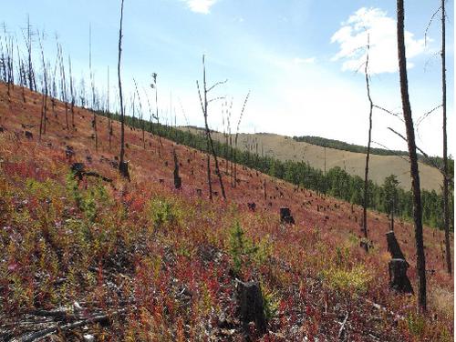
In semi-arid central Asia, relief has a strong impact on the distribution of vegetation and discontinuous permafrost. Our aim was to analyse causal chains and inter-relationships that control the spatial patterns of forest and permafrost in the forest-steppe of the northern Khangai Mountains in Mongolia. For this purpose, we conducted soil-profile descriptions, ground-penetrating radar sounding, and vegetation mapping to gain information about forest and permafrost distribution. We integrated remote-sensing analysis and field-mapping data, including soil properties, vegetation cover, forest fires and anthropogenic forest use. We developed and applied a technique for spatial delineation of permafrost distribution, based on the parameters Topographic Wetness Index (TWI), incoming solar radiation and Normalized Difference Vegetation Index (NDVI). Key outcomes of this study are that the occurrence of discontinuous permafrost within 1 m depth is limited to forest stands larger than 100 ha on north-facing slopes. Dense ground vegetation supports permafrost, whereas sandy soil texture leads to greater depth of the permafrost table. As the seasonal ice in the active layer progressively melts down during summer, meltwater interflow above the permafrost table provides additional soil moisture downslope. This process is reflected in enhanced vitality of the steppe vegetation on toe slopes below forests with permafrost. This effect can in turn be used to indirectly detect permafrost in forest stands by remote sensing. Permafrost mostly disappears after forest fires and other severe disturbances, but it may re-establish during forest regrowth. However, climate warming is presently leading to a loss of permafrost regeneration potential after disturbance, and to a shift from climate-induced and ecosystem-driven permafrost to entirely ecosystem-protected permafrost. These trends will result in a further decrease of permafrost area after forest disturbance.
中文翻译:

蒙古中部森林草原的地貌、植被、干扰和多年冻土之间的相互关系
在半干旱的中亚地区,地势对植被和不连续多年冻土的分布有很强的影响。我们的目的是分析控制蒙古汉盖山脉北部森林草原森林和永久冻土空间格局的因果链和相互关系。为此,我们进行了土壤剖面描述、探地雷达探测和植被测绘,以获取有关森林和永久冻土分布的信息。我们整合了遥感分析和实地测绘数据,包括土壤特性、植被覆盖、森林火灾和人为森林利用。我们开发并应用了一种基于地形湿度指数 (TWI)、入射太阳辐射和归一化差异植被指数 (NDVI) 参数的永久冻土分布空间描绘技术。本研究的主要结果是 1 m 深度内不连续永久冻土的出现仅限于朝北斜坡上大于 100 公顷的林分。密集的地面植被支持永久冻土,而沙质土壤质地导致永久冻土层更深。随着夏季活动层中的季节性冰逐渐融化,永久冻土层上方的融水互流为下坡提供了额外的土壤水分。这一过程反映在具有永久冻土层的森林下方脚趾斜坡上草原植被的活力增强。这种效应又可用于通过遥感间接检测林分中的永久冻土层。永久冻土在森林火灾和其他严重干扰后大部分消失,但在森林再生过程中可能会重新建立。然而,目前,气候变暖正在导致干扰后永久冻土再生潜力的丧失,并导致从气候诱导和生态系统驱动的永久冻土转变为完全受生态系统保护的永久冻土。这些趋势将导致森林干扰后多年冻土面积进一步减少。
更新日期:2021-03-15
中文翻译:
蒙古中部森林草原的地貌、植被、干扰和多年冻土之间的相互关系
在半干旱的中亚地区,地势对植被和不连续多年冻土的分布有很强的影响。我们的目的是分析控制蒙古汉盖山脉北部森林草原森林和永久冻土空间格局的因果链和相互关系。为此,我们进行了土壤剖面描述、探地雷达探测和植被测绘,以获取有关森林和永久冻土分布的信息。我们整合了遥感分析和实地测绘数据,包括土壤特性、植被覆盖、森林火灾和人为森林利用。我们开发并应用了一种基于地形湿度指数 (TWI)、入射太阳辐射和归一化差异植被指数 (NDVI) 参数的永久冻土分布空间描绘技术。本研究的主要结果是 1 m 深度内不连续永久冻土的出现仅限于朝北斜坡上大于 100 公顷的林分。密集的地面植被支持永久冻土,而沙质土壤质地导致永久冻土层更深。随着夏季活动层中的季节性冰逐渐融化,永久冻土层上方的融水互流为下坡提供了额外的土壤水分。这一过程反映在具有永久冻土层的森林下方脚趾斜坡上草原植被的活力增强。这种效应又可用于通过遥感间接检测林分中的永久冻土层。永久冻土在森林火灾和其他严重干扰后大部分消失,但在森林再生过程中可能会重新建立。然而,目前,气候变暖正在导致干扰后永久冻土再生潜力的丧失,并导致从气候诱导和生态系统驱动的永久冻土转变为完全受生态系统保护的永久冻土。这些趋势将导致森林干扰后多年冻土面积进一步减少。


 京公网安备 11010802027423号