当前位置:
X-MOL 学术
›
Hydrol. Process.
›
论文详情
Our official English website, www.x-mol.net, welcomes your
feedback! (Note: you will need to create a separate account there.)
Long‐term database of Beasley Lake Watershed with 25 years of agricultural conservation practices
Hydrological Processes ( IF 2.8 ) Pub Date : 2021-01-25 , DOI: 10.1002/hyp.14061 Richard E. Lizotte 1 , Lindsey M. W. Yasarer 1 , Mark K. Griffith 1 , Martin A. Locke 1 , Ronald L. Bingner 1
Hydrological Processes ( IF 2.8 ) Pub Date : 2021-01-25 , DOI: 10.1002/hyp.14061 Richard E. Lizotte 1 , Lindsey M. W. Yasarer 1 , Mark K. Griffith 1 , Martin A. Locke 1 , Ronald L. Bingner 1
Affiliation
|
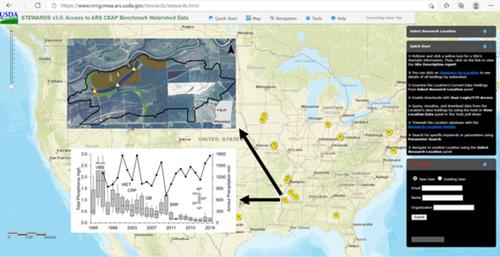
Beasley Lake Watershed is an agriculturally influenced drainage basin in western Mississippi that has been intensively studied for 25 years. As part of the USDA Conservation Effects Assessment Project (CEAP), the watershed has archived hydrology, precipitation, and water quality data in order to measure the effects of multiple USDA Natural Resources Conservation Service conservation practices on lake water quality. The long‐term database is available to researchers using a web‐based application, Sustaining the Earth's Watersheds, Agricultural Research Data System (STEWARDS). STEWARDS is a GIS‐based data retrieval application that encompasses spatial and temporal data collected from multiple sites within the watershed. This data note describes information located in the STEWARDS Beasley Lake Watershed database, including hydrology, precipitation, and water quality data. This information is valuable to researchers and agencies beyond the USDA as an available and useful database to improve the understanding of how land‐use practices affect the water quality of shallow lake systems.
中文翻译:

具有25年农业保护实践的比斯利湖流域长期数据库
比斯利湖流域是密西西比州西部受农业影响的流域,经过25年的深入研究。作为USDA保护效果评估项目(CEAP)的一部分,该流域已存档了水文,降水和水质数据,以衡量USDA多种自然资源保护服务保护措施对湖泊水质的影响。研究人员可以使用基于Web的应用程序(维持地球的流域,农业研究数据系统(STEWARDS))来使用长期数据库。STEWARDS是一个基于GIS的数据检索应用程序,包含从流域内多个站点收集的空间和时间数据。本数据说明描述了STEWARDS Beasley Lake流域数据库中的信息,包括水文学,降水量和水质数据。这些信息对于美国农业部以外的研究人员和机构来说都是有价值的,它是一个有用且有用的数据库,有助于增进人们对土地使用方式如何影响浅湖系统水质的理解。
更新日期:2021-02-25
中文翻译:
具有25年农业保护实践的比斯利湖流域长期数据库
比斯利湖流域是密西西比州西部受农业影响的流域,经过25年的深入研究。作为USDA保护效果评估项目(CEAP)的一部分,该流域已存档了水文,降水和水质数据,以衡量USDA多种自然资源保护服务保护措施对湖泊水质的影响。研究人员可以使用基于Web的应用程序(维持地球的流域,农业研究数据系统(STEWARDS))来使用长期数据库。STEWARDS是一个基于GIS的数据检索应用程序,包含从流域内多个站点收集的空间和时间数据。本数据说明描述了STEWARDS Beasley Lake流域数据库中的信息,包括水文学,降水量和水质数据。这些信息对于美国农业部以外的研究人员和机构来说都是有价值的,它是一个有用且有用的数据库,有助于增进人们对土地使用方式如何影响浅湖系统水质的理解。


 京公网安备 11010802027423号