Computers & Geosciences ( IF 4.2 ) Pub Date : 2021-01-12 , DOI: 10.1016/j.cageo.2021.104687 Hamid Vahdat-Aboueshagh , Frank T.-C. Tsai
|
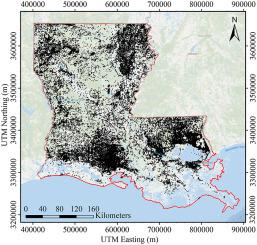
This study introduces a lithofacies modeling method to construct a complex Louisiana stratigraphy model up to depth of 900 m using more than 114,000 well logs. Lithofacies intervals in one well log can be as many as 76. Louisiana comprises a number of interconnected aquifer systems and distinct geological features, such as angular unconformities, domes, and faults. The method contains processes of tessellation, discretization, translation, and interpolation to accommodate these geological features. First, the model domain is tessellated into tiles. Formations have the same dip direction within the same tile, but may have varying dip angles. Each tile is then discretized into computational cells. The data of well logs in and around a tile are translated to a non-dipping domain. A tile-lithofacies model for each tile is then constructed by interpolating well log data in the non-dipping domain. Tile-lithofacies models for all tiles are generated concurrently through parallel computing. Finally, the tile-lithofacies models are back-translated to the dipping domain and are assembled to form a complex lithofacies model. The method was applied to construct a Louisiana stratigraphy model as deep as 800 m. The model revealed two different depositional patterns in southeastern Louisiana likely due to depositional dissimilarity of the ancestral Mississippi River and Tennessee River. The major recharge zones appear to be in northwestern, southeastern, and west-central Louisiana. These recharge zones represent essential outcrop zones for Louisiana's principal aquifers. The model confirmed hydraulic connections of the Mississippi River and the Red River to their underlying alluvial sands. Hydraulic connections among different aquifer systems were also revealed. The Louisiana lithofacies model offers valuable information to improve current knowledge about Louisiana's geology and demonstrates a method potential for large-scale lithofacies modeling.
中文翻译:
用大测井数据构建大型复杂含水层系统:路易斯安那州模型
这项研究引入了岩相学建模方法,使用114,000多个测井曲线构造了一个深度达900 m的复杂路易斯安那地层模型。一个测井中的岩相间隔可以多达76个。路易斯安那州包括许多相互连接的含水层系统和独特的地质特征,例如角不整合面,穹顶和断层。该方法包含镶嵌,离散化,平移和插值的过程,以适应这些地质特征。首先,将模型域细分为图块。在相同的图块中,地层具有相同的倾斜方向,但可能具有不同的倾斜角。然后将每个图块离散化为计算单元。瓦片及其周围的测井数据将转换为非浸入域。然后,通过在非浸入域中内插测井数据,构建每个瓦片的瓦片岩相模型。通过并行计算同时生成所有图块的图块-岩层模型。最后,将瓦片-岩相模型反转换为浸渍域,并进行组装以形成复杂的岩相模型。该方法被用于构造深达800 m的路易斯安那地层模型。该模型揭示了路易斯安那州东南部两种不同的沉积模式,这可能是由于祖先密西西比河和田纳西河的沉积差异所致。主要的补给区似乎位于西北,东南和中西部的路易斯安那州。这些补给区代表了路易斯安那州主要含水层的基本露头区。该模型证实了密西西比河和红河与其潜在冲积砂的水力联系。还揭示了不同含水层系统之间的液压连接。路易斯安那州岩相模型提供了有价值的信息,可以增进对路易斯安那州地质学的当前了解,并证明了大规模岩相建模的方法潜力。


 京公网安备 11010802027423号