当前位置:
X-MOL 学术
›
Photogramm. Rec.
›
论文详情
Our official English website, www.x-mol.net, welcomes your
feedback! (Note: you will need to create a separate account there.)
Automated Registration of SfM‐MVS Multitemporal Datasets Using Terrestrial and Oblique Aerial Images
The Photogrammetric Record ( IF 2.1 ) Pub Date : 2021-01-06 , DOI: 10.1111/phor.12346 Luigi Parente 1 , Jim H. Chandler 2 , Neil Dixon 2
The Photogrammetric Record ( IF 2.1 ) Pub Date : 2021-01-06 , DOI: 10.1111/phor.12346 Luigi Parente 1 , Jim H. Chandler 2 , Neil Dixon 2
Affiliation
|
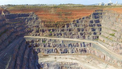
Accurate alignment of 3D models is critical for valid change‐detection analysis from multitemporal photogrammetric datasets. This paper assesses an automated registration strategy which uses the scale‐invariant feature transform (SIFT) algorithm implemented in modern photogrammetric software. This registration solution, also known as “Time‐SIFT”, was tested at two study sites featuring vertical surfaces, including a sea cliff (~500 m2) and a quarry face (~50 000 m2). Tests demonstrated that the investigated registration strategy can achieve accurate alignments between multitemporal point clouds even when using multisource and multi‐perspective data, captured across widely varying spatial and temporal scales and under a range of weather and illumination conditions. The combination of the Time‐SIFT approach with an ICP algorithm produced moderate improvements in the alignment. Furthermore, the use of an innovative direct georeferencing technique, which used the tracking feature of a robotic total station, allowed for accurate georectification of 3D models.
中文翻译:

使用地面和倾斜航空影像自动注册SfM-MVS多时相数据集
3D模型的准确对齐对于从多时相摄影测量数据集进行有效的变化检测分析至关重要。本文评估了一种自动注册策略,该策略使用了在现代摄影测量软件中实现的尺度不变特征变换(SIFT)算法。此配准解决方案也称为“ Time-SIFT”,已在两个具有垂直表面的研究地点进行了测试,包括海崖(〜500 m 2)和采石场(〜50000 m 2))。测试表明,所研究的配准策略即使在使用多源和多视角数据时也可以实现多时相点云之间的精确对齐,这些跨时空点和范围广泛的天气和光照条件下捕获的数据。Time-SIFT方法与ICP算法的结合在对齐方面产生了适度的改进。此外,使用了创新的直接地理配准技术,该技术利用了机器人全站仪的跟踪功能,可以对3D模型进行精确的地理校正。
更新日期:2021-01-06
中文翻译:
使用地面和倾斜航空影像自动注册SfM-MVS多时相数据集
3D模型的准确对齐对于从多时相摄影测量数据集进行有效的变化检测分析至关重要。本文评估了一种自动注册策略,该策略使用了在现代摄影测量软件中实现的尺度不变特征变换(SIFT)算法。此配准解决方案也称为“ Time-SIFT”,已在两个具有垂直表面的研究地点进行了测试,包括海崖(〜500 m 2)和采石场(〜50000 m 2))。测试表明,所研究的配准策略即使在使用多源和多视角数据时也可以实现多时相点云之间的精确对齐,这些跨时空点和范围广泛的天气和光照条件下捕获的数据。Time-SIFT方法与ICP算法的结合在对齐方面产生了适度的改进。此外,使用了创新的直接地理配准技术,该技术利用了机器人全站仪的跟踪功能,可以对3D模型进行精确的地理校正。


 京公网安备 11010802027423号