当前位置:
X-MOL 学术
›
Ecol. Res.
›
论文详情
Our official English website, www.x-mol.net, welcomes your
feedback! (Note: you will need to create a separate account there.)
Large‐scale ecological field data for satellite validation in deciduous forests and grasslands
Ecological Research ( IF 1.7 ) Pub Date : 2020-10-16 , DOI: 10.1111/1440-1703.12155 Tomoko Kawaguchi Akitsu 1 , Tatsuro Nakaji 2 , Hajime Kobayashi 3 , Tetsuo Okano 3 , Yoshiaki Honda 4 , Undrakh Bayarsaikhan 5 , Terigele 5 , Masato Hayashi 6 , Tsutom Hiura 7 , Reiko Ide 8 , Susumu Igarashi 9 , Koji Kajiwara 4 , Syoji Kumikawa 9 , Yuuichi Matsuoka 9 , Takashi Nakano 10 , Tomoko Nakano 11 , Atsushi Okuda 9 , Tomoaki Sato 9 , Kaoru Tachiiri 12 , Yoshiyuki Takahashi 8 , Jiro Uchida 9 , Kenlo Nishida Nasahara 1
Ecological Research ( IF 1.7 ) Pub Date : 2020-10-16 , DOI: 10.1111/1440-1703.12155 Tomoko Kawaguchi Akitsu 1 , Tatsuro Nakaji 2 , Hajime Kobayashi 3 , Tetsuo Okano 3 , Yoshiaki Honda 4 , Undrakh Bayarsaikhan 5 , Terigele 5 , Masato Hayashi 6 , Tsutom Hiura 7 , Reiko Ide 8 , Susumu Igarashi 9 , Koji Kajiwara 4 , Syoji Kumikawa 9 , Yuuichi Matsuoka 9 , Takashi Nakano 10 , Tomoko Nakano 11 , Atsushi Okuda 9 , Tomoaki Sato 9 , Kaoru Tachiiri 12 , Yoshiyuki Takahashi 8 , Jiro Uchida 9 , Kenlo Nishida Nasahara 1
Affiliation
|
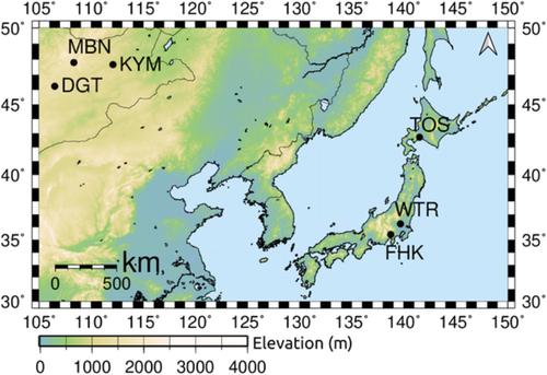
In situ accurate data sets of leaf area index (LAI), above‐ground biomass (AGB), and fraction of absorbed photosynthetically active radiation (fAPAR) are indispensable to validate and improve ecological products obtained from satellites. In situ data for satellite validation must be created not from a single‐point data but from areal data (such as multiple‐points data) representing a satellite footprint. Using multiple‐points data, the error of in situ data can be calculated statistically. The quantification of the error in the in situ data enables us to evaluate the discrepancy between the satellites' products and the in situ data as the error in the in situ data and the estimation error in the products separately. Besides, the accuracy of the in situ data is required to be much higher than the accuracy of the satellite products which was officially set. To obtain such in situ data, we have established observation sites for typical land cover types in East Asia, from temperate to cool ecosystems: deciduous needle‐leaved forest (DNF), evergreen needle‐leaved forest (ENF), deciduous broad‐leaved forest (DBF), and grassland (GL). We conducted the observations in 500 m × 500 m areas, which is the footprint scale of the Global Change Observation Mission‐Climate satellite. In this paper, the data of LAI, AGB, and fAPAR observed at DNF, DBF, and GL (i.e., except at ENF) are reported. These data are useful even for the validation of other satellite products, especially with higher spatial resolution. Also, the long‐term tree census data from 2005 to 2018 at DNF are reported.
中文翻译:

大型生态田地数据,用于在落叶林和草地上进行卫星验证
为了验证和改善从卫星获得的生态产品,必不可少的准确的叶面积指数(LAI),地上生物量(AGB)和吸收的光合有效辐射分数(fAPAR)的准确数据集是必不可少的。必须不是从单点数据而是从代表卫星足迹的面积数据(例如多点数据)创建用于卫星验证的现场数据。使用多点数据,可以统计计算原位数据的误差。量化原位数据中的误差使我们能够分别评估卫星产品和原位数据之间的差异,因为原位数据中的误差和产品中的估计误差。除了,要求现场数据的精度要比正式设定的卫星产品的精度高得多。为了获得这种原位数据,我们建立了东亚典型的土地覆盖类型观测站,从温带到凉爽的生态系统:落叶针叶林(DNF),常绿针叶林(ENF),落叶阔叶林(DBF)和草原(GL)。我们在500 m×500 m区域内进行了观测,这是全球变化观测团气候卫星的足迹规模。本文报道了在DNF,DBF和GL(即ENF除外)观察到的LAI,AGB和fAPAR数据。这些数据甚至对于验证其他卫星产品也很有用,尤其是在具有更高空间分辨率的情况下。此外,还报告了DNF从2005年到2018年的长期树木普查数据。
更新日期:2020-11-21
中文翻译:
大型生态田地数据,用于在落叶林和草地上进行卫星验证
为了验证和改善从卫星获得的生态产品,必不可少的准确的叶面积指数(LAI),地上生物量(AGB)和吸收的光合有效辐射分数(fAPAR)的准确数据集是必不可少的。必须不是从单点数据而是从代表卫星足迹的面积数据(例如多点数据)创建用于卫星验证的现场数据。使用多点数据,可以统计计算原位数据的误差。量化原位数据中的误差使我们能够分别评估卫星产品和原位数据之间的差异,因为原位数据中的误差和产品中的估计误差。除了,要求现场数据的精度要比正式设定的卫星产品的精度高得多。为了获得这种原位数据,我们建立了东亚典型的土地覆盖类型观测站,从温带到凉爽的生态系统:落叶针叶林(DNF),常绿针叶林(ENF),落叶阔叶林(DBF)和草原(GL)。我们在500 m×500 m区域内进行了观测,这是全球变化观测团气候卫星的足迹规模。本文报道了在DNF,DBF和GL(即ENF除外)观察到的LAI,AGB和fAPAR数据。这些数据甚至对于验证其他卫星产品也很有用,尤其是在具有更高空间分辨率的情况下。此外,还报告了DNF从2005年到2018年的长期树木普查数据。


 京公网安备 11010802027423号