当前位置:
X-MOL 学术
›
Earth Surf.Process. Land.
›
论文详情
Our official English website, www.x-mol.net, welcomes your
feedback! (Note: you will need to create a separate account there.)
Monitoring soil surface roughness under growing winter wheat with low‐altitude UAV sensing: Potential and limitations
Earth Surface Processes and Landforms ( IF 2.8 ) Pub Date : 2020-09-05 , DOI: 10.1002/esp.4998 Nils Onnen 1 , Anette Eltner 2 , Goswin Heckrath 1 , Kristof Van Oost 3
Earth Surface Processes and Landforms ( IF 2.8 ) Pub Date : 2020-09-05 , DOI: 10.1002/esp.4998 Nils Onnen 1 , Anette Eltner 2 , Goswin Heckrath 1 , Kristof Van Oost 3
Affiliation
|
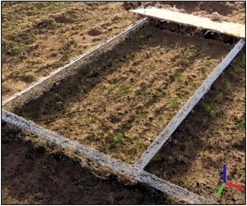
Soil surface roughness (SSR) is an important factor in controlling sediment and runoff generation, influencing directly a wide spectrum of erosion parameters. SSR is highly variable in time and space under natural conditions, and characterizing SSR to improve the parameterization of hydrological and erosion models has proved challenging. Our study uses recent technological and algorithmic developments in capturing and processing close aerial sensing data to evaluate how high‐resolution imagery can assist the temporally and spatially explicit monitoring of SSR. We evaluated the evolution of SSR under natural rainfall and growing vegetation conditions on two arable fields in Denmark. Unmanned aerial vehicle (UAV) photogrammetry was used to monitor small field plots over 7 months after seeding of winter wheat following conventional and reduced tillage treatments. Field campaigns were conducted at least once a month from October until April, resulting in nine time steps of data acquisition. Structure from motion photogrammetry was used to derive high‐resolution point clouds with an average ground sampling distance of 2.7 mm and a mean ground control point accuracy of 1.8 mm. A comprehensive workflow was developed to process the point clouds, including the detection of vegetation and the removal of vegetation‐induced point cloud noise. Rasterized and filtered point clouds were then used to determine SSR geostatistically as the standard deviation of height, applying different kernel sizes and using semivariograms. The results showed an influence of kernel size on roughness, with a value range of 0.2–1 cm of average height deviation during the monitoring period. Semivariograms showed a measurable decrease in sill variance and an increase in range over time. This research demonstrated multiple challenges to measuring SSR with UAV under natural conditions with increasing vegetation cover. The proposed workflow represents a step forward in tackling those challenges and provides a knowledge base for future research. © 2020 John Wiley & Sons, Ltd.
中文翻译:

利用低空无人机监测冬小麦生长过程中的土壤表面粗糙度:潜力和局限性
土壤表面粗糙度(SSR)是控制沉积物和径流产生的重要因素,直接影响广泛的侵蚀参数。在自然条件下,SSR在时间和空间上变化很大,并且表征SSR以改善水文和侵蚀模型的参数化已证明具有挑战性。我们的研究使用最新的技术和算法发展来捕获和处理近距离的航空遥感数据,以评估高分辨率图像如何协助对SSR进行时空明确监测。我们评估了丹麦两个耕地上自然降雨和植被生长条件下SSR的演变。使用常规和减耕处理技术,在播种冬小麦后的7个月内,使用无人飞行器(UAV)摄影测量来监测小块田地。从10月到4月,每月至少进行一次野外活动,从而获得了9个时间数据采集步骤。运动摄影测量的结构用于获得高分辨率的点云,其平均地面采样距离为2.7 mm,平均地面控制点精度为1.8 mm。开发了一个全面的工作流来处理点云,包括检测植被和消除植被引起的点云噪声。然后使用栅格化和滤波后的点云,以统计学的方式确定SSR地统计学为高度的标准偏差,应用不同的核大小并使用半变异函数。结果显示了籽粒大小对粗糙度的影响,在监测期间平均高度偏差的值范围为0.2-1 cm。半变异函数图显示,随着时间的变化,门槛差异明显减小,范围增大。这项研究表明,在自然条件下,随着植被覆盖的增加,用无人机测量SSR面临多重挑战。拟议的工作流程代表了应对这些挑战的步骤,并为将来的研究提供了知识库。©2020 John Wiley&Sons,Ltd. 这项研究表明,在自然条件下,随着植被覆盖的增加,用无人机测量SSR面临多重挑战。拟议的工作流程代表了应对这些挑战的步骤,并为将来的研究提供了知识库。©2020 John Wiley&Sons,Ltd. 这项研究表明,在自然条件下,随着植被覆盖的增加,用无人机测量SSR面临多重挑战。拟议的工作流程代表了应对这些挑战的步骤,并为将来的研究提供了知识库。©2020 John Wiley&Sons,Ltd.
更新日期:2020-11-03
中文翻译:
利用低空无人机监测冬小麦生长过程中的土壤表面粗糙度:潜力和局限性
土壤表面粗糙度(SSR)是控制沉积物和径流产生的重要因素,直接影响广泛的侵蚀参数。在自然条件下,SSR在时间和空间上变化很大,并且表征SSR以改善水文和侵蚀模型的参数化已证明具有挑战性。我们的研究使用最新的技术和算法发展来捕获和处理近距离的航空遥感数据,以评估高分辨率图像如何协助对SSR进行时空明确监测。我们评估了丹麦两个耕地上自然降雨和植被生长条件下SSR的演变。使用常规和减耕处理技术,在播种冬小麦后的7个月内,使用无人飞行器(UAV)摄影测量来监测小块田地。从10月到4月,每月至少进行一次野外活动,从而获得了9个时间数据采集步骤。运动摄影测量的结构用于获得高分辨率的点云,其平均地面采样距离为2.7 mm,平均地面控制点精度为1.8 mm。开发了一个全面的工作流来处理点云,包括检测植被和消除植被引起的点云噪声。然后使用栅格化和滤波后的点云,以统计学的方式确定SSR地统计学为高度的标准偏差,应用不同的核大小并使用半变异函数。结果显示了籽粒大小对粗糙度的影响,在监测期间平均高度偏差的值范围为0.2-1 cm。半变异函数图显示,随着时间的变化,门槛差异明显减小,范围增大。这项研究表明,在自然条件下,随着植被覆盖的增加,用无人机测量SSR面临多重挑战。拟议的工作流程代表了应对这些挑战的步骤,并为将来的研究提供了知识库。©2020 John Wiley&Sons,Ltd. 这项研究表明,在自然条件下,随着植被覆盖的增加,用无人机测量SSR面临多重挑战。拟议的工作流程代表了应对这些挑战的步骤,并为将来的研究提供了知识库。©2020 John Wiley&Sons,Ltd. 这项研究表明,在自然条件下,随着植被覆盖的增加,用无人机测量SSR面临多重挑战。拟议的工作流程代表了应对这些挑战的步骤,并为将来的研究提供了知识库。©2020 John Wiley&Sons,Ltd.


 京公网安备 11010802027423号