当前位置:
X-MOL 学术
›
Int. J. Climatol.
›
论文详情
Our official English website, www.x-mol.net, welcomes your
feedback! (Note: you will need to create a separate account there.)
Precipitation in peninsular Spain: Influence of teleconnection indices and spatial regionalisation
International Journal of Climatology ( IF 3.5 ) Pub Date : 2020-07-26 , DOI: 10.1002/joc.6770 Joan Martinez‐Artigas 1 , Marc Lemus‐Canovas 1 , Joan Albert Lopez‐Bustins 1
International Journal of Climatology ( IF 3.5 ) Pub Date : 2020-07-26 , DOI: 10.1002/joc.6770 Joan Martinez‐Artigas 1 , Marc Lemus‐Canovas 1 , Joan Albert Lopez‐Bustins 1
Affiliation
|
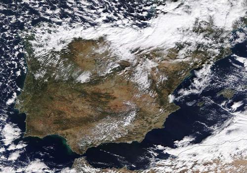
Precipitation constitutes a particularly variable climatic element in Spain. Study of teleconnection indices, closely related to precipitation, enables us to establish to a greater or lesser degree the mechanisms regulating pluviometric variability; these are vital for planning and managing water resources in semiarid regions. In the present article we attempt to identify the low‐frequency patterns that present the closest statistical relationship with rainfall for each of the points on the MOPREDAS pluviometric data grid, covering the whole area of peninsular Spain. The results obtained reveal the clear dominance of Mediterranean Basin patterns, specifically of the Mediterranean Oscillation (MO) and of its version in the mid‐levels of the troposphere (ULMO). Results, however, show a significant dominance of the Western Mediterranean Oscillation (WeMO) in the east of the Iberian Peninsula and the eastern part of the Cantabrian façade. Also noteworthy is the control exerted by the NAO over much of the centre and southwest of Spain, as well as the surprising dominance of an index that heretofore has not been used much, known as the Paris‐London Westerly Index. Finally, we performed a regionalisation based upon the correlations between the teleconnection and precipitation indices by means of a principal components analysis, which revealed the existence of three differentiated pluviometric regions in peninsular Spain: Atlantic (centre and south), Mediterranean (east) and Cantabrian (north).
中文翻译:

西班牙半岛的降水:遥相关指数和空间分区的影响
在西班牙,降水是一个特别易变的气候要素。对与降水密切相关的遥相关指数的研究使我们或多或少地建立了调节测雨量变异性的机制;这些对于半干旱地区的水资源规划和管理至关重要。在本文中,我们尝试确定MOPREDAS测雨量数据网格上每个点的降雨与降雨之间的统计关系最密切的低频模式,这些频率覆盖西班牙半岛的整个区域。获得的结果揭示了地中海盆地模式的明显优势,特别是地中海涛动(MO)及其对流层中层(ULMO)的版本。结果,但是 展示了伊比利亚半岛东部和坎塔布连立面东部的西地中海涛动(WeMO)的显着优势。同样值得注意的是,NAO对西班牙中部和西南部大部分地区的控制,以及迄今为止从未使用过的一个令人吃惊的主导地位,即巴黎-伦敦西风指数。最后,我们通过主成分分析,根据遥相关性与降水指数之间的相关性,进行了区域划分,揭示了西班牙半岛上存在三个不同的测雨区:大西洋(中部和南部),地中海(东部)和坎塔布连(北)。同样值得注意的是,NAO对西班牙中部和西南部大部分地区的控制,以及迄今为止从未使用过的一个令人吃惊的主导地位,即巴黎-伦敦西风指数。最后,我们通过主成分分析,根据遥相关性与降水指数之间的相关性,进行了区域划分,揭示了西班牙半岛上存在三个不同的测雨区:大西洋(中部和南部),地中海(东部)和坎塔布连(北)。同样值得注意的是,NAO对西班牙中部和西南部大部分地区的控制,以及迄今为止从未使用过的一个令人吃惊的主导地位,即巴黎-伦敦西风指数。最后,我们通过主成分分析,根据遥相关性与降水指数之间的相关性,进行了区域划分,揭示了西班牙半岛上存在三个不同的测雨区:大西洋(中部和南部),地中海(东部)和坎塔布连(北)。
更新日期:2020-07-26
中文翻译:
西班牙半岛的降水:遥相关指数和空间分区的影响
在西班牙,降水是一个特别易变的气候要素。对与降水密切相关的遥相关指数的研究使我们或多或少地建立了调节测雨量变异性的机制;这些对于半干旱地区的水资源规划和管理至关重要。在本文中,我们尝试确定MOPREDAS测雨量数据网格上每个点的降雨与降雨之间的统计关系最密切的低频模式,这些频率覆盖西班牙半岛的整个区域。获得的结果揭示了地中海盆地模式的明显优势,特别是地中海涛动(MO)及其对流层中层(ULMO)的版本。结果,但是 展示了伊比利亚半岛东部和坎塔布连立面东部的西地中海涛动(WeMO)的显着优势。同样值得注意的是,NAO对西班牙中部和西南部大部分地区的控制,以及迄今为止从未使用过的一个令人吃惊的主导地位,即巴黎-伦敦西风指数。最后,我们通过主成分分析,根据遥相关性与降水指数之间的相关性,进行了区域划分,揭示了西班牙半岛上存在三个不同的测雨区:大西洋(中部和南部),地中海(东部)和坎塔布连(北)。同样值得注意的是,NAO对西班牙中部和西南部大部分地区的控制,以及迄今为止从未使用过的一个令人吃惊的主导地位,即巴黎-伦敦西风指数。最后,我们通过主成分分析,根据遥相关性与降水指数之间的相关性,进行了区域划分,揭示了西班牙半岛上存在三个不同的测雨区:大西洋(中部和南部),地中海(东部)和坎塔布连(北)。同样值得注意的是,NAO对西班牙中部和西南部大部分地区的控制,以及迄今为止从未使用过的一个令人吃惊的主导地位,即巴黎-伦敦西风指数。最后,我们通过主成分分析,根据遥相关性与降水指数之间的相关性,进行了区域划分,揭示了西班牙半岛上存在三个不同的测雨区:大西洋(中部和南部),地中海(东部)和坎塔布连(北)。


 京公网安备 11010802027423号