当前位置:
X-MOL 学术
›
Q. J. R. Meteorol. Soc.
›
论文详情
Our official English website, www.x-mol.net, welcomes your
feedback! (Note: you will need to create a separate account there.)
How an urban parameterization affects a high‐resolution global climate simulation
Quarterly Journal of the Royal Meteorological Society ( IF 3.0 ) Pub Date : 2020-07-13 , DOI: 10.1002/qj.3874 Jack Katzfey 1 , Heinke Schlüzen 2 , Peter Hoffmann 1, 3 , Marcus Thatcher 1
Quarterly Journal of the Royal Meteorological Society ( IF 3.0 ) Pub Date : 2020-07-13 , DOI: 10.1002/qj.3874 Jack Katzfey 1 , Heinke Schlüzen 2 , Peter Hoffmann 1, 3 , Marcus Thatcher 1
Affiliation
|
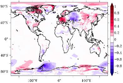
The impact of urban areas on the global and regional climate has been assessed using the global Conformal Cubic Atmospheric Model (CCAM) including an urban canyon parameterization at a global resolution of 50 km. Simulations were produced with and without urban areas to assess urban impacts for the historical period 1980–2000. Two different land cover and urban datasets (one based on IGBP‐DIS, the other on MODIS) were tested. In addition, simulations were performed for the end of the 21st century with the RCP8.5 scenario. Evaluation of the historical climate simulations indicates realistic local urban effects, such as higher daily minimum air temperatures (tasmin), higher sensible heat flux and lower latent heat flux at urban grid cells. In regions with large fractions of urban areas, some regional changes are also noted. In addition, there are significant regional effects far away from the main urban areas, which are similar in magnitude to the effects of the different non‐urban land cover input datasets. Under the projected warming at the end of the 21st century (with no land cover change), there is a decrease in anthropogenic heating, primarily during wintertime. There is a slightly smaller increase in daily maximum temperature and a slightly larger increase in tasmin in urban areas compared to rural areas. This leads to a smaller increase in the diurnal temperature range within urban areas. The tasmin changes also imply an increase in the urban heat island effect for larger cities. The results of this sensitivity study show that there is a detectable impact of urban areas on high‐resolution global climate simulations. Consequently, there is a need to include urban areas in global simulations, as well as in studies of land‐use change.
中文翻译:

城市参数化如何影响高分辨率的全球气候模拟
已使用全球共形立方大气模型(CCAM)评估了城市地区对全球和区域气候的影响,其中包括以50 km的全球分辨率进行的城市峡谷参数化。进行了有或没有城市区域的模拟,以评估1980-2000年历史时期的城市影响。测试了两个不同的土地覆盖和城市数据集(一个基于IGBP-DIS,另一个基于MODIS)。另外,在21世纪末使用RCP8.5方案进行了模拟。对历史气候模拟的评估表明了实际的当地城市影响,例如更高的每日最低气温(塔斯敏),更高的显热通量和更低的城市网格单元潜热通量。在城市地区所占比例较大的地区,也注意到了一些区域变化。此外,远离主要城市地区的区域影响显着,其大小与不同的非城市土地覆被输入数据集的影响相似。在预计的21世纪末变暖(土地覆盖没有变化)的情况下,人为采暖的减少主要在冬季。与农村地区相比,城市地区的每日最高温度升高幅度较小,而塔斯明的升高幅度较大。这导致市区内昼夜温度范围的增加较小。鲜味的改变也暗示了大城市的城市热岛效应增加。这项敏感性研究的结果表明,城市地区对高分辨率全球气候模拟有可检测的影响。所以,
更新日期:2020-07-13
中文翻译:
城市参数化如何影响高分辨率的全球气候模拟
已使用全球共形立方大气模型(CCAM)评估了城市地区对全球和区域气候的影响,其中包括以50 km的全球分辨率进行的城市峡谷参数化。进行了有或没有城市区域的模拟,以评估1980-2000年历史时期的城市影响。测试了两个不同的土地覆盖和城市数据集(一个基于IGBP-DIS,另一个基于MODIS)。另外,在21世纪末使用RCP8.5方案进行了模拟。对历史气候模拟的评估表明了实际的当地城市影响,例如更高的每日最低气温(塔斯敏),更高的显热通量和更低的城市网格单元潜热通量。在城市地区所占比例较大的地区,也注意到了一些区域变化。此外,远离主要城市地区的区域影响显着,其大小与不同的非城市土地覆被输入数据集的影响相似。在预计的21世纪末变暖(土地覆盖没有变化)的情况下,人为采暖的减少主要在冬季。与农村地区相比,城市地区的每日最高温度升高幅度较小,而塔斯明的升高幅度较大。这导致市区内昼夜温度范围的增加较小。鲜味的改变也暗示了大城市的城市热岛效应增加。这项敏感性研究的结果表明,城市地区对高分辨率全球气候模拟有可检测的影响。所以,


 京公网安备 11010802027423号