International Journal of Applied Earth Observation and Geoinformation ( IF 7.6 ) Pub Date : 2018-10-12 , DOI: 10.1016/j.jag.2018.10.001 Mariana Tiné , Liliana Perez , Roberto Molowny-Horas , Marcel Darveau
|
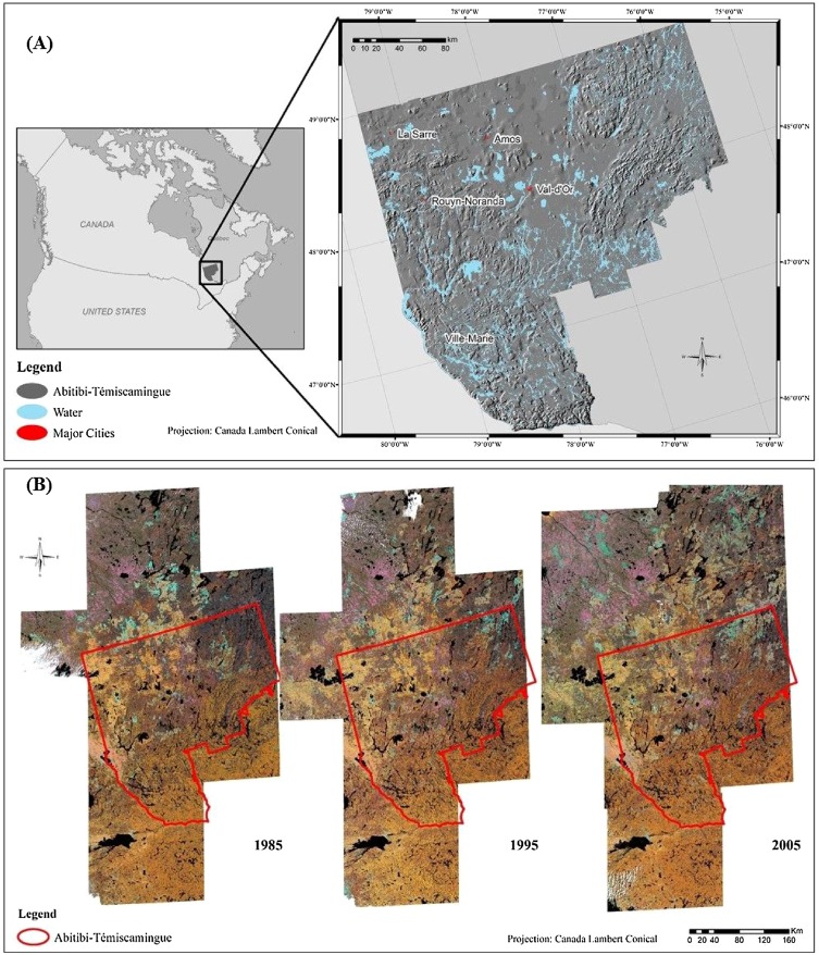
Among the most productive ecosystems around the world, wetlands support a wide range of biodiversity such as waterfowl, fish, amphibians, plants and many other species. They also provide ecosystem services that play important roles in relation to nutrient cycling, climate mitigation and adaptation, as well as food security. In this research, we examined and projected the spatiotemporal trends of change in open wetlands by coupling logistic regression, Markov chain methods and a multi-objective land allocation model into a hybrid geosimulation model. To study the changes in open wetlands we used multi-temporal land cover information interpreted from LANDSAT images (1985, 1995, and 2005). We predicted future spatial distributions of open wetlands in the administrative region of Abitibi-Témiscamingue, Quebec, Canada for 2015, 2025, 2035, 2045 and 2055. A comparison and assessment of the model’s outcomes were performed using map-comparison techniques as well as landscape metrics. Change analysis between 1985 and 2005 showed an increase of about 63% in open wetlands, while simulation results indicated that this tendency would persist into 2055 with a continuous augmentation of open wetlands in the region. The spatial distribution of predicted trends in open wetlands could provide support to local biodiversity assessments, management and conservation planning of the open wetlands in Quebec, Canada.
中文翻译:
开放湿地未来变化的混合时空模拟:加拿大魁北克省Abitibi-Témiscamingue地区的研究
在世界上生产力最高的生态系统中,湿地支持广泛的生物多样性,例如水禽,鱼类,两栖动物,植物和许多其他物种。他们还提供生态系统服务,这些服务在养分循环,减缓和适应气候变化以及粮食安全方面发挥着重要作用。在这项研究中,我们通过将逻辑回归,马尔可夫链方法和多目标土地分配模型耦合到混合地球模拟模型中,研究并预测了开放湿地的时空变化趋势。为了研究开放湿地的变化,我们使用了从LANDSAT图像(1985、1995和2005)解释的多时相土地覆盖信息。我们预测了2015年,2025年,2035年,加拿大魁北克Abitibi-Témiscamingue行政区域内开放湿地的未来空间分布,2045年和2055年。使用地图比较技术和景观指标对模型结果进行了比较和评估。1985年至2005年之间的变化分析表明,开放的湿地增加了约63%,而模拟结果表明,随着该地区开放湿地的不断增加,这种趋势将持续到2055年。开放湿地的趋势预测的空间分布可以为加拿大魁北克开放湿地的当地生物多样性评估,管理和保护规划提供支持。模拟结果表明,随着该地区开放湿地的不断增加,这种趋势将持续到2055年。开放湿地的趋势预测的空间分布可以为加拿大魁北克开放湿地的当地生物多样性评估,管理和保护规划提供支持。模拟结果表明,随着该地区开放湿地的不断增加,这种趋势将持续到2055年。开放湿地的趋势预测的空间分布可以为加拿大魁北克开放湿地的当地生物多样性评估,管理和保护规划提供支持。


 京公网安备 11010802027423号