当前位置:
X-MOL 学术
›
Remote Sens. Environ.
›
论文详情
Our official English website, www.x-mol.net, welcomes your
feedback! (Note: you will need to create a separate account there.)
Fine-scale three-dimensional modeling of boreal forest plots to improve forest characterization with remote sensing
Remote Sensing of Environment ( IF 11.1 ) Pub Date : 2018-12-01 , DOI: 10.1016/j.rse.2018.09.026 Jean-François Côté , Richard A. Fournier , Joan E. Luther , Olivier R. van Lier
Remote Sensing of Environment ( IF 11.1 ) Pub Date : 2018-12-01 , DOI: 10.1016/j.rse.2018.09.026 Jean-François Côté , Richard A. Fournier , Joan E. Luther , Olivier R. van Lier
|
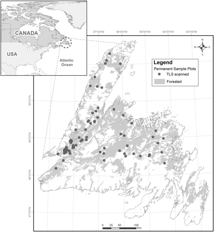
Abstract Improving the quality of information that can be obtained from forest inventories can enhance planning for the best use of forest resources. In this study, we demonstrate the capability to improve the characterization of forest inventory attributes using terrestrial laser scanner (TLS) data, a fine-scale architectural model (L-Architect), and airborne laser scanner (ALS) data. Terrestrial laser scanning provides detailed and accurate three-dimensional data and has the potential to characterize forest plots with comprehensive structural information. We use TLS data and in situ measurements as input to L-Architect to create reference plots. The use of L-Architect for modeling was validated by comparing selected attributes of the reference plots with validation plots produced using simulated TLS data, with normalized root-mean square error (NMRSE) values below 17%. Surrogate plots were then created using a library of tree models where individual trees were selected according to three attributes—tree height, diameter at breast height, and crown projected area—either measured from in situ plots or derived from ALS data. The accuracy of the surrogate plots was assessed by comparing several key forest attributes from the reference plots, including branching structure (e.g., number of whorls, knot surface), crown shape and size (e.g., base height, asymmetry), heterogeneity (e.g., lacunarity, fractal dimension), tree volume, and the spatial distribution of material (e.g., Weibull fit, leaf area index). Overall, the surrogate plots reproduced the attributes of the reference plots with NRMSE mean value of 17% (R2 = 0.68) using in situ ground measurements and 24% (R2 = 0.51) using inputs estimated with ALS. Some attributes, such as leaf area index, knot surface, and fractal dimension, were well predicted (R2 > 0.80), whereas others, like crown asymmetry and lacunarity, had weak correspondence (R2
中文翻译:

北方森林地块的精细三维建模,以利用遥感改善森林特征
摘要 提高从森林清单中获得的信息质量可以加强规划以实现森林资源的最佳利用。在本研究中,我们展示了使用地面激光扫描仪 (TLS) 数据、精细建筑模型 (L-Architect) 和机载激光扫描仪 (ALS) 数据改进森林清单属性表征的能力。地面激光扫描提供详细而准确的三维数据,并有可能用全面的结构信息来表征森林地块。我们使用 TLS 数据和原位测量作为 L-Architect 的输入来创建参考图。通过将参考图的选定属性与使用模拟 TLS 数据生成的验证图进行比较,验证了 L-Architect 在建模中的使用,归一化均方根误差 (NMRSE) 值低于 17%。然后使用树木模型库创建替代图,其中根据三个属性(树高、胸高直径和树冠投影面积)选择单个树木,这些属性可以从原位图测量,也可以从 ALS 数据中获得。通过比较参考地块的几个关键森林属性来评估替代地块的准确性,包括分枝结构(例如,轮数、节面)、树冠形状和大小(例如,基部高度、不对称性)、异质性(例如,空隙度、分形维数)、树木体积和材料的空间分布(例如,威布尔拟合、叶面积指数)。总体而言,替代图再现了参考图的属性,NRMSE 平均值为 17% (R2 = 0. 68) 使用原位地面测量,24% (R2 = 0.51) 使用 ALS 估计的输入。一些属性,如叶面积指数、结面和分形维数,被很好地预测 (R2 > 0.80),而其他属性,如冠不对称和缺孔,具有弱对应性 (R2
更新日期:2018-12-01
中文翻译:
北方森林地块的精细三维建模,以利用遥感改善森林特征
摘要 提高从森林清单中获得的信息质量可以加强规划以实现森林资源的最佳利用。在本研究中,我们展示了使用地面激光扫描仪 (TLS) 数据、精细建筑模型 (L-Architect) 和机载激光扫描仪 (ALS) 数据改进森林清单属性表征的能力。地面激光扫描提供详细而准确的三维数据,并有可能用全面的结构信息来表征森林地块。我们使用 TLS 数据和原位测量作为 L-Architect 的输入来创建参考图。通过将参考图的选定属性与使用模拟 TLS 数据生成的验证图进行比较,验证了 L-Architect 在建模中的使用,归一化均方根误差 (NMRSE) 值低于 17%。然后使用树木模型库创建替代图,其中根据三个属性(树高、胸高直径和树冠投影面积)选择单个树木,这些属性可以从原位图测量,也可以从 ALS 数据中获得。通过比较参考地块的几个关键森林属性来评估替代地块的准确性,包括分枝结构(例如,轮数、节面)、树冠形状和大小(例如,基部高度、不对称性)、异质性(例如,空隙度、分形维数)、树木体积和材料的空间分布(例如,威布尔拟合、叶面积指数)。总体而言,替代图再现了参考图的属性,NRMSE 平均值为 17% (R2 = 0. 68) 使用原位地面测量,24% (R2 = 0.51) 使用 ALS 估计的输入。一些属性,如叶面积指数、结面和分形维数,被很好地预测 (R2 > 0.80),而其他属性,如冠不对称和缺孔,具有弱对应性 (R2


 京公网安备 11010802027423号