International Journal of Applied Earth Observation and Geoinformation ( IF 7.6 ) Pub Date : 2018-10-09 , DOI: 10.1016/j.jag.2018.09.017 Shanti Shrestha , Isabel Miranda , Abhishek Kumar , Maria Luisa Escobar Pardo , Subash Dahal , Taufiq Rashid , Caren Remillard , Deepak R. Mishra
|
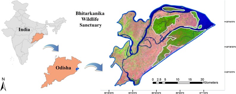
Mangroves are one of the most productive ecosystems known for provisioning of various ecosystem goods and services. They help in sequestering large amounts of carbon, protecting coastline against erosion, and reducing impacts of natural disasters such as hurricanes. Bhitarkanika Wildlife Sanctuary in Odisha harbors the second largest mangrove ecosystem in India. This study used Terra, Landsat and Sentinel-1 satellite data for spatio-temporal monitoring of mangrove forest within Bhitarkanika Wildlife Sanctuary between 2000 and 2016. Three biophysical parameters were used to assess mangrove ecosystem health: leaf chlorophyll (CHL), Leaf Area Index (LAI), and Gross Primary Productivity (GPP). A long-term analysis of meteorological data such as precipitation and temperature was performed to determine an association between these parameters and mangrove biophysical characteristics. The correlation between meteorological parameters and mangrove biophysical characteristics enabled forecasting of mangrove health and productivity for year 2050 by incorporating IPCC projected climate data. A historical analysis of land cover maps was also performed using Landsat 5 and 8 data to determine changes in mangrove area estimates in years 1995, 2004 and 2017. There was a decrease in dense mangrove extent with an increase in open mangroves and agricultural area. Despite conservation efforts, the current extent of dense mangrove is projected to decrease up to 10% by the year 2050. All three biophysical characteristics including GPP, LAI and CHL, are projected to experience a net decrease of 7.7%, 20.83% and 25.96% respectively by 2050 compared to the mean annual value in 2016. This study will help the Forest Department, Government of Odisha in managing and taking appropriate decisions for conserving and sustaining the remaining mangrove forest under the changing climate and developmental activities.
中文翻译:
使用多传感器数据识别和预测热带红树林生态系统内的潜在生物物理风险区域
红树林是生产力最高的生态系统之一,以提供各种生态系统产品和服务而闻名。它们有助于封存大量碳,保护海岸线免受侵蚀,并减少飓风等自然灾害的影响。奥里萨邦的Bhitarkanika野生动物保护区拥有印度第二大红树林生态系统。本研究使用Terra,Landsat和Sentinel-1卫星数据对Bhitarkanika野生动物保护区内的红树林进行时空监测。三个生物物理参数用于评估红树林生态系统的健康状况:叶绿素(CHL),叶面积指数( LAI)和总初级生产力(GPP)。对诸如降水和温度之类的气象数据进行了长期分析,以确定这些参数与红树林生物物理特征之间的关联。气象参数与红树林生物物理特征之间的相关性使得能够通过纳入IPCC预测的气候数据来预测2050年的红树林健康和生产力。还使用Landsat 5和Landsat 8数据对土地覆盖图进行了历史分析,以确定1995年,2004年和2017年的红树林面积估计值的变化。茂密的红树林范围有所减少,而开阔的红树林和农业面积则有所增加。尽管进行了保护性努力,但到2050年,目前茂密的红树林面积预计将减少10%。GPP,LAI和CHL等所有三个生物物理特征,


 京公网安备 11010802027423号