当前位置:
X-MOL 学术
›
Mar. Environ. Res.
›
论文详情
Our official English website, www.x-mol.net, welcomes your feedback! (Note: you will need to create a separate account there.)
THREE-DECADE changes of reef cover in Pulau Layang-Layang, Malaysia using multitemporal Landsat images
Marine Environmental Research ( IF 3.3 ) Pub Date : 2024-03-19 , DOI: 10.1016/j.marenvres.2024.106454 Daniella Hsu Tsyr Han , Daniel James , Zarinah Waheed , Mui-How Phua
Marine Environmental Research ( IF 3.3 ) Pub Date : 2024-03-19 , DOI: 10.1016/j.marenvres.2024.106454 Daniella Hsu Tsyr Han , Daniel James , Zarinah Waheed , Mui-How Phua
|
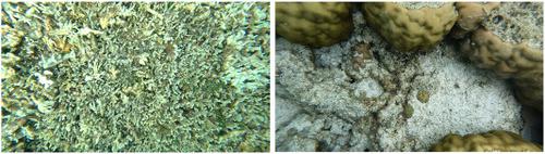
Over the years, coral reefs in the South China Sea have degraded and faced severe threats from rapid development, coral bleaching, and Crown-of-Thorns Starfish (COTS) outbreak. There is limited knowledge relating to the effects of anthropogenic disturbances and natural events on the coral reefs of Pulau Layang-Layang. This study aims to assess reef cover changes by utilizing Landsat satellite images spanning from 1989 to 2022. Using the object-based image analysis method, this study classified the reef cover into three categories: coral, rock and rubble, and sand. The supervised classification had an overall accuracy of 86.41–87.38 % and Tau's coefficients of 0.80–0.81. The results showed island development and construction of artificial bird sanctuary have led to an increase in coral cover. Furthermore, it was illustrated that the impact of COTS outbreaks in 2010 and 2020 differed significantly, with the latter showing no signs of recovery. Our study underscores the importance of timely intervention to mitigate the spread of COTS. This study provides insights into the resilience and vulnerability of these ecosystems in the face of various stressors.
中文翻译:

使用多时相 Landsat 图像观察马来西亚拉央-拉央岛珊瑚礁覆盖三个十年的变化
近年来,南海珊瑚礁退化,面临快速开发、珊瑚白化、棘冠海星爆发等严重威胁。关于人为干扰和自然事件对拉央-拉央岛珊瑚礁影响的知识有限。本研究旨在利用 1989 年至 2022 年的 Landsat 卫星图像评估珊瑚礁覆盖变化。利用基于对象的图像分析方法,本研究将珊瑚礁覆盖分为三类:珊瑚、岩石和碎石以及沙子。监督分类的总体准确率为 86.41–87.38%,Tau 系数为 0.80–0.81。结果显示,岛屿开发和人工鸟类保护区建设导致珊瑚覆盖面积增加。此外,研究还表明,2010年和2020年COTS爆发的影响存在显着差异,后者没有出现恢复的迹象。我们的研究强调了及时干预以减轻 COTS 传播的重要性。这项研究深入了解了这些生态系统面对各种压力源时的恢复力和脆弱性。
更新日期:2024-03-19
中文翻译:
使用多时相 Landsat 图像观察马来西亚拉央-拉央岛珊瑚礁覆盖三个十年的变化
近年来,南海珊瑚礁退化,面临快速开发、珊瑚白化、棘冠海星爆发等严重威胁。关于人为干扰和自然事件对拉央-拉央岛珊瑚礁影响的知识有限。本研究旨在利用 1989 年至 2022 年的 Landsat 卫星图像评估珊瑚礁覆盖变化。利用基于对象的图像分析方法,本研究将珊瑚礁覆盖分为三类:珊瑚、岩石和碎石以及沙子。监督分类的总体准确率为 86.41–87.38%,Tau 系数为 0.80–0.81。结果显示,岛屿开发和人工鸟类保护区建设导致珊瑚覆盖面积增加。此外,研究还表明,2010年和2020年COTS爆发的影响存在显着差异,后者没有出现恢复的迹象。我们的研究强调了及时干预以减轻 COTS 传播的重要性。这项研究深入了解了这些生态系统面对各种压力源时的恢复力和脆弱性。


 京公网安备 11010802027423号