当前位置:
X-MOL 学术
›
Environ. Sci.: Processes Impacts
›
论文详情
Our official English website, www.x-mol.net, welcomes your feedback! (Note: you will need to create a separate account there.)
Use of remote sensing to assess vegetative stress as a proxy for soil contamination
Environmental Science: Processes & Impacts ( IF 5.5 ) Pub Date : 2023-11-23 , DOI: 10.1039/d3em00480e John R Dean 1 , Shara Ahmed 1 , William Cheung 1 , Ibrahim Salaudeen 1 , Matthew Reynolds 1 , Samantha L Bowerbank 1 , Catherine E Nicholson 1 , Justin J Perry 1
Environmental Science: Processes & Impacts ( IF 5.5 ) Pub Date : 2023-11-23 , DOI: 10.1039/d3em00480e John R Dean 1 , Shara Ahmed 1 , William Cheung 1 , Ibrahim Salaudeen 1 , Matthew Reynolds 1 , Samantha L Bowerbank 1 , Catherine E Nicholson 1 , Justin J Perry 1
Affiliation
|
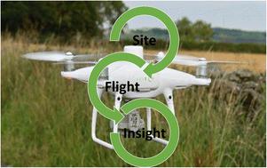
We report, for the first time, a multimodal investigation of current crude oil reprocessing and storage sites to assess their impact on the environment after 50 years of continuous operation. We have adopted a dual approach to investigate potential soil contamination. The first approach uses conventional analytical techniques i.e. energy dispersive X-ray fluorescence (ED-XRF) for metal analysis, and a complementary metabolomic investigation using hydrophilic liquid interaction chromatography hi-resolution mass spectrometry (HILIC-MS) for organic contaminants. Secondly, the deployment of an unmanned aerial vehicle (UAV) with a multispectral image (MSI) camera, for the remote sensing of vegetation stress, as a proxy for sub-surface soil contamination. The results identified high concentrations of barium (mean 21 017 ± 5950 μg g−1, n = 36) as well as metabolites derived from crude oil (polycyclic aromatic hydrocarbons), cleaning processes (surfactants) and other organic pollutants (e.g. pesticides, plasticizers and pharmaceuticals) in the reprocessing site. This data has then been correlated, with post-flight data analysis derived vegetation indices (NDVI, GNDVI, SAVI and Cl green VI), to assess the potential to identify soil contamination because of vegetation stress. It was found that strong correlations exist (an average R2 of >0.68) between the level of soil contamination and the ground cover vegetation. The potential to deploy aerial remote sensing techniques to provide an initial survey, to inform decision-making, on suspected contaminated land sites can have global implications.
中文翻译:

利用遥感评估植物胁迫作为土壤污染的替代指标
我们首次报告对当前原油后处理和储存场所进行的多模式调查,以评估其连续运行 50 年后对环境的影响。我们采用了双重方法来调查潜在的土壤污染。第一种方法使用传统的分析技术,即用于金属分析的能量色散 X 射线荧光 (ED-XRF),以及使用亲水液体相互作用色谱高分辨率质谱 (HILIC-MS) 进行有机污染物的补充代谢组学研究。其次,部署带有多光谱图像(MSI)相机的无人机(UAV),用于遥感植被压力,作为地下土壤污染的代表。结果确定了高浓度的钡(平均 21 017 ± 5950 μg g −1,n = 36)以及源自原油(多环芳烃)、清洁过程(表面活性剂)和其他有机污染物(例如杀虫剂、增塑剂)的代谢物和药品)在后处理场所。然后将这些数据与飞行后数据分析得出的植被指数(NDVI、GNDVI、SAVI 和 Cl green VI)相关联,以评估识别植被胁迫引起的土壤污染的潜力。结果发现,土壤污染水平与地被植被之间存在很强的相关性(平均R 2 >0.68)。利用航空遥感技术对可疑污染土地进行初步调查并为决策提供信息的潜力可能会产生全球影响。
更新日期:2023-11-23
中文翻译:
利用遥感评估植物胁迫作为土壤污染的替代指标
我们首次报告对当前原油后处理和储存场所进行的多模式调查,以评估其连续运行 50 年后对环境的影响。我们采用了双重方法来调查潜在的土壤污染。第一种方法使用传统的分析技术,即用于金属分析的能量色散 X 射线荧光 (ED-XRF),以及使用亲水液体相互作用色谱高分辨率质谱 (HILIC-MS) 进行有机污染物的补充代谢组学研究。其次,部署带有多光谱图像(MSI)相机的无人机(UAV),用于遥感植被压力,作为地下土壤污染的代表。结果确定了高浓度的钡(平均 21 017 ± 5950 μg g −1,n = 36)以及源自原油(多环芳烃)、清洁过程(表面活性剂)和其他有机污染物(例如杀虫剂、增塑剂)的代谢物和药品)在后处理场所。然后将这些数据与飞行后数据分析得出的植被指数(NDVI、GNDVI、SAVI 和 Cl green VI)相关联,以评估识别植被胁迫引起的土壤污染的潜力。结果发现,土壤污染水平与地被植被之间存在很强的相关性(平均R 2 >0.68)。利用航空遥感技术对可疑污染土地进行初步调查并为决策提供信息的潜力可能会产生全球影响。


 京公网安备 11010802027423号