Science of the Total Environment ( IF 8.2 ) Pub Date : 2017-11-10 , DOI: 10.1016/j.scitotenv.2017.11.020 A. Ginebreda , L. Sabater-Liesa , A. Rico , A. Focks , D. Barceló
|
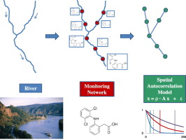
Rivers extend in space and time under the influence of their catchment area. Our perception largely relies on discrete spatial and temporal observations carried out at certain sites located throughout the catchment (monitoring networks, MN). However, MNs are constrained by (a) the distribution of sampling sites, (b) the dynamics of the variable considered and (c) the river hydrological conditions. In this study, all three aspects were captured and quantified by applying a spatial autocorrelation modeling approach. We exemplarily studied its application to 235 emerging contaminants (pesticides, pharmaceuticals, and personal care products [PPCP], industrial and miscellaneous) measured at 55 sampling sites in the Danube River. 22 out of the 235 compounds monitored were present at all sites and 125 were found in at least 50%.We first calculated the Moran Index (MI) to characterize the spatial autocorrelation of the compound set. 59 compounds showed MI ≤ 0, which can be interpreted as ‘no spatial correlation’. Next, spatial autocorrelation models were set for each compound. From the autocorrelation parameter ρ, catchment average correlation lengths were derived for each compound. MN optimality was examined and compounds were classified into three groups: (a) those with ρ ≤ 0 [25%]; (b) those with ρ > 0 and correl. length < average distance between consecutive sites [ 2%] and (c) those with ρ > 0 and correl. length > average distance between consecutive sites [73%]. The MN was considered optimal only for the latter class. Networks with the larger average distance between consecutive sites resulted in a decreasing number of optimally monitored compounds. Furthermore, neighbors vs. local relative contributions were quantified based on the spatial autocorrelation model for all the measured compounds. The results of this study show how autocorrelation models can aid water managers to improve the design of river MNs, which are a key aspect of the Water Framework Directive.
中文翻译:
协调监测和建模:基于空间自相关方法的河流监测网络评估-以多瑙河中的新兴污染物为例
河流在其集水区的影响下在时空上延伸。我们的感知很大程度上取决于在整个集水区(监测网络,MN)的某些地点进行的离散时空观测。但是,移动节点受到以下因素的限制:(a)采样点的分布;(b)考虑的变量的动态;(c)河流水文条件。在这项研究中,通过应用空间自相关建模方法捕获并量化了所有三个方面。我们示例性地研究了其在多瑙河55个采样点测量的235种新兴污染物(农药,药品和个人护理产品[PPCP],工业和杂物)中的应用。在所有受监测的235种化合物中,有22种存在于所有位点,发现125种化合物的比例至少为50%。我们首先计算了Moran指数(MI)来表征化合物集的空间自相关。59种化合物的MI≤0,这可以解释为“无空间相关性”。接下来,为每种化合物设置空间自相关模型。从自相关参数ρ,得出每种化合物的流域平均相关长度。检查了MN的最佳性,并将化合物分为三类:(a)ρ≤0 [25%];(b)那些ρ > 0且相关。长度<连续位点之间的平均距离[2%]和(c)ρ > 0且相关的位点。长度>连续站点之间的平均距离[73%]。MN仅被认为对于后一类是最佳的。连续位点之间的平均距离较大的网络导致最佳监测化合物的数量减少。此外,邻居VS。基于所有测量化合物的空间自相关模型对局部相对贡献进行了定量。这项研究的结果表明,自相关模型如何帮助水管理者改善河流MN的设计,这是《水框架指令》的关键方面。


 京公网安备 11010802027423号