


Introduction
The Khibiny Educational and Scientific Station (KESS) of the Faculty of Geography of Moscow State University (MSU) was founded on 9 March 1948 in Kirovsk in the Khibiny Mountains, on the Kola Peninsula, north-western Russia (Fig. 1). This placed it amongst a handful of field stations worldwide operating north of the Arctic Circle by the late 1940s. Since then, the station has become a major centre of Russian and international field expeditions, research, educational and professional training.
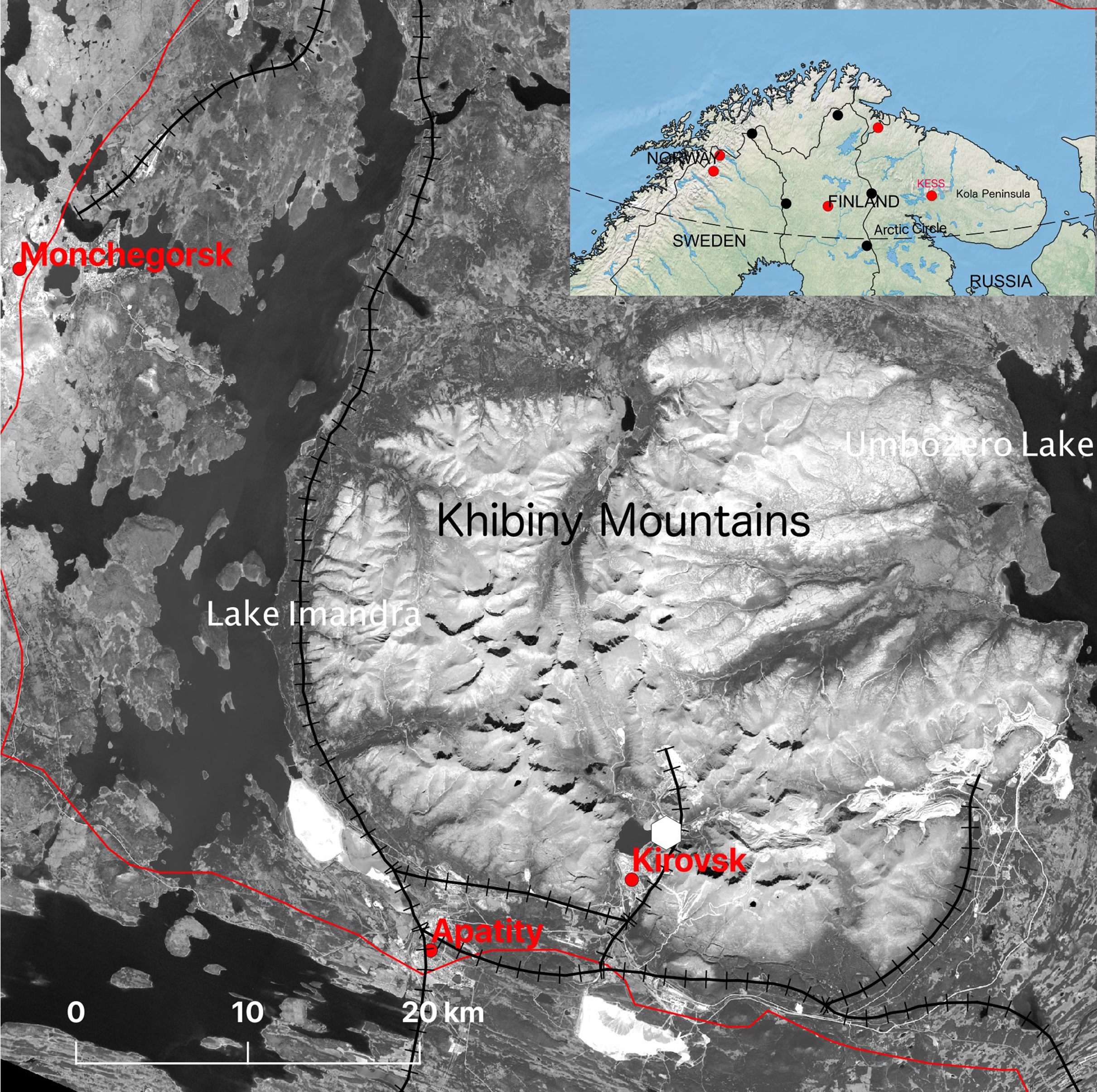
Fig. 1. Location of Kirovsk, the site of the Khibiny Educational and Scientific Station (KESS) of the Faculty of Geography of Moscow State of University (MSU), on the Kola Peninsula, Russia. Base map is derived from Landsat 8 ETM+ band 4, 29 July 2019, with an overlay of towns, roads and railways from Natural Earth (https://www.naturalearthdata.com). The white symbol shows the location of KESS. Lower map shows the location of the Kola Peninsula in north-western Russia. The red dots show locations of field stations, now part of the International Network for Terrestrial Research and Monitoring in the Arctic (INTERACT) network, that was operational before 1950; the black dots show such stations that became operational after that year.
The Khibiny station is one of the oldest stations of the MSU Faculty of Geography and the only one located beyond the Arctic Circle in a mountainous region. It is one of those peripheral bases of the Moscow University whose foundation and continuing presence have been due to the enthusiasm of individuals and the sense of duty of the staff of the departments. In this article, we explain why the Khibiny station was established in this particular location, describe how it has developed over the subsequent 70 years in terms of both science and international collaboration and outline the opportunities that it currently offers for contemporary Arctic scientists.
Foundation of the station
Professor Georgiy Tushinsky (Fig. 2), an outstanding scientist and the founder of Soviet avalanche science, initiated the creation of KESS. By the late 1940s, Tushinsky was already a recognised expert in the field of forecasting and protection against snow avalanches in the USSR. At that time, he began to conduct in situ studies on the conditions of formation and evolution of depth hoar, which forms weakened horizons in the snowy mass in the Khibiny Mountains.

Fig. 2. Founder and Scientific Director of KESS, Professor of the geographical faculty of MSU G. K. Tushinsky, in the Khibiny Mountains (1940s photo by an unknown author from KESS archive).
The Khibiny Mountains were chosen as the location for a scientific station for several reasons: the mountains are characterised by unusual terrain, with steep slopes and plateau-like flat summits, and are subjected to a long polar winter with abundant snow, frequent snowstorms and avalanches (Myagkov, Reference Myagkov1986; Vikulina, Reference Vikulina2006). The area is located close to the latitudinal treeline so that the high relief of the mountains provides an opportunity to study transitions between forest, tundra and barren ground. These transitions have been modified in parts through nearby industrial activities: the world’s largest deposit of apatite ore had already been mined in the Khibiny Mountains for 20 years prior to the foundation of KESS in 1948, and extraction and processing of copper-nickel ores at Monchegorsk, 50 km to the north-west, had been ongoing for a similar period of time (Doncheva & Kalutskov, Reference Doncheva and Kalutskov1977; Kozlov, Haukioja, Bakhtiarov, & Stroganov, Reference Kozlov, Haukioja, Bakhtiarov and Stroganov1995; Kryuchkov, Reference Kryuchkov1987; Rees & Kapitsa, Reference Rees and Kapitsa1994). The industrial activities in the Khibiny Mountains emphasised the practical need for avalanche research, since many workers faced a high avalanche hazard every year.
Scientific background
The Kola Peninsula and, in particular, the Khibiny Mountains had already been highlighted for their geographic and geopolitical position, natural, ethnographic and socio-economic objects of study, and as an example of continuity of scientific research is carried out by scientists of different countries. The first scientific results on Khibiny and the central part of the Kola Peninsula were generated during an expedition led by the Finnish geologist Wilhelm Ramsay (Ramsay, Reference Ramsay1898). However, Ramsay referred to the results of the route surveys of these territories performed by the French explorer Charles Rabot (Reference Rabot1889–1891), and Russian experts: the mining engineer Nikolay Shirokshin, the naturalist Alexander von Middendorf and the traveller Nikolay Kudryavtsev. Shirokshin, a relative of the composer Tchaikovsky, visited Khibiny in 1834. His research resulted in the first scientific description of the Khibiny as a large orographic element of the Kola Peninsula and Russian Lapland (Shirokshin, Reference Shirokshin1835). Alexander von Middendorf carried out a topographic survey during the expedition led by K. Baer in 1839–1840, noting the similarity of the relief of Russian Lapland to that of adjacent regions of Finland, which testified to the common history of its development (Middendorf, Reference von Middendorff1840). Nikolay Kudryavtsev, a geologist, led an expedition on behalf of the Russian Geographical Society to explore the Khibiny Mountains determining, amongst other things, the position of the northern boundary of the forest.
The systematic scientific study of the Khibiny Mountain massif, which began in the 1920s, is also closely linked with the name of the Soviet academician Alexander Fersman. He paid much attention to local place names, placing Sámi toponyms on the map of Khibiny. He also paid tribute to his predecessors and named several places in honour of members of Ramsay’s expedition: Ramsay pass, Petrelius pass, the Gakman and Petrelius rivers and Chilman mountain. (Gakman [Victor Axel Hackman] was the expedition’s petrographer, Alfred Gustav Petrelius was its surveyor and Oswald Chilman was the botanist.)
In subsequent years, researchers of the Faculty of Geography of MSU and the Institute of Geography of the Russian Academy of Sciences, who conducted studies at KESS, repeatedly referred to the materials of Ramsay’s expedition. In particular, they used photographs of the Khibiny landscapes of different high-altitude zones, which permitted the analysis of changes in plant communities attributed to climate change in the 20th century (Vaschalova, Kremenetski, & Sulerzhitsky, Reference Vaschalova, Kremenetski and Sulerzhitsky1999).
Rapid socio-economic development of the region followed soon, centred around the extraction and processing of apatite. Great reserves of this mineral, used especially for producing fertilisers, were discovered in the Khibiny Mountains in the 1920s by expeditions under the leadership of Fersman. This attracted the attention of scientists and creative intellectuals to the region. In 1930, the Kola Science base of the USSR Academy of Sciences (now the Kola Scientific Centre of the Russian Academy of Sciences) was created on the shore of lake Maliy Vud’yavr. It was called “Tietta” (Sámi for knowledge or science). Many artists worked in Khibiny at the time, amongst them Petr Konchalovsky and Vitold Byalynitsky-Birulya, both masters of Russian and Soviet painting of the early 20th century. Pictures of the pre-war and post-war years are an interesting source of information about the landscapes, now changed by economic activity. The station continues to collect a gallery of Khibiny landscapes from different years.
Rapid development of KESS, from 1948 to 1985
At first, KESS was located in a single-storey building in a now non-existent settlement near the Yuksporr plateau on the bank of the Yuksporryok River (Fig. 3). Only a few employees could be accommodated in this building. The equipment was stored in the adjacent sheds. Eventually, it became possible to take over another old single-storey hut which had several small rooms along a corridor, heated by stoves.

Fig. 3. The first building of KESS of MSU’s Faculty of Geography (photo by an unknown author from KESS archive). This settlement near the Yuksporr plateau no longer exists.
Konstantin Zvorykin, a young scientist from MSU, was the first director of KESS. The educational and scientific functions of the station have always been inseparable from one another. Results of the research work were not only theoretical but also applied. The scientific programme of KESS was for many years aimed at protection of the city, e.g. snow avalanches and other dangerous nival-glacial processes had to be considered when constructing mines and roads. Some types of research were carried out for the Joint Stock Company “Apatit”, which extracted and processed apatite ore. Throughout the 20th century, “Apatit” supported the development of KESS. Close cooperation with the company, which increased ore production in the 1950s–1970s, provided opportunities for active research for Russian scientists. The resulting studies were mainly focused on the estimation of avalanche danger rate in industrial areas, and on mitigation. This research extended theoretical and practical knowledge in engineering glaciology, avalanche and mudflow studies and palaeogeography, as well as developing geobotanical and geomorphological indicators of hazardous processes.
The scientific team of the station began to take shape in the 1950s. Outstanding Soviet geographers worked here at various times, including Konstantin Gromov, Veniamin Perov, Vasiliy Kryuchkov, Kira Ryabzeva, Viktor Puzanov, Innokentiy Tichomirov, Nadezda Chepurko and Andrey Gedymin. Their technical staff were students who stayed at KESS after the completion of their field training. Some of the students later became famous scientists, including Alexander Krenke (climatology), Valentina Kravtsova (cartography and remote sensing) and Nikolay Karpov (geomorphology).
From 1957 to 1959, KESS was one of the focal points for implementing the International Geophysical Year of 1957–1958. [Fig. 4(b) presents a timeline of the history of the station.] The entire station staff took part in IGY activities. The mission of the IGY expedition included the study of snow cover, summer snowfields, snow avalanches, slushflows and nival processes. During that period, Veniamin Perov discovered the existence of relict small forms of glaciation in the Khibiny Mountains (Perov, Reference Perov1978). Konstantin Gromov studied the temperature and humidity regime of soils in mountainous regions within the Arctic Circle, creating a new measuring instrument and developing a method of surveying soil moisture taking into account the diversity of mountain slopes and valley floors (Gromov, Reference Gromov1962).
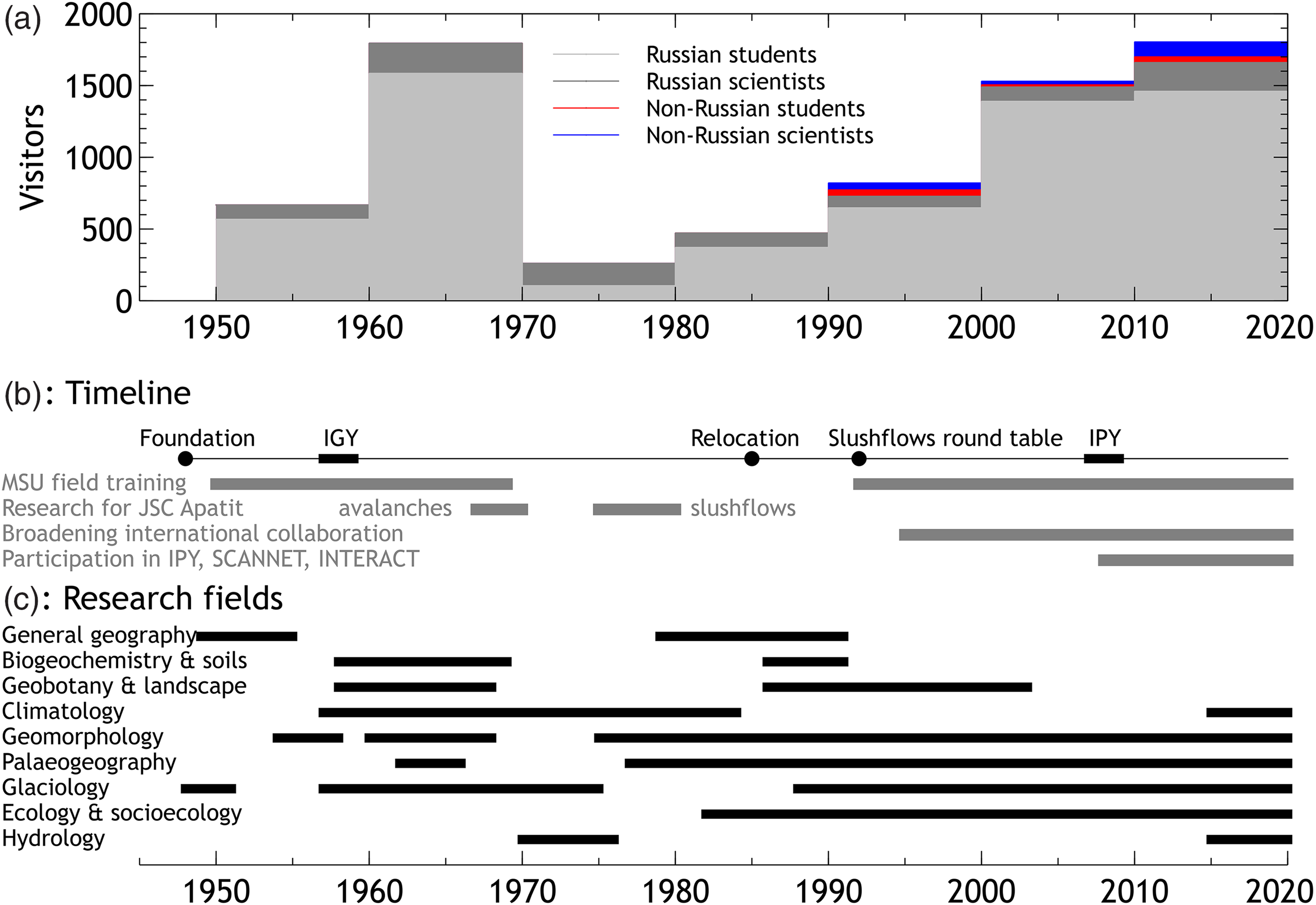
Fig. 4. (a) Numbers of visitors to the KESS field station, by decade, from the 1950s to the 2010s. The category “Russian scientists” includes scientists from both MSU and elsewhere in Russia and “Russian students” includes school children. (b) Timeline of the history of KESS. (c) Summary of research activity in different fields.
The 1950s–1970s were the intellectual heyday of KESS. Geobotanical, geomorphological, climatological and glaciological studies were conducted at the station (Fig. 4(c)). Every year, 150 MSU students took part in field training (Fig. 4(a)). But living conditions were difficult. People lived in rickety old barracks, in which the walls were frozen. It was necessary to burn a great deal of wood for heating. People themselves sawed and chopped dozens of cubic metres of firewood. “Aunt Zina”, a war veteran, was the driver of an old GAZ truck with a petrol engine, more of an antique exhibit than a means of transportation (Fig. 5).
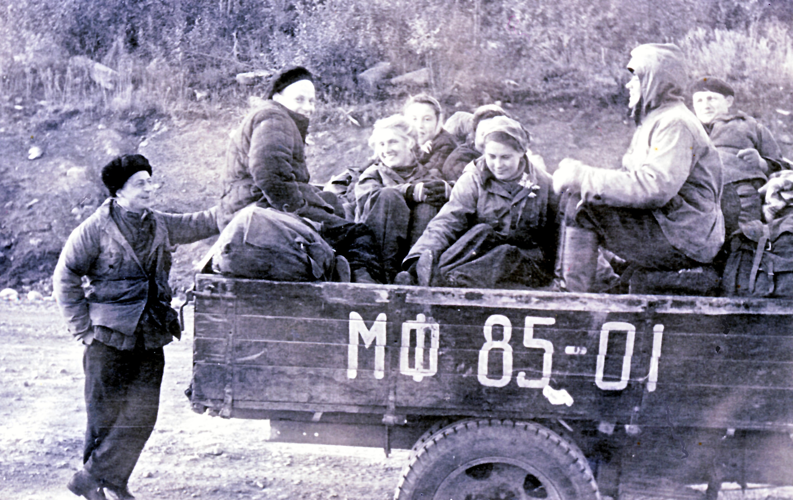
Fig. 5. Students of the 1950s (photo by an unknown author from KESS archive).
The station had not only technical but also scientific staff. The complex stationary and field route-based research included glacio-geomorphological, meteorological and climatic, soil-geochemical and botanical studies. In addition to these, Veniamin Perov studied permafrost processes in detail (Perov, Reference Perov1978), as well as modern and relict forms of permafrost. Vladimir Puzanov experimentally studied physical processes in the snowpack such as evaporation and melting, and developed methods for quantifying the changes occurring in snow in time and space using direct and proxy indicators (Puzanov, Reference Puzanov1960). Vasily Kryuchkov analysed a set of factors that determine the position of the upper limit of tree growth on slopes of different steepness, exposure and moisture (Kryuchkov, Reference Kryuchkov1960). Nadezhda Chepurko studied the structure and annual balance of biomass in the forests of the Khibiny Mountains and described the biogeochemistry of the mountain forest belt landscapes. Vera Zhuchkova made the first landscape map of Khibiny (Zhuchkova, Reference Zhuchkova1972).
In the early years, the Joint Stock Company “Apatit” asked the Faculty of Geography to assess the avalanche hazard and to improve methods for forecasting avalanches and protecting industrial areas (Fig. 4(b)). Field research to establish the boundaries of avalanche zones was led by the geomorphologist Sergey Myagkov (Myagkov, Reference Myagkov1967). He developed geomorphological methods for determining the boundaries of avalanche hazard areas of different age and compiled a map of the avalanches of the Khibiny industrial zone at a scale of 1:10000. Vitold Okolov carried out research on the role of turbulent heat and moisture exchange in the process of snowmelt. These results were unique in the Soviet Union (Okolov, Reference Okolov1967). Mikhail Laptev and Nadezda Lapteva carried out observations of the physical and mechanical properties of snow (Fig. 6). Methods for estimating the impact force of avalanches and the runout zones were developed jointly with the Institute of Mechanics of MSU (Savelyev, Laptev, & Lapteva, Reference Savelyev, Laptev and Lapteva1967).

Fig. 6. Study of snow properties in the 1960s (photo by an unknown author from KESS archive).
The optimistic mood of the decade following the Second World War, which affected the whole country, manifested itself in various forms. Employees and students who worked at the station, despite everyday difficulties (old houses, stove heating, etc.), found time for creative activities. For the 10th anniversary of the station, they designed commemorative badges and a logo for official papers. They wrote lyrical songs about fieldwork, which are still sung on camping trips. Art students came for plein air sessions and described the hard work of local scientists in a friendly cartoon (Fig. 7).
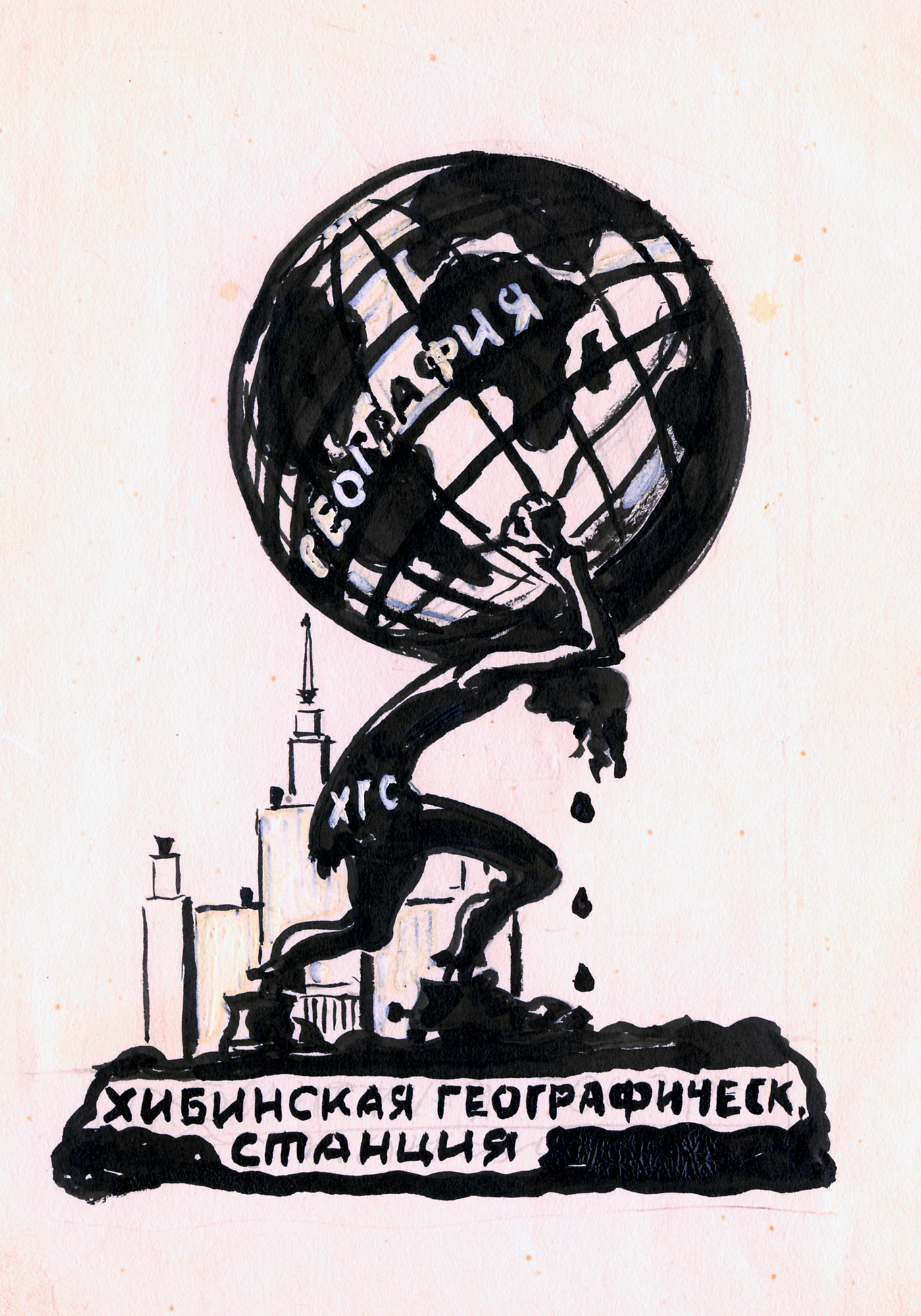
Fig. 7. A cartoon from the 1950s showing a fieldworker at the Khibiny Geographical Station (written at the base of the picture, and as an abbreviation “ХГС” on their clothes), sweating under a heavy globe of “GEOGRAPHY” on their back, with the Moscow University buildings in the background (collective art of MSU students).
In the late 1960s, the building of the hostel fell into disrepair, and field training of first-year Geography students took place at KESS for the last time in 1969. At the same time, the Faculty of Geography established new field stations elsewhere. Despite difficulties with accommodation, the station continued to operate through enthusiasm and to respond to the requests of different universities to accept small groups of students and teachers for field training in the Arctic. The station received specialists from various institutes as well as student winter expeditions of the Faculty of Geography. In these years, glaciologists Valentin Akkuratov, Kirill Voytkovsky, Semyon Fleyshman, Valentin Sapunov and Veniamin Perov worked at the station. Under their guidance, conditions for the formation of slushflows and debris flows were studied, and types of protective dams with diversion channels were designed (Perov, Reference Perov1978, Reference Perov1998; Perov, Turmanina, & Akifeva, Reference Perov, Turmanina, Akifeva, Fletcher and Linnard1977).
Systematic multiyear observations of snow cover at a fixed location were begun at this time, and continue to this day (Fig. 8). A map of slushflow basins in the Khibiny Mountain was compiled, methods for estimating snow cover depth on the mountain slopes were developed and the history of periods of high slushflow activity was reconstructed (Bozinsky et. al., Reference Bozinsky, Evteev, Myagkov, Perov, Sapunov, Sapunova and Freydlin2001).

Fig. 8. Study of a snow pit, with V. Sapunov inside it, in the 1980s (photo by an unknown author from KESS archives).
Slushflows were the subject of the exclusive attention of the station’s scientific personnel and staff of the Geography Department during the second half of the 1970s. Protection against the damaging effects of slushflows had become particularly relevant in the new industrial sites of the “Apatit” company. Valentin Sapunov was the head of the station from 1974. Every year till 2000, he organised fieldwork to study the slushflows in Khibiny. An international round table on slushflows was organised at KESS in 1992 by the station team and their colleagues from the MSU laboratory on snow avalanches and debris flows, and experts from Norway and the USA took part (Perov, Reference Perov1998). The event (Fig. 4(b)) confirmed the significant scientific contribution of Russia and KESS to the long-term field and experimental study of the nature of slushflow hazard in circumpolar regions and high mountains.
From the late 1970s to the early 1980s, investigations of the palaeogeography of the Khibiny Mountains (climate and avalanche activity), and landscape mapping, were carried out at a new scientific level. A new direction emerged, the study of slope processes in human-made ground (including industrial spoil heaps). MSU staff working at the station, including Tatiana Krasovskaya, took part in the AMAP studies on bioindicators of pollution (AMAP, 1997), environment impact assessment guidelines for the polar regions, and field studies of snow cover pollution in collaboration with Martin-Luther University in Halle, Germany.
Relocation in 1985 and continuation of scientific work despite the economic crisis of the 1990s
In 1985, the station was moved 2 km west, into buildings closer to the city of Kirovsk (Fig. 9), because the industrial zone of the “Apatit” company had expanded. The staff left the old station with sadness. So much effort had been spent on making it liveable. But the new buildings had hot water and plumbing, which seemed miraculous. After radical refurbishment, the living conditions were much improved. The station began a new life. Teachers and students quickly appreciated the improvement of conditions. Summer training and scientific research were resumed. At the end of the 1980s, the last major contractual work was carried out for JSC “Apatit”, to provide a comprehensive assessment and forecast for the Kirovsk–Apatity region, encompassing both the natural and socio-economic spheres.
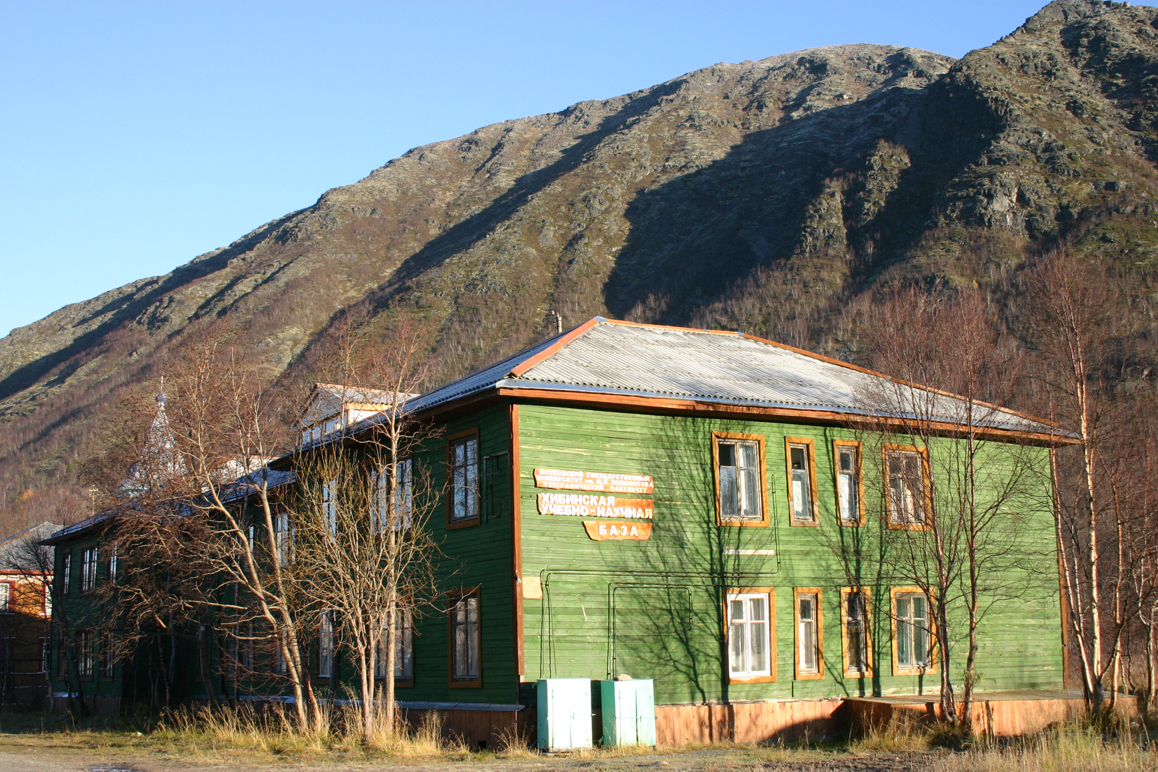
Fig. 9. The current staff building of KESS near the town of Kirovsk (photo by S.K. Konyaev).
In the 1980s, the staff of the Faculty of Geography of MSU began to use KESS for a wide range of studies concerning environmental protection, environmental management and sustainable development (Fig. 4(c)). In the 1990s, the station began collaborative work with specialists from the Kola Scientific Centre of the Russian Academy of Sciences, as well as with overseas researchers (Rees, Golubeva, & Williams, Reference Rees, Golubeva and Williams1998).
At the same time, a new scientific trend emerged in the KESS: geoecological research. It was started by well-known researchers of the polar regions, Tatiana Krasovskaya and Alexander Evseev (Krasovskaya, Kirk, & Voinov, Reference Krasovskaya, Kirk and Voinov2004; Krasovskaya, Vilchek, & Tsyban, Reference Krasovskaya, Vilchek and Tsyban1996). They made a major contribution to the resumption of student field training at the Khibiny station in the early 1990s, and attracted foreign students from Germany, Finland, Great Britain and the USA.
In the 1990s, when Russia experienced an economic collapse, many research institutions were closed. But thanks to the courage, patience and perseverance of the station’s director Valentin Sapunov and his family, the station went safely through the trying times. Sapunov created an experimental tray to study slushflows, and determined the critical water saturation of snow on different slopes. In addition, he conducted regular meteorological observations, observation of snow covers and annual snow surveys in the basins of the emergence of slushflows. Some contribution to the resilience of the station during this period was made by the establishment of a new bilateral research area in which methods of satellite remote sensing were applied to geoecological questions. This field was established in 1992 as a collaboration between the Geography Faculty of MSU, and the Scott Polar Research Institute of the University of Cambridge, and in expanded and modified form, it continues to the present day (Hofgaard et al. Reference Hofgaard, Rees, Tømmervik, Tutubalina, Golubeva, Lukina and Kharuk2010; Kapitsa & Rees (eds.) Reference Kapitsa and Rees2003; Kapitsa et al. Reference Kapitsa, Golubeva, Kravtsova, Krasnushkin, Lurie, Malyshev, Rees and Tututablina2005; Rees, Golubeva, & Williams, Reference Rees, Golubeva and Williams1998; Rees & Kapitsa Reference Rees and Kapitsa1994; Rees & Williams, Reference Rees and Williams1997; Rees, Golubeva, & Williams, Reference Rees, Golubeva and Williams1998; Rees & Kapitsa Reference Rees and Kapitsa1994; Rees & Williams, Reference Rees and Williams1997; Shipigina & Rees, Reference Shipigina and Rees2012). The Khibiny station was, and continues to be, central to this research.
The risk to research activity in the Russian Arctic during the Russian economic crisis, and on the other hand, the potential for international involvement in such activity, was recognised at the international level and resulted in the formation in 1993 of the International Science Initiative in the Russian Arctic (ISIRA), under the aegis of the International Arctic Science Committee (IASC). (https://iasc.info/isira) The history of KESS during this time is thus in accord with the aims of ISIRA.
New development since 2000 and international collaboration
In 2000, Sergey Konyaev, a graduate of the Faculty of Geography, became the new director. Young and energetic, he breathed new life into the station, but retained the old traditions. The team received fresh staff, the material basis was strengthened and special attention was paid to improving the living conditions for teachers and students.
Currently, KESS has an automatic weather station, and studies of nival-glacial processes continue (Figs. 10 and 11). These focus on the dynamics of small forms of glaciation, snow cover monitoring, mapping of avalanche parameters, assessing avalanche risk, modelling snow cover stability on the slopes (Shnyparkov et al., Reference Shnyparkov, Fuchs, Sokratov, Koltermann, Seliverstov and Vikulina2012; Vikulina Reference Vikulina2006, Reference Vikulina2008).
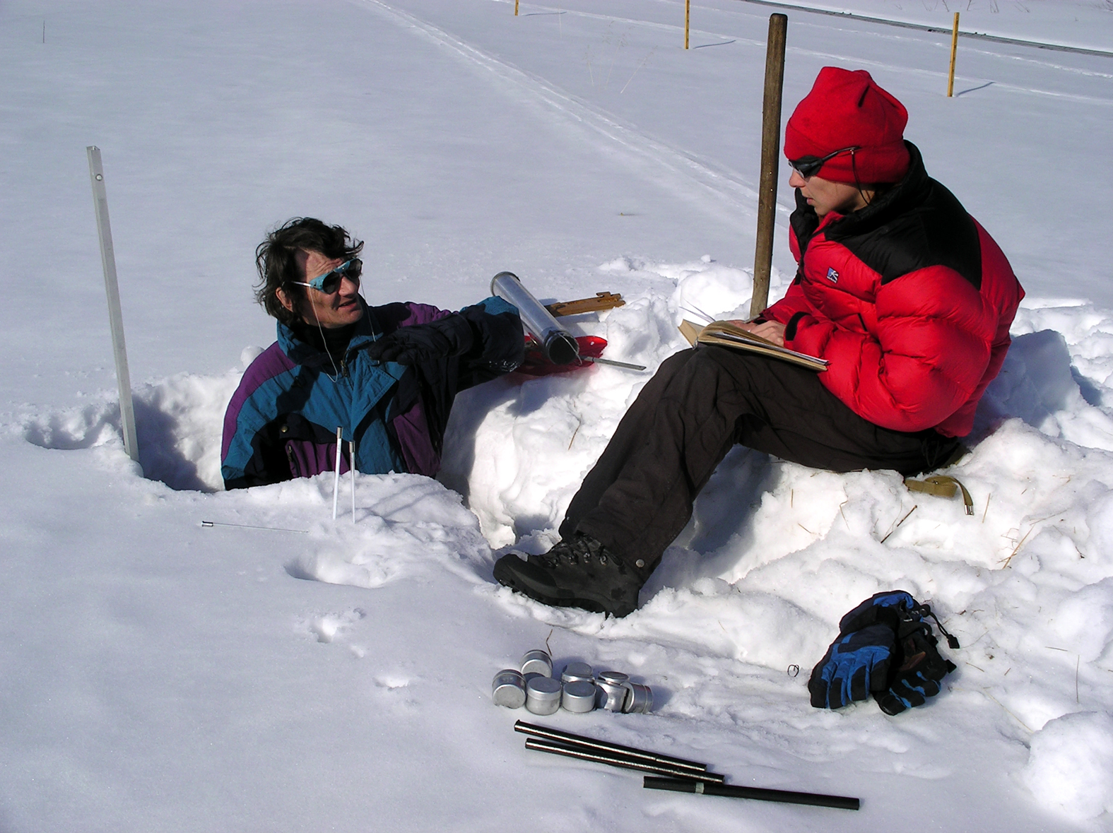
Fig. 10. Snow studies at the station in 2004 (photo by S.K. Konyaev).
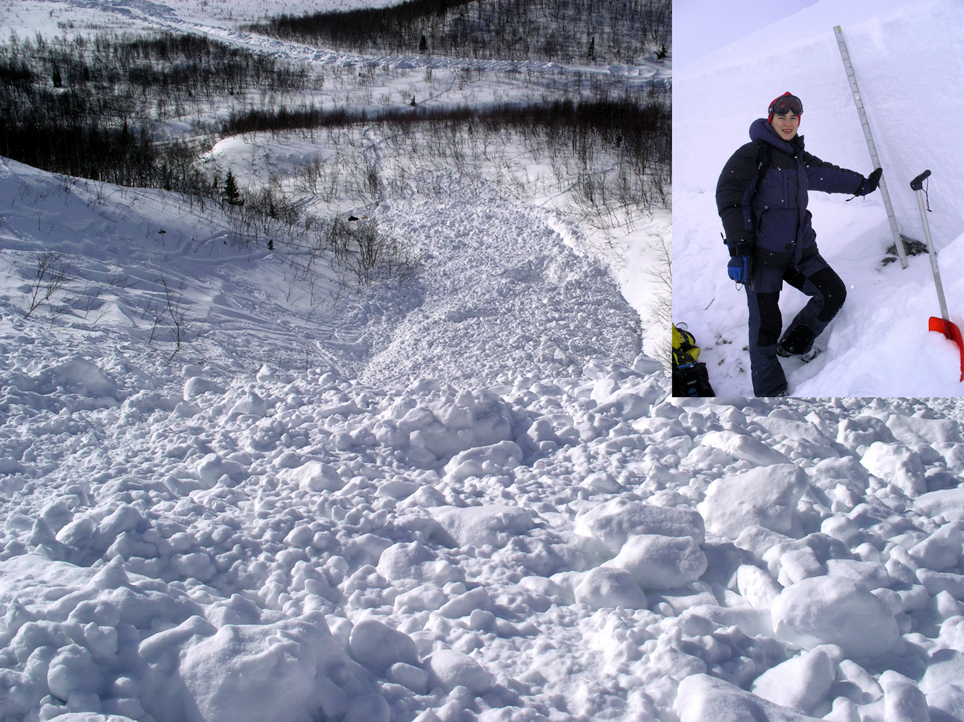
Fig. 11. Field description of an avalanche on 23 March 23 2006 (photos by M.A. Vikulina and Yu. G. Seliverstov).
About 100 students and teachers from MSU visit KESS every summer for field training (Fig. 12). Expeditions of the Student Scientific Society visit every winter (Fig. 13). Many students visit the station after their third and fourth years of study for individual research work and writing their theses. Often, students from universities of Germany, Finland, the United Kingdom and the USA visit for study tours.
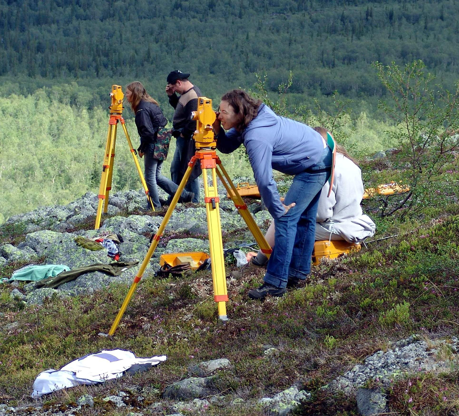
Fig. 12. Each year about 100 students go through summer field training (photo by an unknown author from KESS archives).
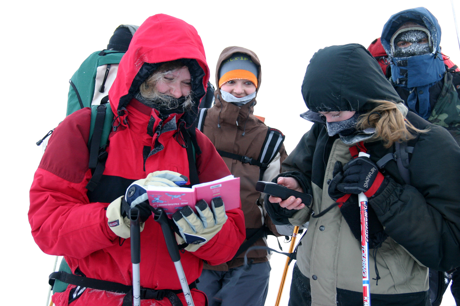
Fig. 13. Students in a winter expedition (photo by S.K. Konyaev).
The current generation of station scientists collaborates with colleagues from the Faculty of Geography of the MSU to develop research on sustainable development and the evolution of the Khibiny natural environment, including treeline change, under conditions of global warming and expanding technogenic impact (Krasovskaya & Kislov, Reference Krasovskaya and Kislov2003; Kravtsova & Loshkareva, Reference Kravtsova and Loshkareva2013; Kravtsova, Tutubalina, & Hofgaard, Reference Kravtsova, Tutubalina and Hofgaard2012; Mathisen, Mikheeva, Tutubalina, Aune, & Hofgaard, Reference Mathisen, Mikheeva, Tutubalina, Aune and Hofgaard2014). During the mid-2000s, the station became an important focus of international research as part of the International Polar Year, providing logistical support for the Russian–Norwegian “Benefits” project that formed part of the “PPS Arctic” research consortium that engaged in circumarctic treeline research. (http://ppsarctic.nina.no/)
The scientific work of the station’s staff and the faculty, in addition to the traditional glaciological, landscape and geoecological research, now has another important focus: scientific and organisational support for the development of Khibiny as a recreational area. KESS was instrumental in the creation of the Khibiny National Park, which officially came into existence in 2018.
Nowadays, the station has navigated towards the enlargement and strengthening of international collaboration as one of the most important facilitators of understanding of the Arctic region and its holistic environmental picture. In 2009, KESS joined the SCANNET network (Scandinavian/North European Network of Terrestrial Field Bases; Figure 4(b)). SCANNET was originally a network of field site leaders, research station managers and user groups who were collaborating to improve comparative observations and access to information on environmental change in the north (Bayfield, Brooker, & Turner, Reference Bayfield, Brooker, Turner, Thompson, Price and Galbraith2005). In 2011, SCANNET developed into the large international multi-partner project INTERACT (International Network for Terrestrial Research and Monitoring in the Arctic, https://eu-interact.org/field-sites/khibiny-educational-and-scientific-station/), which has now enlarged into a circumarctic network of 86 terrestrial field stations in northern Europe, Russia, USA, Canada, Greenland, Iceland, the Faroe Islands and the United Kingdom as well as stations in northern alpine areas. By becoming part of such a large network from the very beginning, KESS had a great opportunity to develop new and strengthen long-standing scientific partnerships. Within almost a decade of involvement, KESS has hosted a large number of research groups from the UK, Italy, Sweden, Slovenia, Finland, Norway and many other countries; has helped to organise field research in the “virtual” mode by recruiting students and station staff for field experiments and work carried out autonomously. This approach has also helped to foster outreach activities at the station and to ensure the continuity of Arctic research and expertise through the engagement of students and young scientists. The diversity of disciplines and topics presented during the visits of INTERACT research groups to KESS ranges from snow sciences to vegetation studies. Such activities and studies as measurements of snowpack changes, investigation of the baseline conditions and Arctic mining impacts under climatic change, a global litter decomposition study and research on Arctic plant success, including deglaciation patterns on the Kola Peninsula and the role of deadwood for biodiversity and carbon storage, dynamics of the treeline and changes of northern forests in the context of climate change, have all been conducted at the station and in its vicinity within the last 10 years. The station participated extensively in the INTERACT I (7 projects, with investigators from Austria, Finland and the United Kingdom) and INTERACT II (10 projects, with investigators from Austria, China, Denmark, Finland, France, Italy, Sweden and the United Kingdom) projects and is looking forward to future collaborative opportunities within the third phase of the project (INTERACT III: 2020–2024, 17 projects accepted). Since 2018, the station hosted field teams of the Russo-British project “Multiplatform remote sensing of the impact of climate change on northern forests of Russia”, which unites five Russian and British academic institutions investigating northern forest change since the year 2000 at multiple spatial scales (ground-based, drone-based, satellite-based regional and all-Russian scales). Another activity, connected to this project, has been the installation of four modern weather stations at a mountain slope in the nearby Polar-Alpine Botanic Garden, organised by Dr Gareth Marshall of the British Antarctic Survey. Through data-sharing agreements this increases the richness of meteorological data available to researchers of the region.
In 2015, the scientific scope of the station was further extended to include socio-economic studies of the area. This built on the historical partnership between the station and JSC “Apatit”, which is also the local planning authority. In this regard, the scientific staff of the station, in cooperation with the Kola Science Centre of the Russian Academy of Sciences, took part in studies of sustainable development of local resource communities in order to identify ways to diversify their economies from their existing high dependency on resource extraction (Sellheim, Zaika, & Kelman, Reference Sellheim, Zaika and Kelman2019). This research is ongoing.
In the periods from August of any given year to May of the following year, within the framework of INTERACT and other international projects, KESS can accept up to 50 foreign researchers and/or students at a time. In June and July, the admission of researchers is limited to only three–five people because in this period, the station is reserved for summer training of MSU students. But at this time, the station canteen is in operation, and for groups of more than 15 people, it can be opened at any time of year. Separate apartments with their own kitchens are available for residents of the station. There is also a hostel with shared facilities. The station can assist with vehicle rental and other logistical arrangements. It is also possible to conduct virtual or distant research. For example, regular observations of snow cover or vegetation can be carried out by station staff or students of the Faculty of Geography. In addition, it is possible to collect samples and obtain meteorological data. Such tasks can be carried out under specific agreements or contracts. The station can be contacted at khibiny_msu@mail.ru.
Conclusions
The KESS has evolved, over the 72 years of its existence, from a relatively small but dedicated facility with a strongly practical and local focus, into an internationally connected resource capable of supporting a wide range of research activities. Its long history of combining educational and research activities renders it practically unique amongst arctic field stations. The staff of the KESS, in collaboration with colleagues from the Geography Department of M.V Lomonosov MSU, are working to ensure that the results of studies accumulated at the Khibiny station over the past decades are preserved and available for subsequent use by all interested researchers, including international cooperations. This maintains the spirit of mutual respect and continuity, which has marked the study of Khibiny for over a century.
Acknowledgements
The writing of this review article has been supported by the Russian–British project “Multiplatform remote sensing of the impact of climate change on northern forests of Russia”, which is a project of the Institutional Links Programme, funded by the British Council (Grant no. 352397111) and the Ministry of Science and Higher Education of the Russian Federation (project RFMEFI61618X0099).


 Open access