Remote Sensing and GIS for Environmental Analysis and Cultural Heritage


1
Department of Land Management and Landscape Architecture, Faculty of Environmental Engineering and Land Surveying, University of Agriculture in Krakow, 253c Balicka Street, 30-149 Krakow, Poland
2
Department of Land Surveying, Faculty of Environmental Engineering and Land Surveying, University of Agriculture in Krakow, 253a Balicka Street, 30-149 Krakow, Poland
*
Author to whom correspondence should be addressed.
Remote Sens. 2020, 12(23), 3960; https://doi.org/10.3390/rs12233960
Submission received: 24 November 2020
/
Accepted: 29 November 2020
/
Published: 3 December 2020
(This article belongs to the Special Issue Remote Sensing and GIS for Environmental Analysis and Cultural Heritage)
Dynamically growing remote sensing and geographic information system (GIS) technologies are gaining popularity all over the world as tools for environmental analysis [1,2,3]. Remote sensing additionally provides data for mapping the surface of the Earth [4,5], identification of landslides [6], and environmental monitoring [7,8,9]. Moreover, in the time of widespread digitalisation, the domain of remote sensing methods and IT systems that support environmental analysis and cultural heritage decision-making is an important player. 2018 was the European Year of Cultural Heritage. It was an opportunity for numerous initiatives and events all over Europe aimed at bringing cultural heritage closer to the public and encouraging people to improve their involvement in the protection of the heritage. All this led to the initiation of the Remote Sensing Special Issue in 2019, Remote Sensing and GIS for Environmental Analysis and Cultural Heritage.
The popularity of application of wide- and close-range remote sensing and GIS tools in such domains as spatial modelling and planning, spatiotemporal analysis, urban analysis, land change science or surveying engineering was reflected in the number of published related articles. This hypothesis was verified with two search queries in the general search interface of the Web of Science Core Collection:
- We searched for ‘remote sensing’ and terms such as spatial modelling and planning, spatiotemporal analysis, urban analysis, land change and surveying engineering, occurring together in titles, abstracts, or keywords;
- We searched for ‘wide- and close-range remote sensing’ and each of the following terms: Spatial modelling and planning, spatiotemporal analysis, urban analysis, land change and surveying engineering, occurring together in titles, abstracts, or keywords.
The results of the queries are presented in Table 1.
The popularity and continuous development of remote sensing and GIS for environmental analysis and cultural heritage are driven by the prevalence of the Big Data approach today [10]. Remote sensing data and databases meet the 3Vs requirements for Big Data regardless of their sources, Volume, Velocity, and Variety [11]. 3Vs of remote sensing data and GIS databases guarantee that they are up to date and available. The potential of the data for environmental analysis and cultural heritage is evident from the know-how related to their analysis and processing to extract such pieces of information that can solve specific research problems.
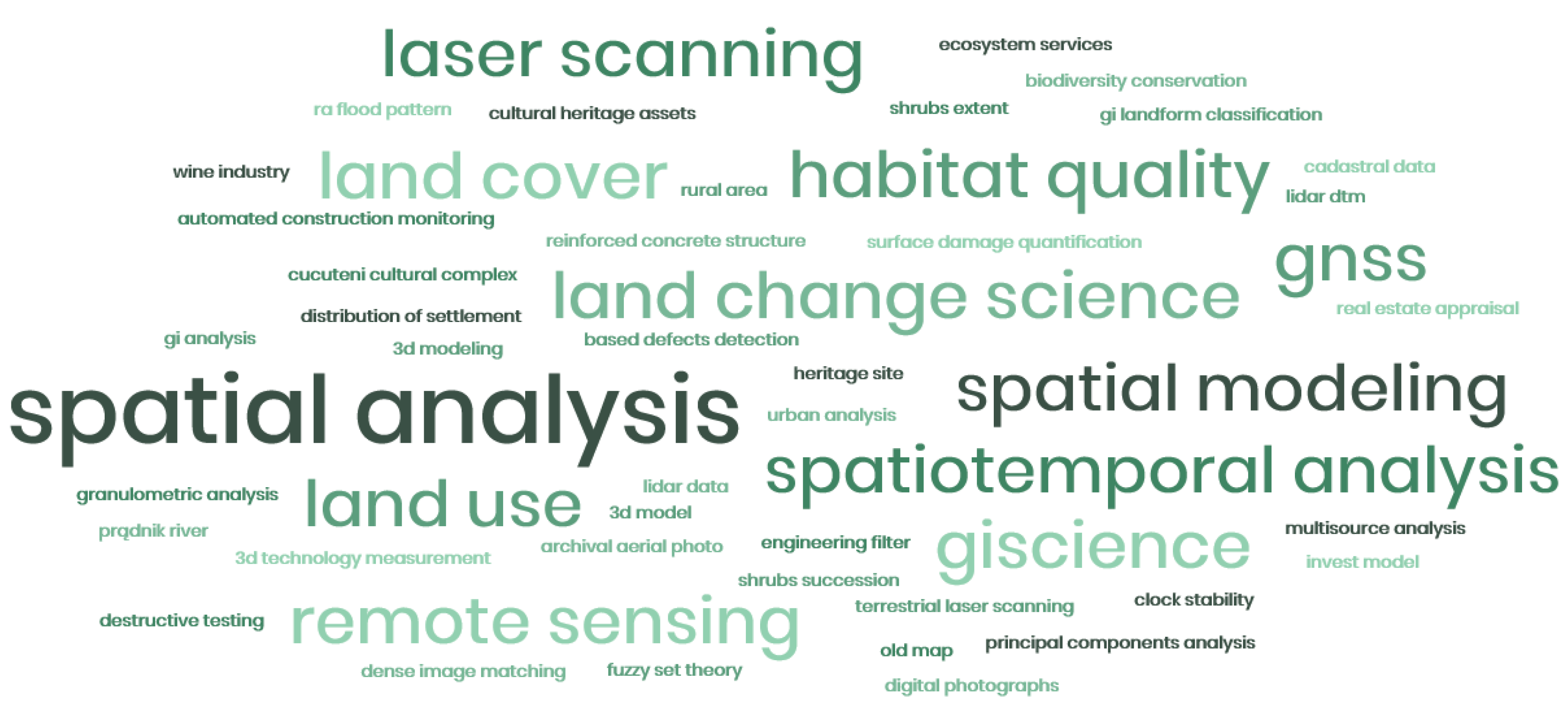
In light of the characteristics and availability of remote-sensing data and the capabilities of GIS tools, this Special Issue proposes 20 different research projects focusing on the theory and practice of the application of modern technologies in environmental and cultural heritage studies (Figure 1).
The environmental and cultural heritage studies published in the Special Issue focus mostly (in 25%) on the synergy of historical materials and modern data [12,13,14,15,16]. Historical maps of settlements and archaeological sites [12,16], economic and cadastral maps [15,16], and aerial orthophotos [13,14,15] digitised into rasters or point clouds underwent spatial analyses, usually together with LiDAR data. Authors of papers on historical sites [12,15] and spatial development (of forest, rivers, etc.) [13,14,16] employed such digital photogrammetry tools as Canopy Height Model (CHM) from a point cloud [14], Photogrammetry Archive Point Cloud (PAPC) [13], and classification of the standard deviation (SD) of Topographic Position Index (TPI) for the mean elevation (DEV) [12].
Close-range [17,18,19] and wide-range [20,21] remote sensing data use was presented in 25% of the contributions to the Special Issue. Many of them involved the application of terrestrial laser scanning data [17,18,19]. In addition, 3D terrestrial laser scanning data were employed to define an original method for automatic detection of damage to continuous surfaces of engineering structures [17], coastal cliff stability analysis [19], or as a basis for determining the geometry of heritage underground structures as part of the development of a 3D cadastre [18]. Wide-range remote sensing projects focused on the classification and texture analysis of satellite imagery for effective investigation of land use [20] and drone-acquired thermal data in the form of near-infrared (NIR) imagery for archaeological investigations [21].
The other papers involved the application of GIS tools for environmental analysis, except for one that focused on methods for the averaging time in high-rate monitoring of satellites [22]. Applications of the information system included mostly the collection, processing, and visualisation of LiDAR data, digital photogrammetry, and topographic and cadastral data. The methodological know-how for GIS analyses included fuzzy theory and fuzzy logic [23,24], the InVEST habitat quality model [25,26], Voronoi diagrams [27], synchronisation algorithms [28], machine learning methods [29], and Ward’s method [30]. GIS tools for environmental analysis were employed to investigate habitat quality [26], topography (altitude of mountain peaks [31], slope aspect [24]), urbanisation [23,25,30], buildings [27,29], or roads [28].
The integration of remote sensing, GIS, and modelling can provide valuable support for management and decision-making. Close-range remote sensing is a means for obtaining comprehensive and detailed spatial data of strategic objects and cultural heritage. Moreover, LiDAR technologies are advancing rapidly, and future developments will have a significant impact on the types of data that will become available in the next decade for remote sensing applications.
Authors were asked to contribute to this Special Issue papers on the application of remote sensing or GIS in such domains as spatial modelling and planning, spatiotemporal analysis, urban analysis, land change science, or surveying engineering. The Special Issue was created in February 2019 and closed on 30 June 2020. Twenty research papers were published over this period following a strict review process.
We hope that this special issue will stimulate further discussion on the real potential of remote sensing and GIS in estimating the status of the environment, its change, and cultural heritage.
Funding
Linguistic support was financed by the Ministry of Science and Higher Education, Republic of Poland [grant number A304/KGPiAK/2019].
Acknowledgments
We are proud to have been entrusted with the roles of Guest Editors and we are immensely grateful to the reviewers who helped us to guarantee the robust scientific value of all the published papers. The work is a result of scientific effort at the University of Agriculture in Krakow, Poland.
Conflicts of Interest
The authors declare no conflict of interest.
References
- Olorunfemi, I.E.; Fasinmirin, J.T.; Olufayo, A.A.; Komolafe, A.A. GIS and remote sensing-based analysis of the impacts of land use/land cover change (LULCC) on the environmental sustainability of Ekiti State, southwestern Nigeria. Environ. Dev. Sustain. 2020, 22, 661–692. [Google Scholar] [CrossRef]
- Aal, A.K.A.; Kamel, M.; Alyami, S.H. Environmental Analysis of Land Use and Land Change of Najran City: GIS and Remote Sensing. Arab. J. Sci. Eng. 2020, 45, 8803–8816. [Google Scholar] [CrossRef]
- Kukulska-Koziel, A.; Szylar, M.; Cegielska, K.; Noszczyk, T.; Hernik, J.; Gawronski, K.; Dixon-Gough, R.; Jombach, S.; Valanszki, I.; Kovacs, K.F. Towards three decades of spatial development transformation in two contrasting post-Soviet cities-Krakow and Budapest. Land Use Policy 2019, 85, 328–339. [Google Scholar] [CrossRef]
- Zhang, X.; Liu, L.Y.; Wu, C.S.; Chen, X.D.; Gao, Y.; Xie, S.; Zhang, B. Development of a global 30m impervious surface map using multisource and multitemporal remote sensing datasets with the Google Earth Engine platform. Earth Syst. Sci. Data 2020, 12, 1625–1648. [Google Scholar] [CrossRef]
- Bielecka, E. GIS spatial analysis modeling for land use change. A bibliometric analysis of the intellectual base and trends. Geosciences 2020, 10, 421. [Google Scholar] [CrossRef]
- Ma, H.R.; Cheng, X.W.; Chen, L.J.; Zhang, H.T.; Xiong, H.W. Automatic identification of shallow landslides based on Worldview2 remote sensing images. J. Appl. Remote Sens. 2016, 10, 016008. [Google Scholar] [CrossRef]
- Guo, B.B.; Fang, Y.L.; Jin, X.B.; Zhou, Y.K. Monitoring the effects of land consolidation on the ecological environmental quality based on remote sensing: A case study of Chaohu Lake Basin, China. Land Use Policy 2020, 95, 104569. [Google Scholar] [CrossRef]
- Jaworek-Jakubska, J.; Filipiak, M.; Napierala-Filipiak, A. Understanding of Forest Cover Dynamics in Traditional Landscapes: Mapping Trajectories of Changes in Mountain Territories (1824–2016), on the Example of Jeleniogorska Basin, Poland. Forests 2020, 11, 867. [Google Scholar] [CrossRef]
- Janus, J.; Bozek, P. Aerial laser scanning reveals the dynamics of cropland abandonment in Poland. J. Land Use Sci. 2019, 14, 378–396. [Google Scholar] [CrossRef]
- Liu, P.; Di, L.; Du, Q.; Wang, L. Remote sensing big data: Theory, methods and applications. Remote Sens. 2018, 10, 711. [Google Scholar] [CrossRef] [Green Version]
- Laney, D. 3D Data Management: Controlling Data Volume, Velocity and Variety. Available online: https://blogs.gartner.com/doug-laney/files/2012/01/ad949-3D-Data-Management-Controlling-Data-Volume-Velocity-and-Variety.pdf (accessed on 11 November 2020).
- Mihu-Pintilie, A.; Nicu, I.C. GIS-based Landform Classification of Eneoli thic Archaeological Sites in the Plateau-plain Transition Zone (NE Romania): Habitation Practices vs. Flood Hazard Perception. Remote Sens. 2019, 11, 915. [Google Scholar] [CrossRef] [Green Version]
- Bożek, P.; Janus, J.; Mitka, B. Analysis of Changes in Forest Structure using Point Clouds from Historical Aerial Photographs. Remote Sens. 2019, 11, 2259. [Google Scholar] [CrossRef] [Green Version]
- Osińska-Skotak, K.; Bakuła, K.; Jełowicki, Ł.; Podkowa, A. Using Canopy Height Model Obtained with Dense Image Matching of Archival Photogrammetric Datasets in Area Analysis of Secondary Succession. Remote Sens. 2019, 11, 2182. [Google Scholar] [CrossRef] [Green Version]
- Prus, B.; Wilkosz-Mamcarczyk, M.; Salata, T. Landmarks as Cultural Heritage Assets Affecting the Distribution of Settlements in Rural Areas—An Analysis Based on LIDAR DTM, Digital Photographs, and Historical Maps. Remote Sens. 2020, 12, 1778. [Google Scholar] [CrossRef]
- Szombara, S.; Lewińska, P.; Żądło, A.; Róg, M.; Maciuk, K. Analyses of the Prądnik riverbed Shape Based on Archival and Contemporary Data Sets—Old Maps, LiDAR, DTMs, Orthophotomaps and Cross-Sectional Profile Measurements. Remote Sens. 2020, 12, 2208. [Google Scholar] [CrossRef]
- Makuch, M.; Gawronek, P. 3D Point Cloud Analysis for Damage Detection on Hyperboloid Cooling Tower Shells. Remote Sens. 2020, 12, 1542. [Google Scholar] [CrossRef]
- Bieda, A.; Bydłosz, J.; Warchoł, A.; Balawejder, M. Historical Underground Structures as 3D Cadastral Objects. Remote Sens. 2020, 12, 1547. [Google Scholar] [CrossRef]
- Ossowski, R.; Przyborski, M.; Tysiac, P. Stability Assessment of Coastal Cliffs Incorporating Laser Scanning Technology and a Numerical Analysis. Remote Sens. 2019, 11, 1951. [Google Scholar] [CrossRef] [Green Version]
- Kupidura, P. The Comparison of different methods of texture analysis for their efficacy for land use classification in satellite imagery. Remote Sens. 2019, 11, 1233. [Google Scholar] [CrossRef] [Green Version]
- Hill, A.C.; Laugier, E.J.; Casana, J. Archaeological Remote Sensing Using Multi-Temporal, Drone-Acquired Thermal and Near Infrared (NIR) Imagery: A Case Study at the Enfield Shaker Village, New Hampshire. Remote Sens. 2020, 12, 690. [Google Scholar] [CrossRef] [Green Version]
- Maciuk, K.; Lewińska, P. High-rate monitoring of satellite clocks using two methods of averaging time. Remote Sens. 2019, 11, 2754. [Google Scholar] [CrossRef] [Green Version]
- Biłozor, A.; Cieślak, I.; Czyża, S. An Analysis of Urbanisation Dynamics with the Use of the Fuzzy Set Theory—A Case Study of the City of Olsztyn. Remote Sens. 2020, 12, 1784. [Google Scholar] [CrossRef]
- Chrobak, K.; Chrobak, G.; Kazak, J.K. The Use of Common Knowledge in Fuzzy Logic Approach for Vineyard Site Selection. Remote Sens. 2020, 12, 1775. [Google Scholar] [CrossRef]
- Hack, J.; Molewijk, D.; Beißler, M.R. A Conceptual Approach to Modeling the Geospatial Impact of Typical Urban Threats on the Habitat Quality of River Corridors. Remote Sens. 2020, 12, 1345. [Google Scholar] [CrossRef] [Green Version]
- Aneseyee, A.B.; Noszczyk, T.; Soromessa, T.; Elias, E. The InVEST Habitat Quality Model Associated with Land Use/Cover Changes: A Qualitative Case Study of the Winike Watershed in the Omo-Gibe Basin, Southwest Ethiopia. Remote Sens. 2020, 12, 1103. [Google Scholar] [CrossRef] [Green Version]
- Bełej, M.; Figurska, M. 3D Modeling of Discontinuity in the Spatial Distribution of Apartment Prices Using Voronoi Diagrams. Remote Sens. 2020, 12, 229. [Google Scholar] [CrossRef] [Green Version]
- Kocur-Bera, K.; Dawidowicz, A. Land use versus land cover: Geo-analysis of national roads and synchronisation algorithms. Remote Sens. 2019, 11, 3053. [Google Scholar] [CrossRef] [Green Version]
- Dawid, L.; Tomza, M.; Dawid, A. Estimation of Usable Area of Flat-Roof Residential Buildings Using Topographic Data with Machine Learning Methods. Remote Sens. 2019, 11, 2382. [Google Scholar] [CrossRef] [Green Version]
- Stręk, Ż.; Noga, K. Method of delimiting the spatial structure of villages for the purposes of land consolidation and exchange. Remote Sens. 2019, 11, 1268. [Google Scholar] [CrossRef] [Green Version]
- Kozioł, K.; Maciuk, K. New Heights of the Highest Peaks of Polish Mountain Ranges. Remote Sens. 2020, 12, 1446. [Google Scholar] [CrossRef]
Figure 1.
A word cloud generated from 20 publications published in the Special Issue on Remote Sensing and GIS for Environmental Analysis and Cultural Heritage in Remote Sensing.
Figure 1.
A word cloud generated from 20 publications published in the Special Issue on Remote Sensing and GIS for Environmental Analysis and Cultural Heritage in Remote Sensing.


Table 1.
The number of related papers following the query (on 19 November 2020).
| Keywords | |||||
|---|---|---|---|---|---|
| spatial modelling and planning | spatiotemporal analysis | urban analysis | land change | surveying engineering | |
| remote sensing | 1448 | 1046 | 4323 | 12,721 | 322 |
| wide- and close-range remote sensing | 4 | 1 | 2 | 7 | 1 |
Publisher’s Note: MDPI stays neutral with regard to jurisdictional claims in published maps and institutional affiliations. |
© 2020 by the authors. Licensee MDPI, Basel, Switzerland. This article is an open access article distributed under the terms and conditions of the Creative Commons Attribution (CC BY) license (http://creativecommons.org/licenses/by/4.0/).
Share and Cite
MDPI and ACS Style
Noszczyk, T.; Gawronek, P. Remote Sensing and GIS for Environmental Analysis and Cultural Heritage. Remote Sens. 2020, 12, 3960. https://doi.org/10.3390/rs12233960
AMA Style
Noszczyk T, Gawronek P. Remote Sensing and GIS for Environmental Analysis and Cultural Heritage. Remote Sensing. 2020; 12(23):3960. https://doi.org/10.3390/rs12233960
Chicago/Turabian StyleNoszczyk, Tomasz, and Pelagia Gawronek. 2020. "Remote Sensing and GIS for Environmental Analysis and Cultural Heritage" Remote Sensing 12, no. 23: 3960. https://doi.org/10.3390/rs12233960
Note that from the first issue of 2016, this journal uses article numbers instead of page numbers. See further details here.