当前位置:
X-MOL 学术
›
Int. J. Climatol.
›
论文详情
Our official English website, www.x-mol.net, welcomes your feedback! (Note: you will need to create a separate account there.)
Spatial and temporal characteristics of near-surface air temperature across local climate zones in a tropical city
International Journal of Climatology ( IF 3.9 ) Pub Date : 2022-09-11 , DOI: 10.1002/joc.7862 Matthias Roth 1 , Beatriz Sanchez 1 , Reuben Li 2 , Erik Velasco 3
International Journal of Climatology ( IF 3.9 ) Pub Date : 2022-09-11 , DOI: 10.1002/joc.7862 Matthias Roth 1 , Beatriz Sanchez 1 , Reuben Li 2 , Erik Velasco 3
Affiliation
|
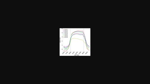
The present study examines the temporal and spatial variability of near-surface air temperature and the canopy layer urban heat island (UHI) in Singapore. Observations collected at 20 locations across the island city-state and during 6 years make this one of the most extensive studies carried out in a tropical city. Local climate zones (LCZs), defined as urban built and rural land cover types which produce a unique air temperature response, are used to standardize intersite comparison. The results show that the choice of the rural reference can affect the night-time UHI magnitude by up to 2°C under “ideal” (dry, clear, calm) conditions. The most frequently observed median UHI magnitude increases from 2.8 during all-weather to 3.7°C during “ideal” conditions, respectively. A seasonality is present with lowest (highest) mean all-weather values of ~2.0°C (~3.3°C), observed during the wet (dry) December–January (April–October) period. Mean night-time UHI intensity across seven built-type LCZs ranges between 1.8 and 3.5°C (2.5 and 4.3°C) for all-weather (“ideal”) conditions. Corresponding daily values are 1.1–2.3°C (1.5–2.7°C). The lowest (highest) night-time magnitudes are associated with open low-rise LCZ 6 (compact high-rise LCZ 1) built type. In the middle of the day LCZ 1 can experience a cool island effect. The average UHI values presented here give an indication of the extra warmth experienced in the built-up spaces of Singapore relative to one possible rural reference land cover type (scattered trees LCZ B). Highest daytime heat exposure is observed in LCZs 3 and 8 which are characterized by low building heights, high impervious surface fraction and lack of vegetation. The present results can be used to support the development and evaluation of urban climate models, develop urban planning policies and improve local weather forecasts and the delivery of integrated urban services.
中文翻译:

热带城市局部气候带近地表气温时空特征
本研究调查了新加坡近地表气温和冠层城市热岛 (UHI) 的时间和空间变化。在整个岛屿城邦的 20 个地点收集了 6 年的观察结果,使其成为在热带城市进行的最广泛的研究之一。当地气候区 (LCZ) 被定义为产生独特气温响应的城市建成和农村土地覆盖类型,用于标准化站点间比较。结果表明,在“理想”(干燥、晴朗、平静)条件下,农村参考点的选择最多可将夜间 UHI 量级影响 2°C。最常观察到的 UHI 震级中值分别从全天候的 2.8 增加到“理想”条件下的 3.7°C。存在季节性,最低(最高)平均全天候值约为 2。0°C(~3.3°C),在潮湿(干燥)的 12 月至 1 月(4 月至 10 月)期间观察到。在全天候(“理想”)条件下,七个建成型低碳区的平均夜间 UHI 强度在 1.8 至 3.5°C(2.5 至 4.3°C)之间。相应的每日值是 1.1–2.3°C (1.5–2.7°C)。最低(最高)夜间震级与开放式低层 LCZ 6(紧凑型高层 LCZ 1)建筑类型相关。白天LCZ 1可以体验到凉爽的岛屿效应。此处显示的平均 UHI 值表明,相对于一种可能的农村参考土地覆盖类型(散落的树木 LCZ B),新加坡建筑空间所经历的额外温暖。在 LCZs 3 和 8 观察到最高的白天热暴露,其特点是建筑物高度低、不透水表面分数高和缺乏植被。
更新日期:2022-09-11
中文翻译:
热带城市局部气候带近地表气温时空特征
本研究调查了新加坡近地表气温和冠层城市热岛 (UHI) 的时间和空间变化。在整个岛屿城邦的 20 个地点收集了 6 年的观察结果,使其成为在热带城市进行的最广泛的研究之一。当地气候区 (LCZ) 被定义为产生独特气温响应的城市建成和农村土地覆盖类型,用于标准化站点间比较。结果表明,在“理想”(干燥、晴朗、平静)条件下,农村参考点的选择最多可将夜间 UHI 量级影响 2°C。最常观察到的 UHI 震级中值分别从全天候的 2.8 增加到“理想”条件下的 3.7°C。存在季节性,最低(最高)平均全天候值约为 2。0°C(~3.3°C),在潮湿(干燥)的 12 月至 1 月(4 月至 10 月)期间观察到。在全天候(“理想”)条件下,七个建成型低碳区的平均夜间 UHI 强度在 1.8 至 3.5°C(2.5 至 4.3°C)之间。相应的每日值是 1.1–2.3°C (1.5–2.7°C)。最低(最高)夜间震级与开放式低层 LCZ 6(紧凑型高层 LCZ 1)建筑类型相关。白天LCZ 1可以体验到凉爽的岛屿效应。此处显示的平均 UHI 值表明,相对于一种可能的农村参考土地覆盖类型(散落的树木 LCZ B),新加坡建筑空间所经历的额外温暖。在 LCZs 3 和 8 观察到最高的白天热暴露,其特点是建筑物高度低、不透水表面分数高和缺乏植被。


 京公网安备 11010802027423号