Nature Communications ( IF 16.6 ) Pub Date : 2022-08-08 , DOI: 10.1038/s41467-022-32194-3 Shujuan Mao 1, 2, 3 , Albanne Lecointre 2 , Robert D van der Hilst 1 , Michel Campillo 1, 2
|
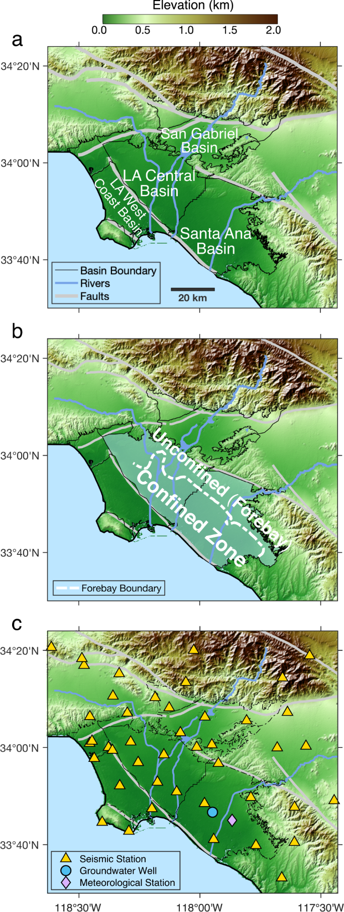
Historic levels of drought, globally, call for sustainable freshwater management. Under pressing demand is a refined understanding of the structures and dynamics of groundwater systems. Here we present an unconventional, cost-effective approach to aquifer monitoring using seismograph arrays. Employing advanced seismic interferometry techniques, we calculate the space-time evolution of relative changes in seismic velocity, as a measure of hydrological properties. During 2000–2020 in basins near Los Angeles, seismic velocity variations match groundwater tables measured in wells and surface deformations inferred from satellite sensing, but the seismological approach adds temporal and depth resolutions for deep structures and processes. Maps of long-term seismic velocity changes reveal distinct patterns (decline or recovery) of groundwater storage in basins that are adjacent but adjudicated to water districts conducting different pumping practices. This pilot application bridges the gap between seismology and hydrology, and shows the promise of leveraging seismometers worldwide to provide 4D characterizations of groundwater and other near-surface systems.
中文翻译:
被动地震干涉法对地下水波动的时空监测
全球干旱的历史水平要求可持续的淡水管理。迫切需要对地下水系统的结构和动态有更深入的了解。在这里,我们提出了一种使用地震仪阵列进行含水层监测的非常规、具有成本效益的方法。我们采用先进的地震干涉测量技术,计算地震速度相对变化的时空演变,作为水文特性的衡量标准。2000 年至 2020 年期间,在洛杉矶附近的盆地,地震速度变化与井中测量的地下水位和卫星感应推断的地表变形相匹配,但地震学方法为深层结构和过程增加了时间和深度分辨率。长期地震速度变化图揭示了盆地中地下水储存的不同模式(下降或恢复),这些盆地毗邻但被裁定为进行不同抽水实践的水区。该试点应用程序弥合了地震学和水文学之间的差距,并展示了利用全球地震仪提供地下水和其他近地表系统的 4D 表征的前景。


 京公网安备 11010802027423号