Applied Water Science ( IF 5.5 ) Pub Date : 2022-07-05 , DOI: 10.1007/s13201-022-01715-2 Aniekan Edet , Chiedu Okereke
|
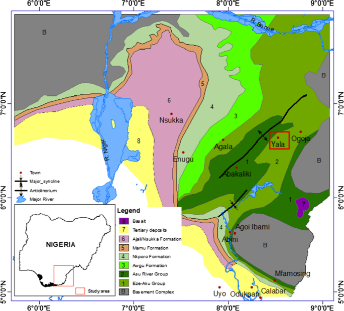
Geological, hydrogeological and geophysical investigations were carried out in Yala Area (SE Nigeria) to delineate potential zones for future groundwater development. The area is underlain by Turonian fractured shale rock intruded by basaltic rocks and saline water. High lineament density (> 30 km−1) recorded in the north suggest high permeable zone, compared with low lineament density (< 10 km−1) in the south and east. Geophysical results reveal four types of aquifers: an upper weathered, fractured shale aquifer with mean resistivity and thickness in the range 27–40 Ω m and 20–28 m and a lower fractured shale aquifer with mean resistivity in the range 28.5 to 36.0 Ω m and unresolved thickness; fractured saline shale aquifer with mean resistivity and thickness of 21 Ω m and 50 m; fractured silty shale aquifer with mean resistivity and thickness of 54.4 Ω m and 10 m and basaltic intrusive fractured shale aquifer with mean resistivity and thickness of 135.6 Ω m and 6 m. A broad range of aquifer parameters were obtained from resistivity data and pumping test. Groundwater quality on the mean indicated alkaline and good fresh water for drinking and irrigation use with minor level of salinization. Concentration of dissolved ions in the area are enhanced through weathering and ion exchange. On the basis of these data, the potential zones for groundwater harnessing have been delineated in Yala Area.
中文翻译:
以咸水地下水为特征的亚拉地区(尼日利亚东南部)裂缝性页岩含水层的水文地质条件调查
在亚拉地区(尼日利亚东南部)进行了地质、水文地质和地球物理调查,以划定未来地下水开发的潜在区域。该地区下伏着被玄武质岩石和咸水侵入的Turonian断裂页岩。北部记录的高线密度(> 30 km -1)表明高渗透带,而低线密度(< 10 km -1) 在南部和东部。地球物理结果揭示了四种类型的含水层:平均电阻率和厚度在 27-40 Ω m 和 20-28 m 范围内的上部风化、裂缝性页岩含水层和平均电阻率在 28.5 至 36.0 Ω m 范围内的下部裂缝性页岩含水层和未解决的厚度;平均电阻率和厚度分别为 21 Ω m 和 50 m 的裂缝性咸水页岩含水层;平均电阻率和厚度分别为 54.4 Ω m 和 10 m 的裂缝性粉质页岩含水层和平均电阻率和厚度分别为 135.6 Ω m 和 6 m 的玄武质侵入性裂缝性页岩含水层。从电阻率数据和抽水试验中获得了广泛的含水层参数。地下水水质平均表明碱性良好,淡水可用于饮用和灌溉,盐化程度较低。通过风化和离子交换增强了该区域溶解离子的浓度。在这些数据的基础上,在雅拉地区划定了地下水利用的潜在区域。


 京公网安备 11010802027423号