Bulletin of Engineering Geology and the Environment ( IF 4.2 ) Pub Date : 2022-07-02 , DOI: 10.1007/s10064-022-02793-x Mohamed K. Salah , Ibrahim M. Salama , Zenhom E. Salem , A. M. Al Temamy , M. M. El Osta
|
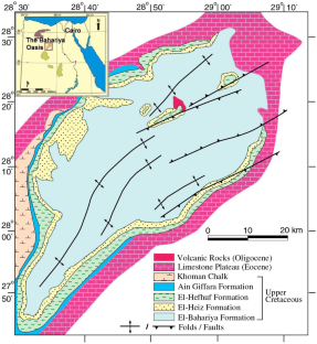
The Nubian Sandstone Aquifer (NSA) is the main freshwater resource in many parts of the Western Desert of Egypt including the Bahariya Oasis which attracted considerable attention during the recent decades. We determined several petrophysical parameters for the aquifer systems in the Bahariya Oasis using resistivity and gamma-ray logs. Geophysical logs recorded at 24 wells in the Bahariya Oasis are used to calculate the vertical thicknesses, total and effective porosities, permeability, shale volume, rock and formation water resistivities, and the total dissolved solids (TDS) in the different sandstone aquifers and shale beds. The logs of ten deep wells drilled in the northern part of the Bahariya Oasis enabled us to identify three aquifer zones separated by two shale beds. Only one aquifer and a shale bed are detected in the southern part of the oasis due to the limited number and the shallow penetration of wells. The shallow aquifer, referred here to as sand I, is detected in all wells with an average thickness of 184 m, moderate/high total and effective porosities, and low amount of total dissolved solids. The shale volume in the sand I aquifer increases towards the northeast but is low in the central and western parts of the Bahariya Oasis. The total dissolved solids are also low especially in the south; hence, this zone represents a suitable aquifer in the entire Bahariya Oasis. Being consistent with previous hydrogeological studies, our results indicate that the NSA in the southwestern part of the Bahariya Oasis contains potential lower-TDS shallow freshwater reserves compared to the aquifer of the northeastern part of Bahariya.
中文翻译:
使用地球物理测井对 Bahariya Oasis Nubian 砂岩含水层进行岩石物理表征
努比亚砂岩含水层 (NSA) 是埃及西部沙漠许多地区的主要淡水资源,包括近几十年来备受关注的巴哈里亚绿洲。我们使用电阻率和伽马射线测井确定了 Bahariya 绿洲含水层系统的几个岩石物理参数。Bahariya 绿洲 24 口井记录的地球物理测井用于计算不同砂岩含水层和页岩层中的垂直厚度、总孔隙度和有效孔隙度、渗透率、页岩体积、岩石和地层水电阻率以及总溶解固体 (TDS) . 在 Bahariya 绿洲北部钻探的 10 口深井的测井记录使我们能够识别被两个页岩床隔开的三个含水层带。绿洲南部仅发现1个含水层和1个页岩层,原因是井数有限且钻孔浅。在所有井中都检测到浅层含水层,这里称为砂 I,平均厚度为 184 m,总孔隙度和有效孔隙度中等/高,总溶解固体量低。砂层 I 含水层中的页岩体积向东北方向增加,但在 Bahariya 绿洲的中部和西部较低。总溶解固体也很低,尤其是在南部;因此,该区域代表了整个 Bahariya 绿洲的合适含水层。与以往的水文地质研究一致,


 京公网安备 11010802027423号