当前位置:
X-MOL 学术
›
Remote Sens. Ecol. Conserv.
›
论文详情
Our official English website, www.x-mol.net, welcomes your feedback! (Note: you will need to create a separate account there.)
Geomorphological development of aquatic mesohabitats in shore channels along longitudinal training dams
Remote Sensing in Ecology and Conservation ( IF 5.5 ) Pub Date : 2022-05-13 , DOI: 10.1002/rse2.273 Natasha Y. Flores 1 , Frank P. L. Collas 1 , Rob S. E. W. Leuven 1
Remote Sensing in Ecology and Conservation ( IF 5.5 ) Pub Date : 2022-05-13 , DOI: 10.1002/rse2.273 Natasha Y. Flores 1 , Frank P. L. Collas 1 , Rob S. E. W. Leuven 1
Affiliation
|
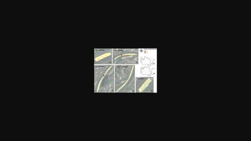
Longitudinal training dams (LTDs) are novel hydraulic engineering structures in the river Waal intended to facilitate intensive navigation and safe discharges in the main channel while providing sheltered habitats for aquatic biota in shore channels. Monitoring data collected using light detection and ranging, multibeam echosounder and aerial photography for the years during and after the construction of the LTDs were analysed in order to determine patterns of erosion and deposition, the retreat rate of steep eroding banks and shoreline length change through time. The LTD shore channels and two traditional groyne fields (references) were divided into nine mesohabitats based on physical attributes. Net erosion was estimated for eight out of the nine mesohabitats for the 2015–2020 period. Generally, there was a pattern of riverbed aggradation towards the LTDs and degradation or bank erosion towards the littoral zones of the LTD shore channels. This kind of continuous behaviour could be indicative of current or eminent channel and thus habitat stability. The bankline erosion in shore channels had mean retreat rates of 1.4–1.6 m/year. The shorelines were longer in sand-dominated mesohabitats, which could be key for habitat heterogeneity. The LTD shore channels offered more complex relatively natural continuous littoral zones than the traditional groyne fields while maintaining the multifunctionality of the river. Thus, the development of sandy shorelines in the LTD shore channels should be encouraged through management in order to enhance biodiversity. Geomorphological monitoring of the shore channels should continue in the future in order to detect any long-term changes in the sedimentary processes and ecological functions.
中文翻译:

纵向训练坝沿岸河道水生中生栖息地的地貌发育
纵向训练水坝 (LTDs) 是瓦尔河中的新型水利工程结构,旨在促进主要航道中的密集航行和安全排放,同时为海岸航道中的水生生物群提供庇护栖息地。通过光探测和测距、多波束测深仪和航空摄影在 LTD 建设期间和之后的几年中收集的监测数据进行了分析,以确定侵蚀和沉积的模式、陡峭侵蚀岸的退缩率和海岸线长度随时间的变化. LTD海岸航道和两个传统的防波堤(参考)根据物理属性分为九个中生境。在 2015-2020 年期间,估计 9 个中生境中有 8 个存在净侵蚀。一般来说,有一种向 LTD 方向河床加积和向 LTD 海岸河道沿岸带退化或河岸侵蚀的模式。这种连续的行为可能表明当前或突出的渠道,从而表明栖息地的稳定性。海岸河道岸线侵蚀的平均退缩率为 1.4-1.6 m/年。以沙为主的中生境的海岸线更长,这可能是生境异质性的关键。与传统的防波堤相比,LTD 岸边渠道提供了更复杂、相对自然的连续沿海地带,同时保持了河流的多功能性。因此,应通过管理鼓励在LTD海岸通道中开发沙质海岸线,以增强生物多样性。
更新日期:2022-05-13
中文翻译:
纵向训练坝沿岸河道水生中生栖息地的地貌发育
纵向训练水坝 (LTDs) 是瓦尔河中的新型水利工程结构,旨在促进主要航道中的密集航行和安全排放,同时为海岸航道中的水生生物群提供庇护栖息地。通过光探测和测距、多波束测深仪和航空摄影在 LTD 建设期间和之后的几年中收集的监测数据进行了分析,以确定侵蚀和沉积的模式、陡峭侵蚀岸的退缩率和海岸线长度随时间的变化. LTD海岸航道和两个传统的防波堤(参考)根据物理属性分为九个中生境。在 2015-2020 年期间,估计 9 个中生境中有 8 个存在净侵蚀。一般来说,有一种向 LTD 方向河床加积和向 LTD 海岸河道沿岸带退化或河岸侵蚀的模式。这种连续的行为可能表明当前或突出的渠道,从而表明栖息地的稳定性。海岸河道岸线侵蚀的平均退缩率为 1.4-1.6 m/年。以沙为主的中生境的海岸线更长,这可能是生境异质性的关键。与传统的防波堤相比,LTD 岸边渠道提供了更复杂、相对自然的连续沿海地带,同时保持了河流的多功能性。因此,应通过管理鼓励在LTD海岸通道中开发沙质海岸线,以增强生物多样性。


 京公网安备 11010802027423号