当前位置:
X-MOL 学术
›
Photogramm. Rec.
›
论文详情
Our official English website, www.x-mol.net, welcomes your feedback! (Note: you will need to create a separate account there.)
Geometric calibration of satellite laser altimeters based on waveform matching
The Photogrammetric Record ( IF 2.4 ) Pub Date : 2021-05-07 , DOI: 10.1111/phor.12362 Shaoning Li 1 , Chaokui Li 1 , Guo Zhang 2 , Yanan Wang 3
The Photogrammetric Record ( IF 2.4 ) Pub Date : 2021-05-07 , DOI: 10.1111/phor.12362 Shaoning Li 1 , Chaokui Li 1 , Guo Zhang 2 , Yanan Wang 3
Affiliation

|
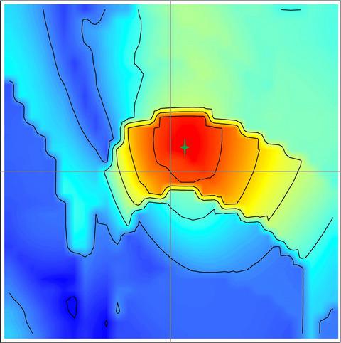
This study proposes a new geometric calibration method for satellite laser altimeters based on waveform matching to solve the problems of poor initial pointing accuracy and a lack of control data. This non-real-time method obtains ground control points without a fixed calibration field. First, a large area with stepped surfaces is chosen from the laser altimetry coverage. Then, the laser echo waveforms are simulated using digital surface model (DSM) data of the stepped features. The real echo waveform attempts to match the simulated echo waveforms through a waveform matching model using a global constraint. Next, the control points of the laser altimeter are obtained through waveform matching. Finally, a geometric calibration model for laser altimeters is proposed to compensate for laser pointing and ranging errors. Two experiments were conducted to verify the calibration method using ICESat/GLAS data and airborne large-footprint laser data. Experimental results confirm that the method is feasible and results in an improvement in the elevation accuracy for the airborne altimeter from 2 to 0.5 m.
中文翻译:

基于波形匹配的卫星激光高度计几何标定
针对卫星激光高度计初始指向精度差、控制数据缺乏等问题,提出一种基于波形匹配的卫星激光高度计几何标定新方法。这种非实时方法无需固定校准场即可获得地面控制点。首先,从激光测高覆盖范围中选择具有阶梯表面的大面积区域。然后,使用阶梯特征的数字表面模型 (DSM) 数据模拟激光回波波形。真实回波波形试图通过使用全局约束的波形匹配模型来匹配模拟回波波形。接下来,通过波形匹配得到激光高度计的控制点。最后,提出了一种激光高度计的几何校准模型来补偿激光指向和测距误差。使用ICESat/GLAS数据和机载大足迹激光数据进行了两个实验来验证校准方法。实验结果证实该方法是可行的,并将机载高度计的高程精度从 2 米提高到 0.5 米。
更新日期:2021-06-17
中文翻译:

基于波形匹配的卫星激光高度计几何标定
针对卫星激光高度计初始指向精度差、控制数据缺乏等问题,提出一种基于波形匹配的卫星激光高度计几何标定新方法。这种非实时方法无需固定校准场即可获得地面控制点。首先,从激光测高覆盖范围中选择具有阶梯表面的大面积区域。然后,使用阶梯特征的数字表面模型 (DSM) 数据模拟激光回波波形。真实回波波形试图通过使用全局约束的波形匹配模型来匹配模拟回波波形。接下来,通过波形匹配得到激光高度计的控制点。最后,提出了一种激光高度计的几何校准模型来补偿激光指向和测距误差。使用ICESat/GLAS数据和机载大足迹激光数据进行了两个实验来验证校准方法。实验结果证实该方法是可行的,并将机载高度计的高程精度从 2 米提高到 0.5 米。


 京公网安备 11010802027423号