当前位置:
X-MOL 学术
›
Geolog. J.
›
论文详情
Our official English website, www.x-mol.net, welcomes your feedback! (Note: you will need to create a separate account there.)
A Pleistocene deposit preserved in deep karst at Coolough, County Galway, western Ireland
Geological Journal ( IF 1.8 ) Pub Date : 2020-11-05 , DOI: 10.1002/gj.4029 Megan J. Dolan 1, 2, 3, 4 , Bryan A. McCabe 1, 3, 4 , Karen Molloy 5 , John Murray 2, 3 , Tiernan Henry 2, 3, 4 , Eve Daly 2, 4 , David O'Leary 2, 4
Geological Journal ( IF 1.8 ) Pub Date : 2020-11-05 , DOI: 10.1002/gj.4029 Megan J. Dolan 1, 2, 3, 4 , Bryan A. McCabe 1, 3, 4 , Karen Molloy 5 , John Murray 2, 3 , Tiernan Henry 2, 3, 4 , Eve Daly 2, 4 , David O'Leary 2, 4
Affiliation
|
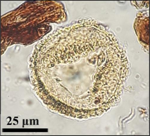
Buried karst features result from a complex interplay between carbonate bedrock and structural geology. The enhancement of carbonate aquifers through this interplay creates hydrogeologically complex subsurface drainage networks and highly variable surface topographies. This article reports on the sediment fill and fossil pollen record from a large enclosed negative karst landform at Coolough, near Galway City in the west of Ireland. The landform was discovered during the preliminary site investigation for the proposed N6 Galway City Ring Road. Major joint sets developed in the Carboniferous (Mississippian) Limestone bedrock govern the local hydrogeology and structural evidence suggests that a local fault has controlled the east–west propagation of the deep enclosed depression. Fluvial and lacustrine palaeoenvironments are interpreted from the sediments infilling the enclosed depression, within which three discrete diamicts are identified, potentially representing distinct phases of glaciation. Pollen assemblages, which reflect palaeoenvironments of open woods and grasslands, have been correlated with other deposits in Ireland and Europe and suggest a minimum date of the Early Pleistocene for the oldest of the diamicts, and thus an upper age limit on the development of the karst depression. Fluvial disturbance to the deposit is evident and is likely to be responsible for the chronological discrepancy between the Early Pleistocene and Middle Pleistocene sediments both recorded from the deposit infill. The findings of this multidisciplinary study contribute to an understanding of Quaternary landscape evolution in western Ireland.
中文翻译:

爱尔兰西部戈尔韦郡库洛市深部岩溶中保存的更新世沉积物
碳酸盐岩基岩与结构地质之间复杂的相互作用导致了岩溶地层的形成。通过这种相互作用增强了碳酸盐含水层,形成了水文地质复杂的地下排水网络和高度变化的地表地形。本文报道了爱尔兰西部戈尔韦市附近库洛夫大型封闭式负喀斯特地貌的沉积物充填和化石花粉记录。该地形是在拟建的N6戈尔韦市环城公路的初步现场调查期间发现的。石炭纪(密西西比)石灰岩基岩中发育的主要节理控制了局部水文地质学,结构证据表明,局部断层控制了深部封闭凹陷的东西向传播。河流和湖相古环境是从充满封闭洼地的沉积物中解释的,在其中识别出了三个离散的铁酰胺,可能代表着不同的冰川期。花粉组合反映了开阔的树林和草原的古环境,已经与爱尔兰和欧洲的其他沉积物相关联,并暗示了最早的更新世的最短的敌敌对日期,因此对喀斯特地貌的发育有年龄上限沮丧。对该沉积物的河流扰动是显而易见的,并且很可能是由该沉积物填充物记录的早更新世和中更新世沉积物之间时间差异的原因。
更新日期:2020-11-05
中文翻译:
爱尔兰西部戈尔韦郡库洛市深部岩溶中保存的更新世沉积物
碳酸盐岩基岩与结构地质之间复杂的相互作用导致了岩溶地层的形成。通过这种相互作用增强了碳酸盐含水层,形成了水文地质复杂的地下排水网络和高度变化的地表地形。本文报道了爱尔兰西部戈尔韦市附近库洛夫大型封闭式负喀斯特地貌的沉积物充填和化石花粉记录。该地形是在拟建的N6戈尔韦市环城公路的初步现场调查期间发现的。石炭纪(密西西比)石灰岩基岩中发育的主要节理控制了局部水文地质学,结构证据表明,局部断层控制了深部封闭凹陷的东西向传播。河流和湖相古环境是从充满封闭洼地的沉积物中解释的,在其中识别出了三个离散的铁酰胺,可能代表着不同的冰川期。花粉组合反映了开阔的树林和草原的古环境,已经与爱尔兰和欧洲的其他沉积物相关联,并暗示了最早的更新世的最短的敌敌对日期,因此对喀斯特地貌的发育有年龄上限沮丧。对该沉积物的河流扰动是显而易见的,并且很可能是由该沉积物填充物记录的早更新世和中更新世沉积物之间时间差异的原因。


 京公网安备 11010802027423号